
Good morning and happy weekend everyone! Just a quick update this morning regarding the risk of severe weather this weekend. For today (Saturday) we have a Marginal (level 1) Risk for strong to severe storms mainly east, south and stretching southwest of the DFW metroplex later this afternoon. Cities within the Marginal Risk include Mt. Pleasant, Tyler, Waco, Austin/San Antonio and Del Rio. A small Slight Risk (Level 2) is outlined in far northeast Texas which includes Texarkana, Longview and Carthage. A weak and stalled cold front will be the source of development later this afternoon with a couple of strong to severe storms possible as we reach peak daytime heating. Widespread severe weather is NOT expected today…in fact widespread rainfall is not expected either. Still if you’re out and about within or near the Marginal Risk areas today…especially folks enjoying outdoor activities – hiking , fishing camping – just keep an eye on the sky and be prepared to seek shelter should any storms pop up in your area. 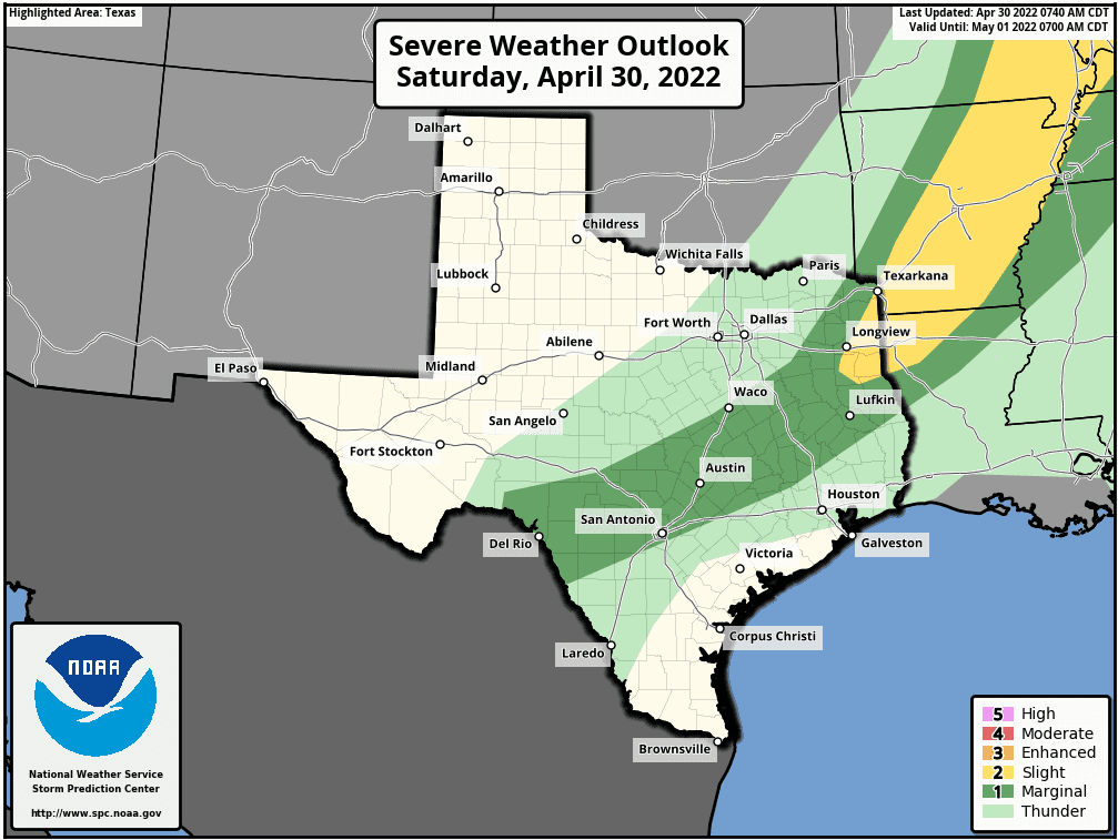
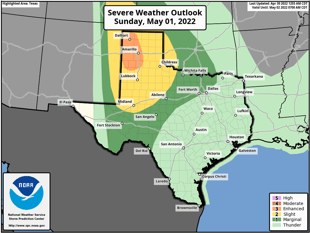
Sunday is when we’re facing a much greater threat for severe storms which will be focused across far eastern New Mexico, the Texas Panhandle and far western Texas. The Storm Prediction Center has outlined an Enhanced Risk (Level 3) across the western and northwestern Panhandle regions, and Slight Risk (Level 2) for the eastern panhandle, rolling plains and northern Permian Basin region for Sunday afternoon and evening. A moderately strong upper level system will arrive by the mid to late afternoon hours across far eastern New Mexico and the far western portions of the Texas Panhandle and western Permian Basin region which will kick off islated to scattered storm development. Today’s stalled front will also begin lifting north by very early tomorrow as a warm front which will drag moisture north/northwest and bring moisture back with it. With lift from the approaching upper level system and surface moisture falling into place, we’ll also see instability increase rapidly during the afternoon hours on Sunday as morning cloud cover clears away and we get some surface heating. Where the warm front ends up will further enhance wind shear and storm development/severity especially across the western Texas panhandle along the dryline Sunday afternoon. The key message for Sunday for folks in the Enhanced and Slight Risk areas is to be weather aware and have a way to receive weather notifications. All modes of severe weather will be likely on Sunday during the afternoon and early evening hours with large to very large hail 2+ inches in diameter likely, damaging winds and a few tornadoes. As we get into the late evening and overnight hours, the tornado threat decreases as storms begin to lose their supercellular structure and become more clustered and linear (mini squall lines/bowing segments) as they continue east into western north Texas and further east into the Permian Basin. We’ll still see issues with hail and damaging winds, but the tornado threat will diminish. Stay tuned for additional updates and live coverage on Sunday as this event unfolks. We’ll have several chasers out in the field on Sunday so Stay Tuned!!!


0 Comments