
The summer solstice isn’t until June 21st, but Mother Nature has elected to throw summer our way early. This past weekend brought record heat to a majority of Texas. Sadly, it is unlikely we’ll see more than short-term breaks from the summer heat over the coming three months. Another aspect of the summer months is the threat of tropical cyclones. We are not anticipating any tropical cyclone mischief impacting Texas over the next seven days.
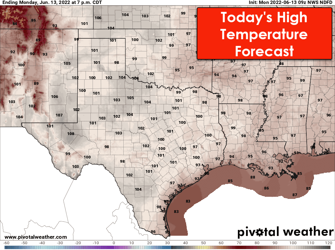
This afternoon’s temperatures will top out in the triple digits across the western seventy-five percent of Texas. We’ll see temperatures ‘only’ in the 90s across East Texas, but ‘feel like’ temperatures will still be in the triple digits. Today will be a couple of degrees cooler’ than yesterday’s record-breaking heat, but that nitpicking won’t change the fact it’s hot.
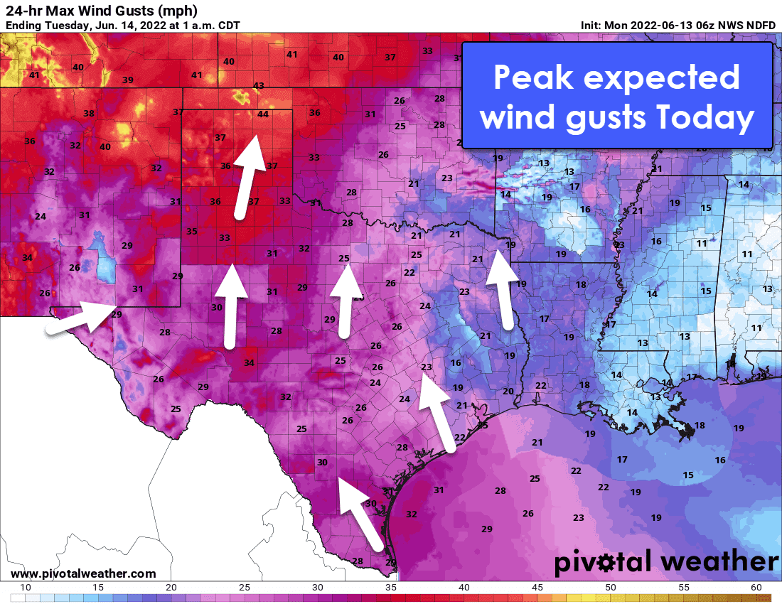
Wind will become quite noticeable this afternoon across Texas. While one might hope the wind would provide relief from the heat, I’m afraid it may also emulate a blowtorch. Given the gusty winds and hot temperatures, we may see a return to more significant wildfire behavior across Western Texas today. Southerly winds may gust up to near 40 miles per hour in the Texas Panhandle and 35 miles per hour in West Texas and the Permian Basin.
Temperatures may ‘cool’ a few degrees tomorrow through mid-week, but it’s still going to be hot. Widespread rain is unlikely to occur in Texas over the next seven days. There is a low chance for a few showers and storms near the Texas Coast late in the week, but nothing widespread or heavy.


0 Comments