
Showers and thunderstorms will continue quickly moving east this morning across Northeast Texas and East Texas. The threat of severe weather remains limited, and we didn’t have too many issues overnight. Precipitation chances will conclude for East Texas around lunchtime today. After that, our focus will once again shift back to fire weather concerns and the timing for today’s cold front.
Cold Front Timing
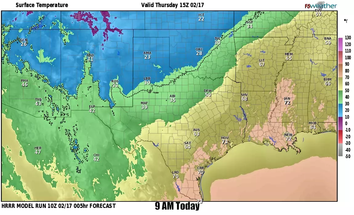
A strong cold front will move south across much of Texas today. The front has already pushed through the northwestern third of Texas – and it’s brought rather unpleasant wind chills with it. Most folks will experience their high temperatures shortly before the front’s arrival today. We do not anticipate temperatures to climb much this afternoon behind the cold front, especially from the Texas Panhandle southeast into the Big Country and North Texas. Temperatures will top out in the 70s across the southeastern half of Texas today. Still, they will fall quickly after the front arrives. Those across South Texas will have to wait until tonight for the front to bring cooler temperatures.
Today’s wildfire danger
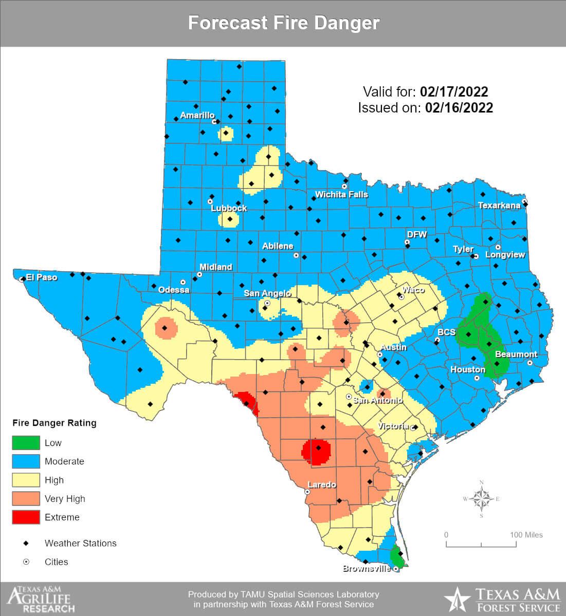
Today’s highest threat for fast-moving grass fires will be in Central Texas, the Hill Country, Edwards Plateau, and South Texas. We note the threat for grass fires will continue behind the cold front today and include areas that may have received some rainfall overnight. Dormant vegetation will not ‘green up’ – all the rain did was make the ground muddy, but the dormant grasses will still burn. The threat of grass fires will increase across Texas on Friday and through the weekend.
Warming up this weekend
Our colder weather today and tonight will be short-lived. Temperatures will end up being cooler on Friday, with high temperatures ‘only’ in the 50s and 60s across Texas. Considering last February, I think we’ll manage to survive those ‘cooler temperatures’ just fine. We’ll continue to climb the temperature roller coaster on Saturday and Sunday – with each day being several degrees warmer than the last. The threat of grass fires will increase over the weekend as above-average temperatures and low humidity values promote fast rates of spread.
Next week’s weather looks active.
Next week is looking busy in the weather department. We’ll have a storm system on Monday and another one Wednesday and Thursday. The first system looks more spring-like, while the mid-week system could feature a colder-weather situation. After we get past today’s weather, we can start to focus our attention on what next week may hold. Either way, it looks like some folks will be getting much-needed precipitation!


0 Comments