
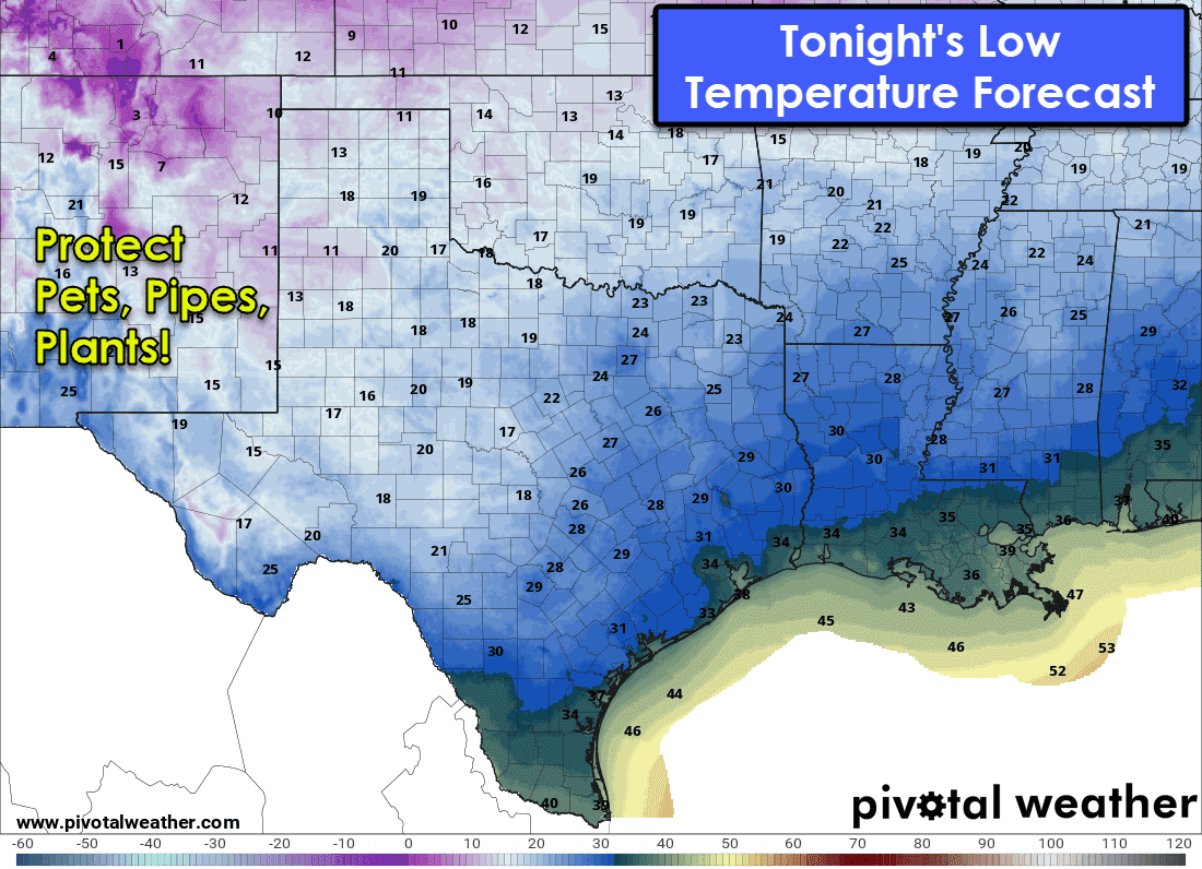
A strong cold front has progressed through the northwestern half of Texas overnight. Gusty north winds and much cooler temperatures are being observed behind the front. The cold front will continue pushing southeast as we continue through the day. Warm weather across the southeastern half of Texas will give way to much cooler weather once the front arrives today. The cold weather will be brief. After a freeze across the northern three-fourths of Texas tonight, a rapid warmup will commence tomorrow and continue through early next week.
Short-term Snow Forecast
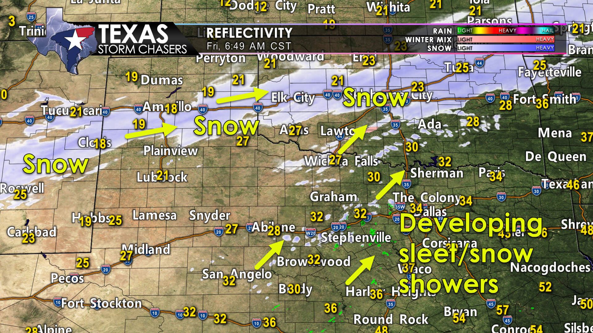
With the temperature formalities out of the way, let’s dive into the ongoing winter weather. Bands of snow are progressing across the Texas Panhandle this morning. We’ve seen one to three inches of snow along the Interstate 40 corridor from Vega to Amarillo. Snow bands now extend from Bovina and Vega east to Amarillo, McLean, Shamrock, and Canadian. Blowing snow and one-half inch to one inch of snow per hour are expected for the next few hours. That snow band will move into Oklahoma later this morning.
Further southeast, we’re seeing scattered ‘sleet showers’ and a winter mix develop across Northwest Texas, the eastern Big Country, and western North Texas. Unlike the heavier snow in the Texas Panhandle, this activity is lighter and more isolated.
We’ll see an uptick in this light activity over the next several hours and into the late morning. We may also see patchy freezing drizzle. Minor accumulations of ice and snow are possible in the western and northern suburbs of the D/FW Metroplex.
Depending on temperature trends, I can’t rule out a bit of accumulation within the metroplex itself. Our primary concern will be for a few slick bridges and overpasses – with those occurrences becoming more widespread toward Wichita Falls and Gainesville. Some surface roads may also become slick where heavier sleet/snow falls closer to the Red River.
This will be more of a localized/minor/spotty issue across North Texas today – not a widespread, shut ‘er down winter storm.
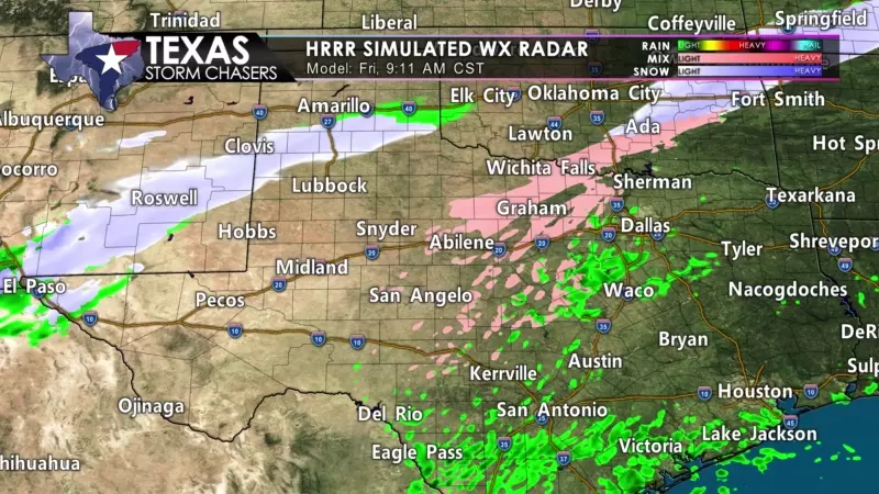
This afternoon, we could see rain change over to snow across Northeast Texas. Weather model data has been a bit more aggressive this morning, with the chance for one to two inches of snow in places like Paris, Clarksville, De Kalb, Texarkana, south toward Tyler, and Marshall.
Slushy conditions on roads would occur, although surface temperatures are projected to remain just above freezing. Hopefully, we’d keep roads just wet, with accumulations limited to the grass and other elevated surfaces.
Travel conditions will likely begin improving not long after the snow stops falling today in the various regions across Texas. Warmer ground temperatures thanks to the recent warm weather and higher sun angle in late winter should help start the melting process.
Any wet roads could freeze up after sunset as temperatures fall below freezing. As stated previously, we’ll start a rapid warmup tomorrow. We will likely melt off most (if not nearly all) accumulations by early Saturday afternoon.
Forecast Accumulations by Region


0 Comments