
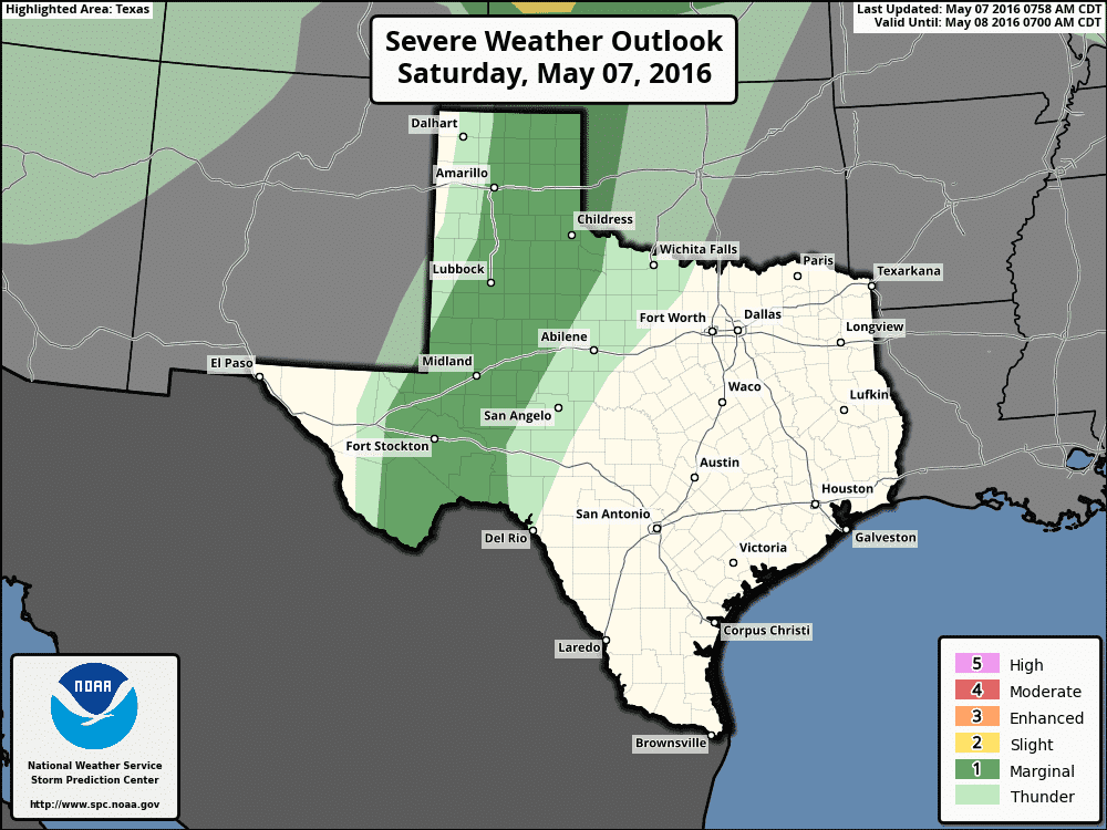
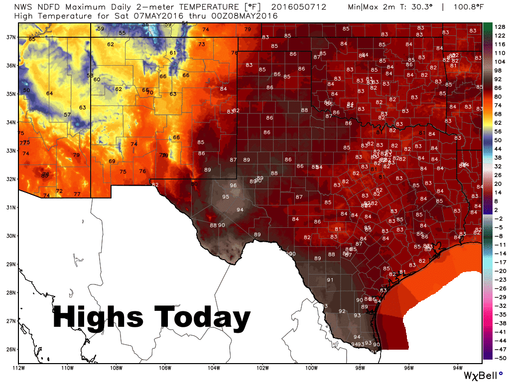
The next several days will hold chances for rain and storms for several locations across the state. Not everyone will see rain or storms, but for those that do, a few could pack some punches. For this afternoon, best chances for seeing isolated severe storm development will be along the dryline in west Texas from the central panhandle down into the central Permian Basin region. Lack of surface moisture, a reasonably strong cap and lack of much upper level support will be the main limiting factors to more robust and widespread storm development, but if a few manage to break through and get going, we could see an isolated hail and damaging wind threat.
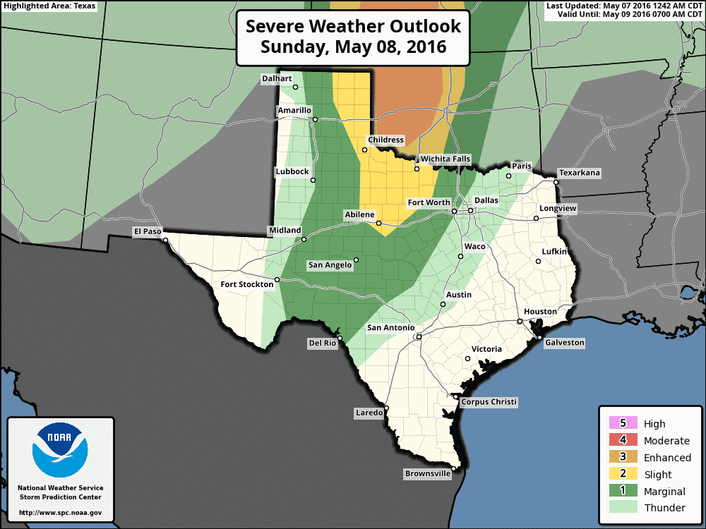
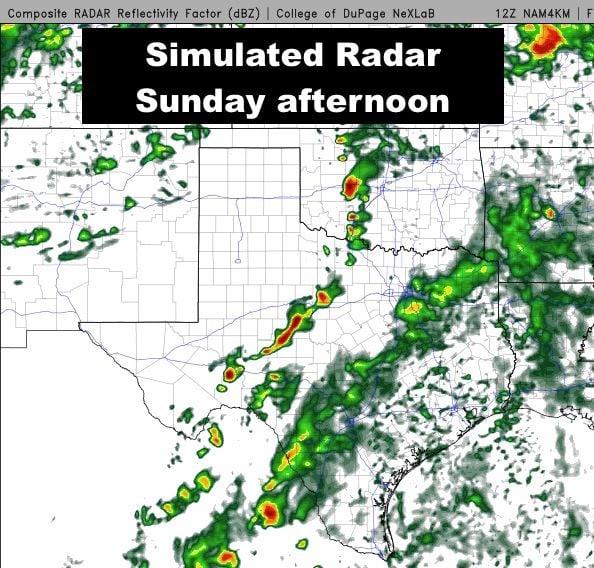
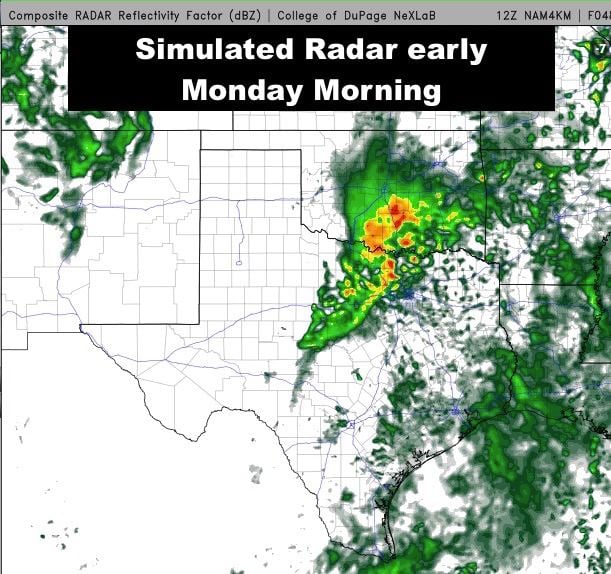
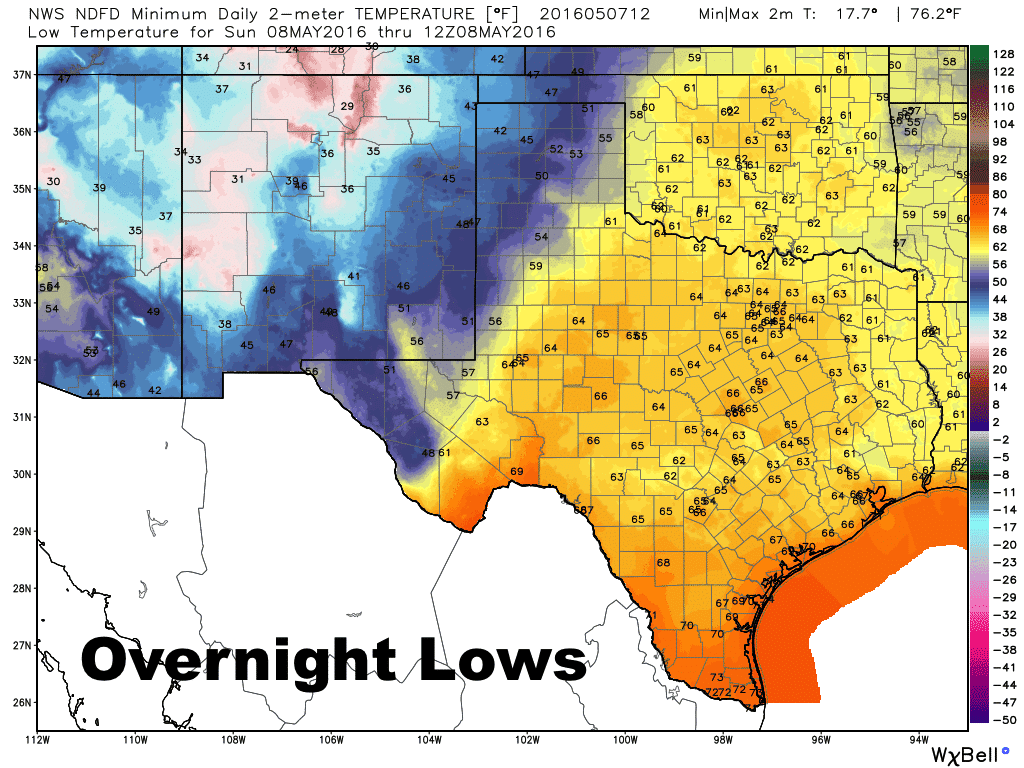
Moisture will be on the rebound by early tomorrow which will increase the chance for seeing scattered light showers very late tonight into tomorrow morning across parts of central and south central Texas. Tomorrow afternoon continues to hold the greatest threat for severe weather this weekend. The strong upper level system on approach from the west will be closer and will provide much more upper level support for storm development along the dryline tomorrow afternoon and evening. The dryline itself will push further east and the potential for more numerous strong to severe storms will exist within the Slight Risk region which stretches from the eastern panhandle down into western north Texas. While the greatest threat for severe weather will be located across western Oklahoma up into Central Kansas, we’ll still see the potential for development in our state across the aforementioned regions after 2-3pm tomorrow afternoon. All modes of severe weather are possible with any of the more robust storms including very large hail, high winds, heavy downpours and a couple of tornadoes. With a couple of waves of energy expected to come from this next system, additional overnight rain/storm development is also possible across north Texas which could carry on through early Monday morning. This activity is not expected to be severe in nature. We will continue to monitor tomorrow’s outlook closely and provide another update later this evening, so be sure to check back!


0 Comments