
Welcome to another Hump-day edition of the Texas Weather Roundup! We’re only 43 days away from Thanksgiving and 73 days away from Christmas. That little trivia has nothing to do with today’s weather, but I figured someone could use some cheer. Unfourtinietly, our weather isn’t going to be particularly cheerful today across some of Texas.
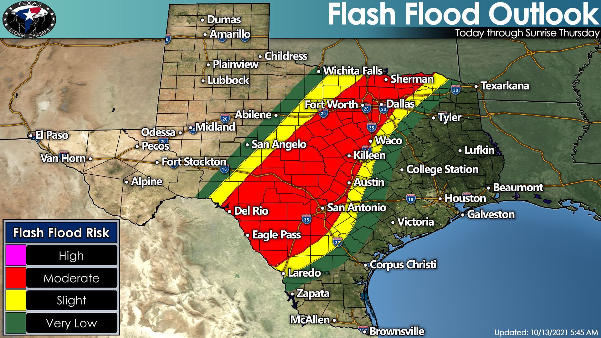
The Weather Prediction Center has issued a sizable moderate risk for flash flooding. This higher threat for flash flooding will be thanks to a cold front coming in from the northwest and tropical moisture arriving from Hurricane Pamela in the eastern Pacific. While a few showers and storms are underway this morning, we expect more widespread rain to develop this afternoon.
Rounds of heavy rain and thunderstorms are likely tonight into the morning hours on Thursday. More rowdy storms will likely produce hourly rainfall rates exceeding two to three inches. Add up a few hours of rain, and one can certainly see why flooding may become a problem.
The Interstate 35 corridor from the D/FW Metroplex south through San Antonio is located in this elevated flooding threat zone. It also includes the Edwards Plateau (Del Rio and Eagle Pass), the Hill Country, the eastern Concho Valley, and North Texas. Urban flash flooding is even more problematic given the higher road density and urban infrastructure.
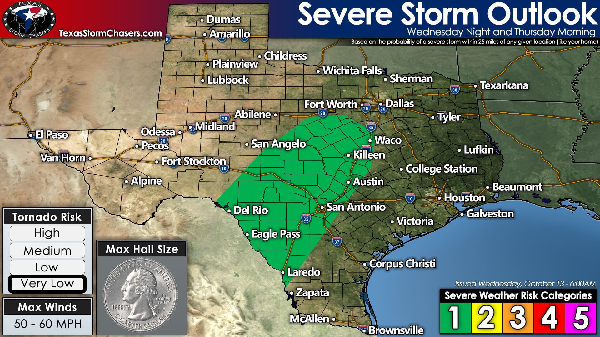
There is a level one risk for isolated severe storms from the Edwards Plateau northeastward into southern North Texas tonight into Thursday morning. The severe weather threat is a secondary concern to what will likely be a far more significant heavy rain/flooding issue. A brief tornado or strong wind gust can’t be ruled out. The ‘T’ word may get a lot of attention, but we need to focus on the threat of flash flooding later today, especially overnight into Thursday morning.
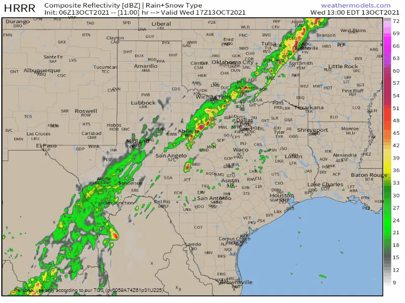
Simulated weather model radar from noon today through 6 PM Thursday. Weather models have not been handling the ‘simulated radar’ portion of this event too well, so use this only for a vague, general idea of how we expect the next day to play out. Locations of heaviest rains may be off, and the timing could be a bit different.
We’re expecting thunderstorm coverage to increase this later this afternoon and tonight from the Edwards Plateau all the way northeast into Texoma – so a big chunk of Texas real estate. Heavy rainfall is likely, with some locations receiving two to four inches of rainfall by midnight. Another round of heavy rain may impact the Hill Country, Central Texas, and South-Central Texas Thursday morning.
The second round of rain may set the stage for a more significant flooding threat around the Central Texas urban corridor. Overall – we’re expecting two to four inches of rain from Del Rio northeast to D/FW over the next 36 hours. That includes the Hill Country, South-Central Texas, Central Texas, and most of North Texas.
Localized rain totals of five to ten inches are possible – and those folks would likely be dealing with more significant flash flooding. Numerous flooded roadways and more substantial creek/stream flooding are what I mean by significant flash flooding. Put that over a large population center, and there’s a reason the Hill Country, Central Texas, and South-Central Texas is nicknamed flash flood alley. It is not a guarantee, but it is a possibility we’ll be closely watching for tonight and Thursday morning.
Heavy rain chances should start decreasing Thursday afternoon – or at least propagate off the I-35 corridor – as the surface low remains of Pamela move northeast.
The simulated radar image above shows storms moving toward the Brazos Valley and Coastal Plains tomorrow afternoon, but this week, the model has not done too well in the more extended range. Let’s see how tonight plays out, and we can get more specific on who will have the highest rain chances tomorrow night into Friday morning.
With all of that said – a very low severe weather risk with a not-so-low heavy rain and flooding concern this afternoon, but especially tonight and on Thursday Morning from the Edwards Plateau northeast through the Hill Country, South-Central Texas, Central Texas, and North Texas.
You can keep tabs on the storms by utilizing our free interactive weather radar here on our website. Better yet, use it in our free mobile app. We’ll be burning the midnight oil again tonight, so be sure to check back for updates as the rains start to fall.


0 Comments