
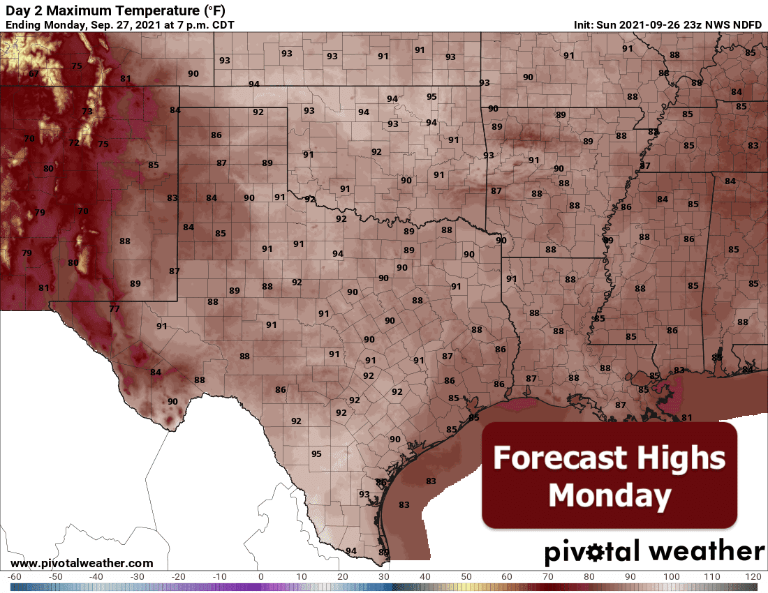
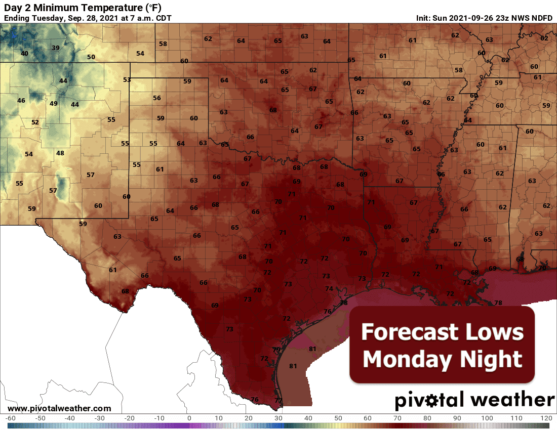
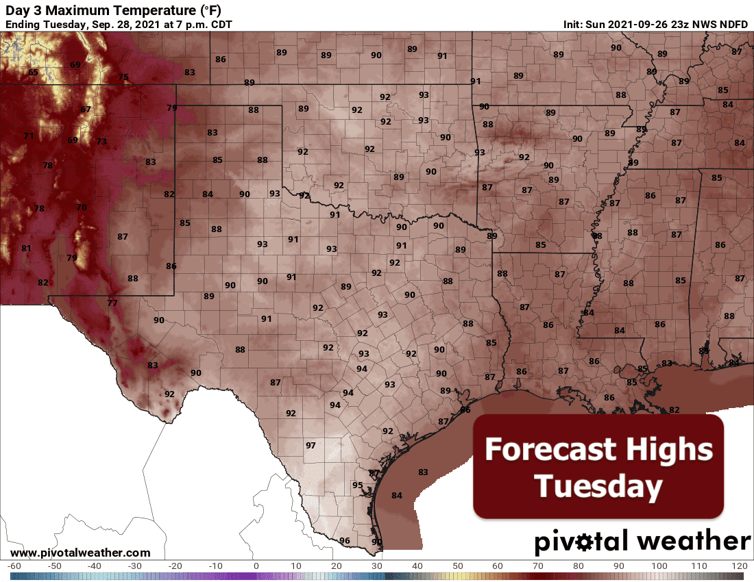
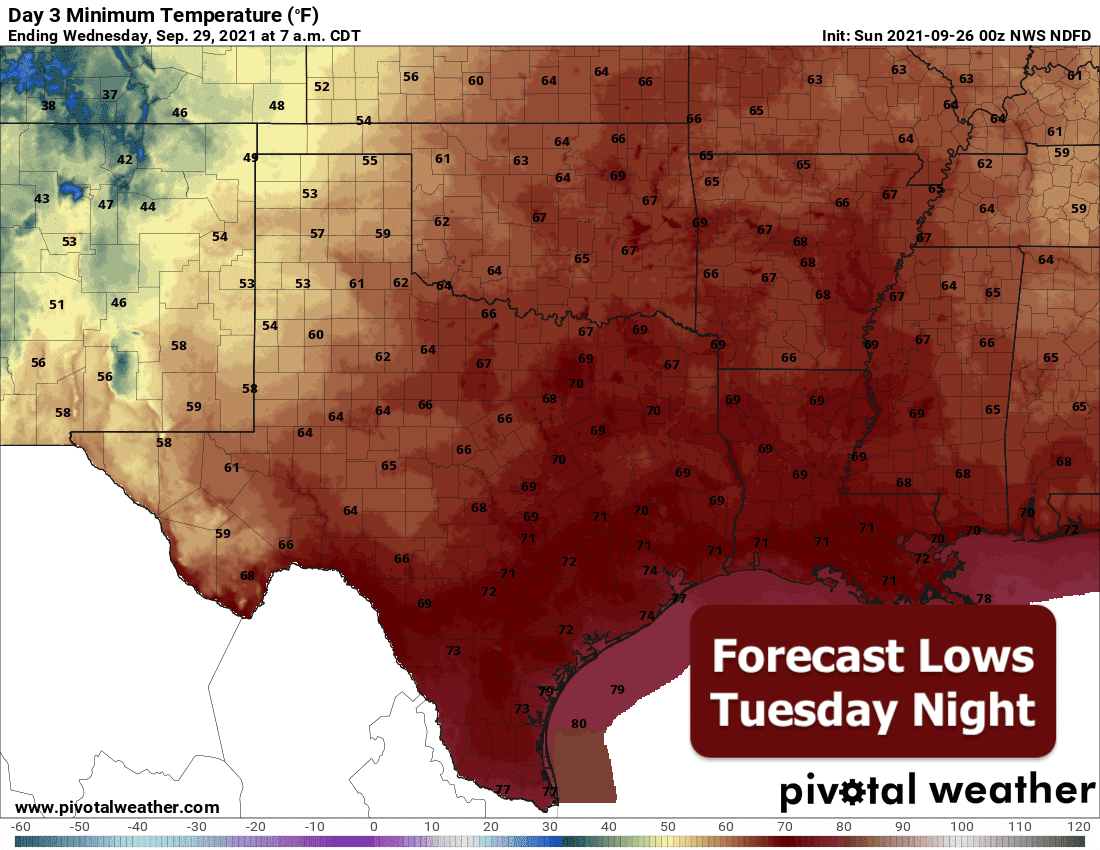
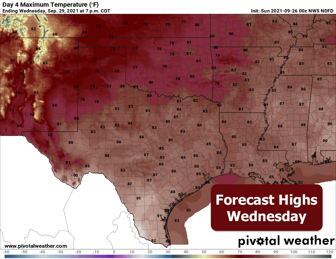
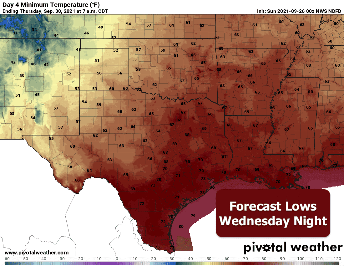
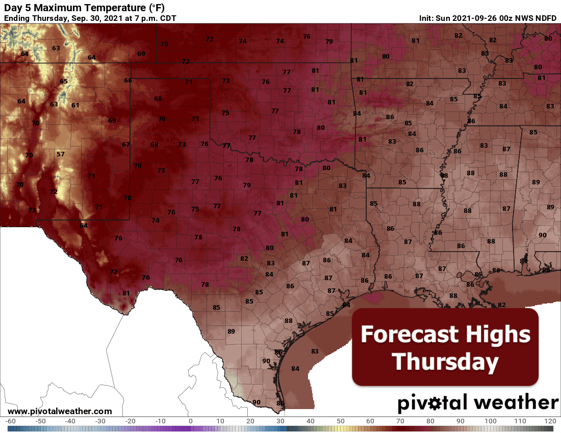
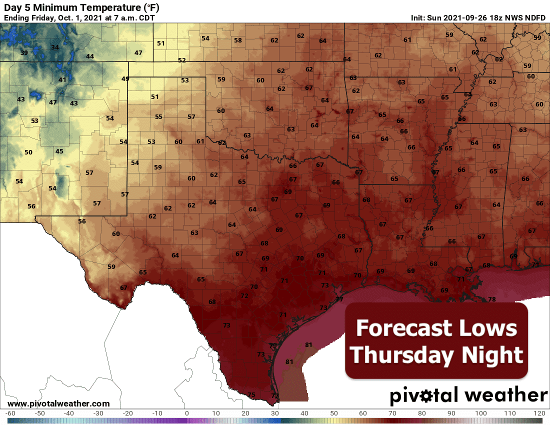
As we’re accustomed to in Texas, just wait in a minute and the weather will change. I hope everyone enjoyed the “False Fall” and the wonderfully dry and mild weather we’ve had since last week’s cool front because we’re to do a complete 360. Monday and Tuesday will be the hottest and likely the driest days of the week before we see rain chances begin to increase by Tuesday afternoon and on through at least Friday. Humid air will also be returning with 60 degree dewpoints pushing into north Texas by early tomorrow morning…and dewpoint temperatures in the 70s further south nearer the coast. That will make the outdoor air feel quite a bit more sticky than we’ve dealt with in about 5 days or so.
Nerd Moment: Has anyone ever wondered why we sometimes reference dewpoint temperature instead of saying how humid it will be? Because it’s a better measure of how saturated the air is relative to our physical comfort while being outdoors. For example, if you have a dewpoint temperature of 65 degrees, the air temperature only has to drop down to 65 degrees before it becomes 100% saturated and fog forms. Using relative humidity can be misleading because you can have air temperature measuring 20 degrees and dewpoint temperature of 20 degrees and have 100% humidity…but that wouldn’t “feel” humid. It would just feel downright cold. By the same measure, you can have a dewpoint temperature of 65 and air temperature of 95 which gives you a relative humidity level of about 38% which doesn’t sound like much…but just go outside, feel how muggy and oppressive that feels and you’ll see why. Basically, dewpoint temperatures of 55 or less is generally considered comfortable. Dewpoint temperatures 65 and greater are considered muggy and becoming oppressive.
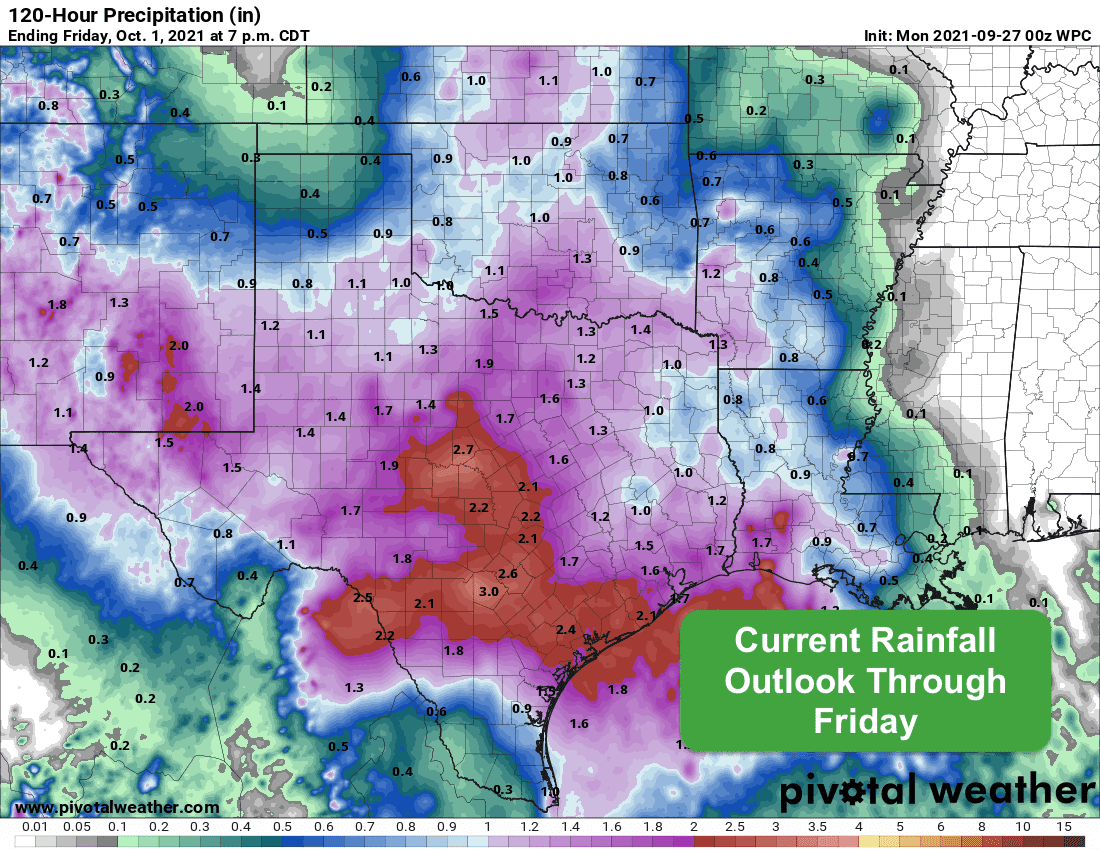
Now, back to the forecast. An upper level low that is currently situated across southern California will shift east/northeast over the next 24 to 48 hours and settle in over the central Rockies. A secondary area of low pressure is also slated to develop over southern Arizona and New Mexico. Both of these areas of low pressure are expected to stick around for a few days and they will assist in bringing lift and moisture back into the region which will work to generate storms for us on a daily basis. Severe weather at this point doesn’t look too likely, but we could see a few stronger storm develop during the week ahead…especially in areas where the greatest daytime heating occurs each day…which could bring a chance for small hail, gusty winds and frequent lightning. We will be keeping an eye on things and will let you know if the potential for any severe weather cranks up. The currently forecasted rainfall this week won’t really swing into gear until Tuesday, but will continue on and off for the remainder of the work week and possibly into next Saturday as well. Not everyone will see rain, but those that do will have a chance of seeing at least a half inch to possibly upwards of 1.5 to 3 inches depending on where you live. At this point in the forecast, it appears the bulk of this week’s rainfall will occur across the Hill Country, Big Country and west central Texas regions. Keep in mind that could change, but the signal for this in recent forecast models has been pretty consistent. As we get further into the week ahead, those who will have received rainfall may begin to encounter localized flooding issues, so keep that in mind as you make your plans for late this week.
Rainfall Outlook Through Friday
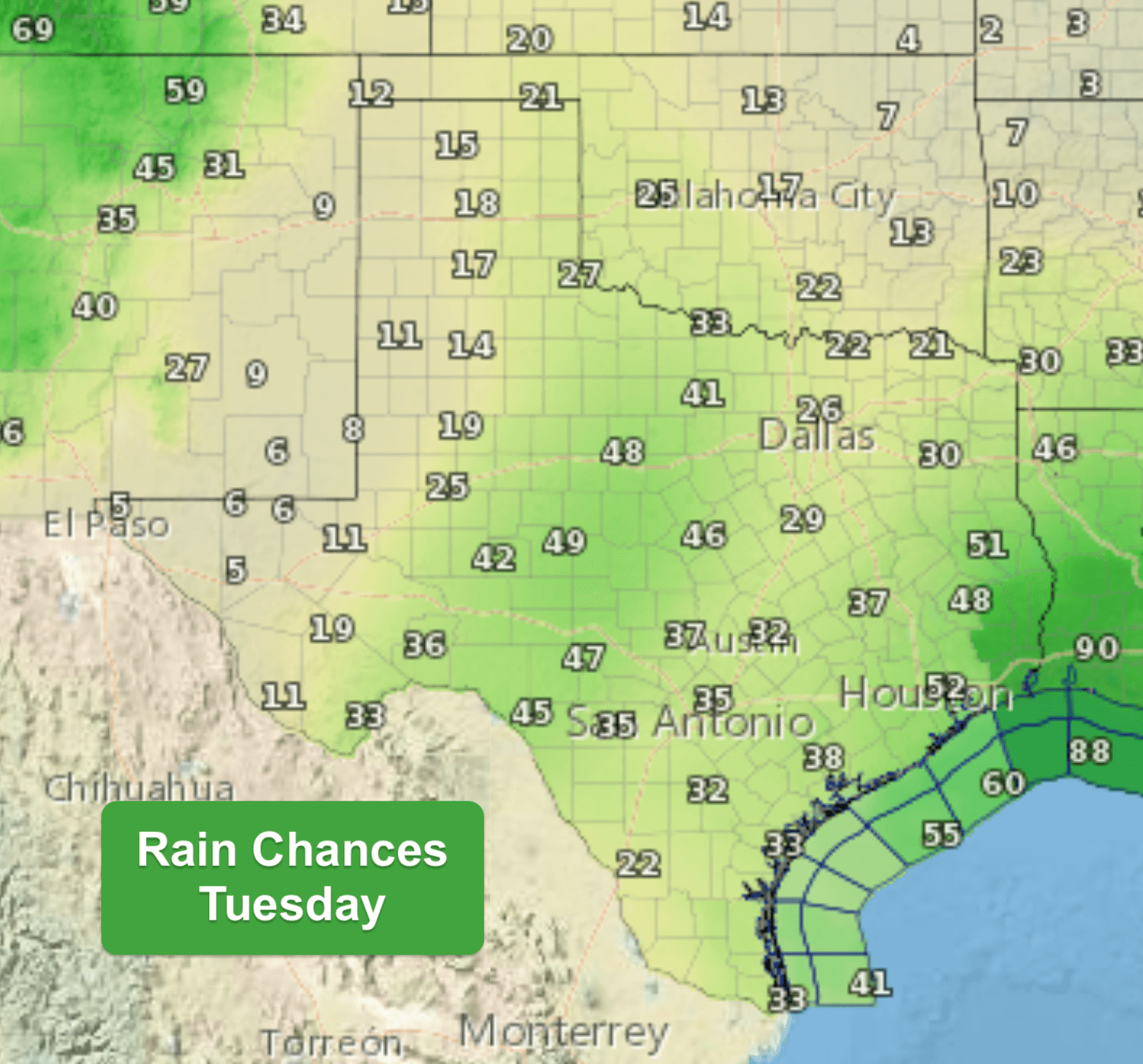
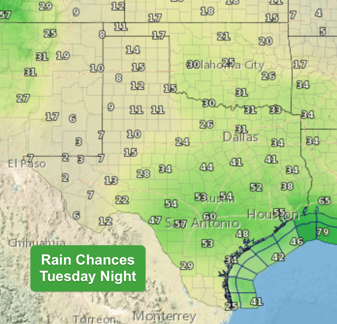
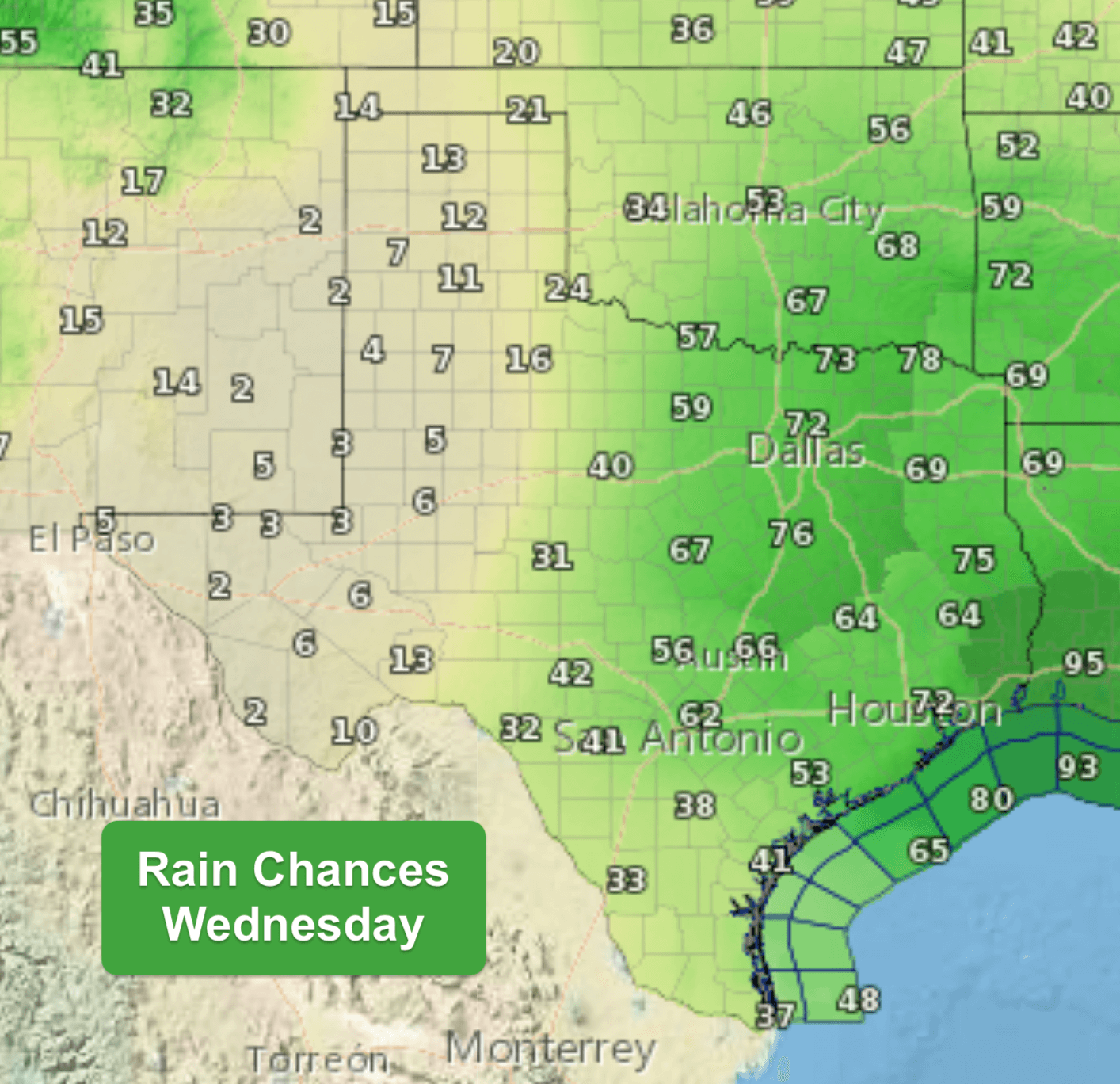
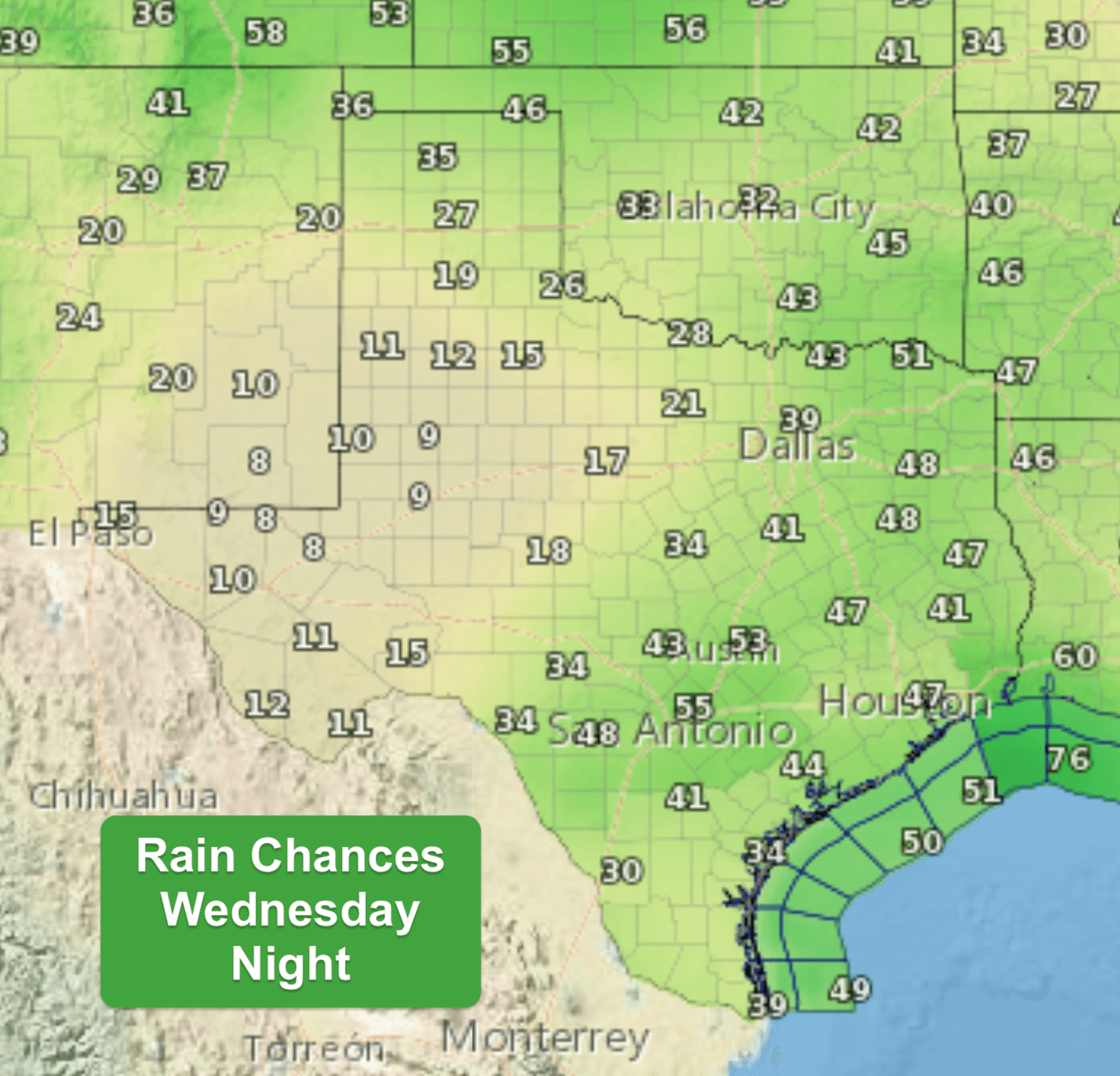
Rain Chances (%) Daily Beginning on Tuesday
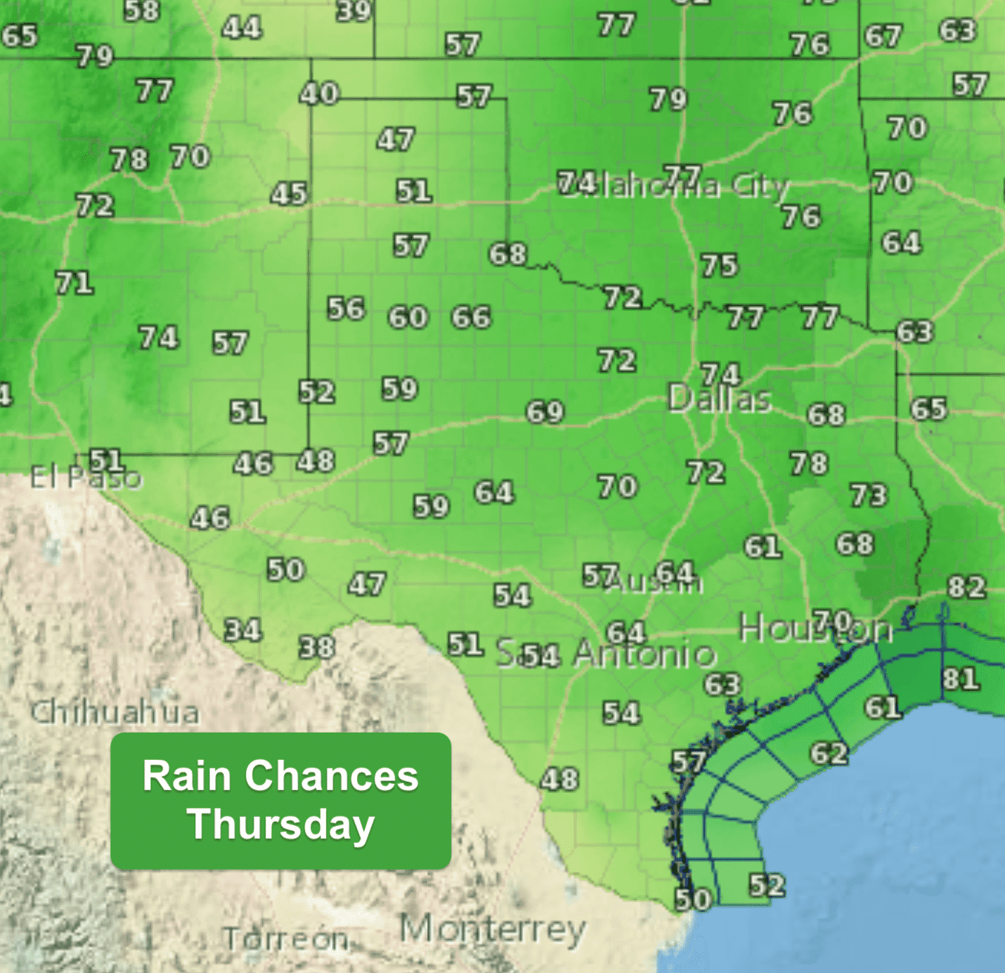
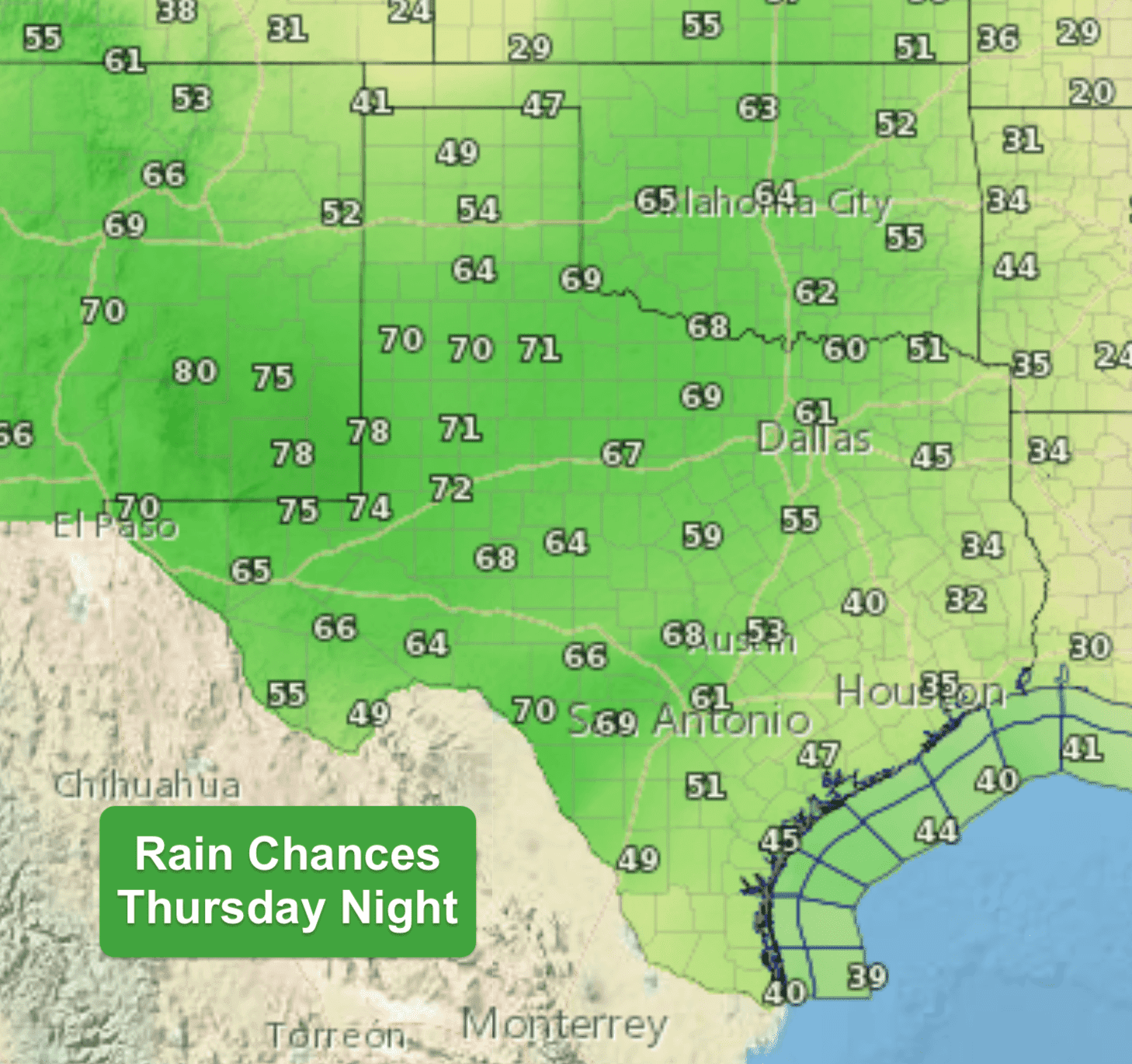
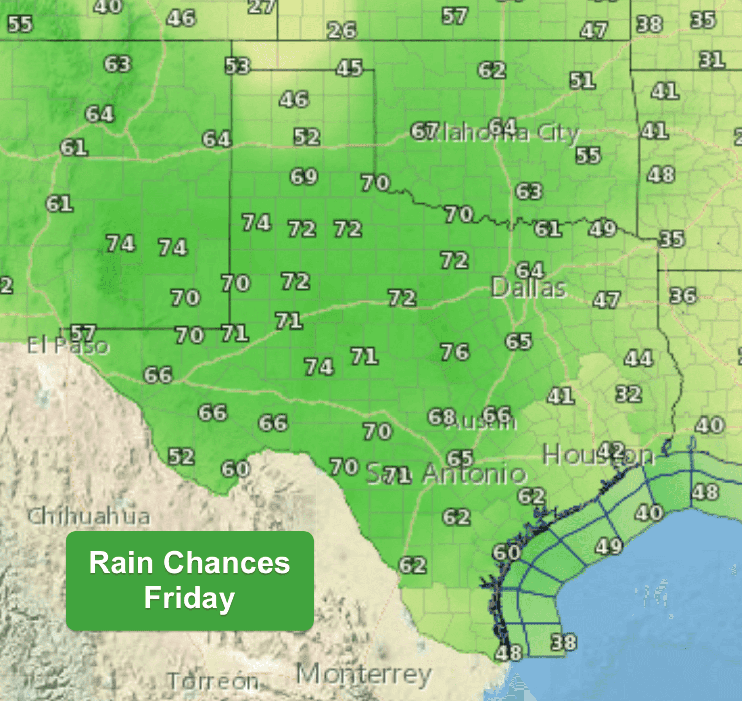
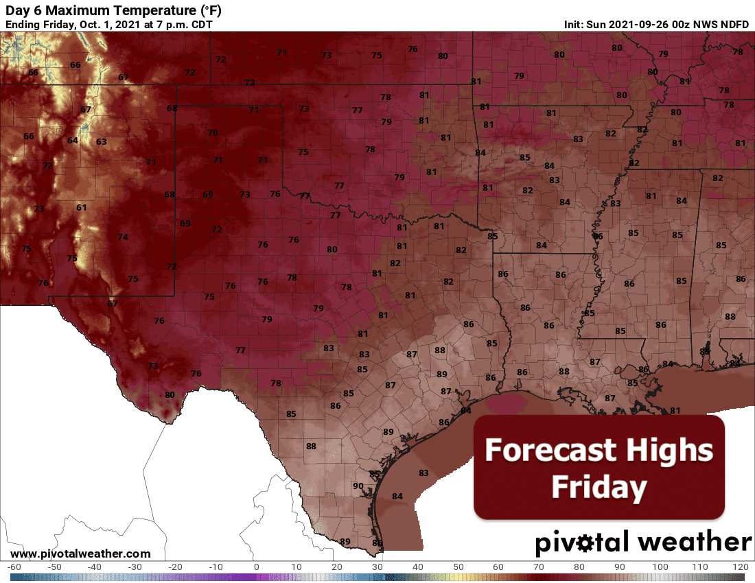
Daily Forecast Highs and Lows Through Friday


0 Comments