
Yesterday was far from typical by Texas-weather standards for August. Precipitation was observed across from Far West Texas all the way east into Louisiana. Some heavier rains exceeding four inches caused street flooding. Temperatures and much lower humidity brought respite from ‘summer heat’ across the northwestern half of Texas. Those pleasant conditions will continue today and again tonight before we head back up the temperature roller coaster.
Scattered to numerous showers and thunderstorms are expected to continue today across South Texas north along the coast into Southeast Texas. More isolated showers and storms may occur in Far West Texas, the Northwestern Texas Panhandle, and North/Northeast Texas. Severe thunderstorms are not expected, but all storms can produce dangerous cloud to ground lightning. Waterspouts cannot be ruled out with convection off-shore. Most of the time, waterspouts will dissipate before moving onshore and are typically quite weak. Localized heavy rain in South Texas could create additional street flooding.
Summer heat returns this weekend
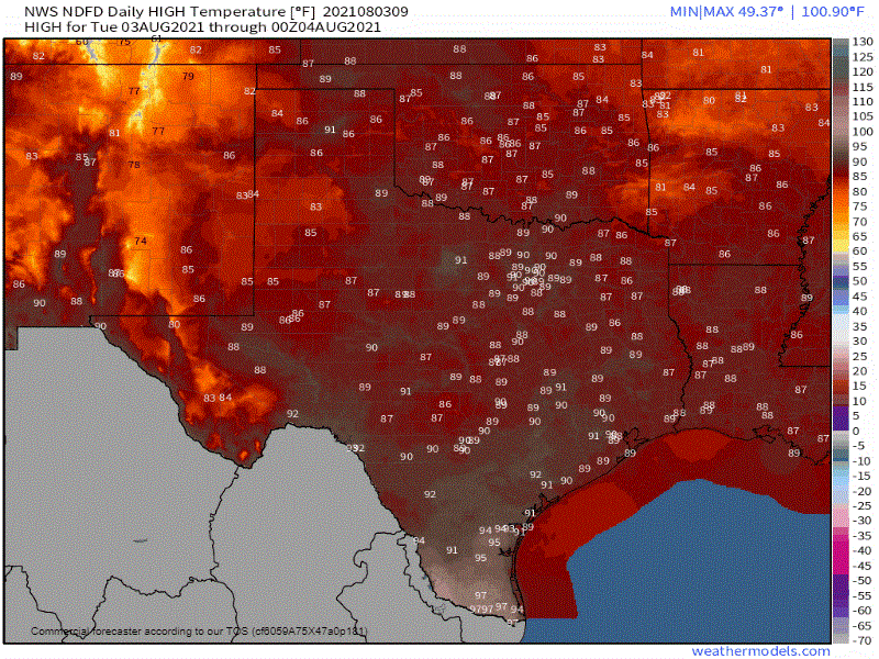
Forecast high temperatures through the remainder of the week
Those across the northwestern half of Texas will enjoy one to two more days of below-average temperatures (for August). After that, rain chances will start to shut off, and the thermostat will climb back into the typical August hell-scape territory. Above-average temperatures for both day and night will be common across all of Texas by the weekend. Triple-digit heat, whether the actual thermostat or the heat index from high humidity, will mean pool and/or beach time. Overnight temperatures will also remain on the hotter side, complicating the threat of heat illness.
The good news? No tropical mischief is on the horizon for us. However, the Atlantic does look like it’ll start cooking out tropical mischief next week. While nothing screams any issues for us yet, we’ll be keeping an eye out. The Gulf of Mexico remains toasty and ready to be jet-fuel for any tropical cyclones that come to visit. Remember: You can keep an eye on the sky with our interactive weather radar here on our website.


0 Comments