
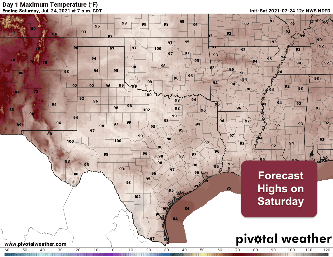
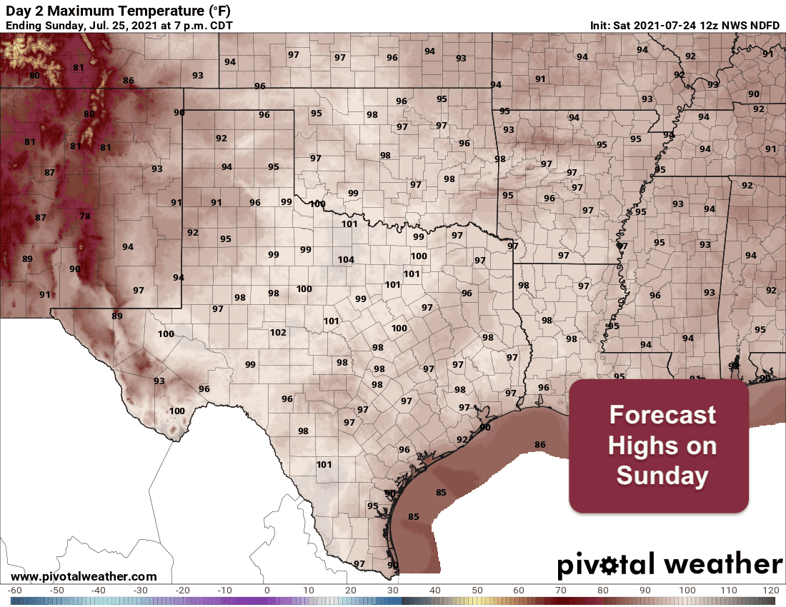
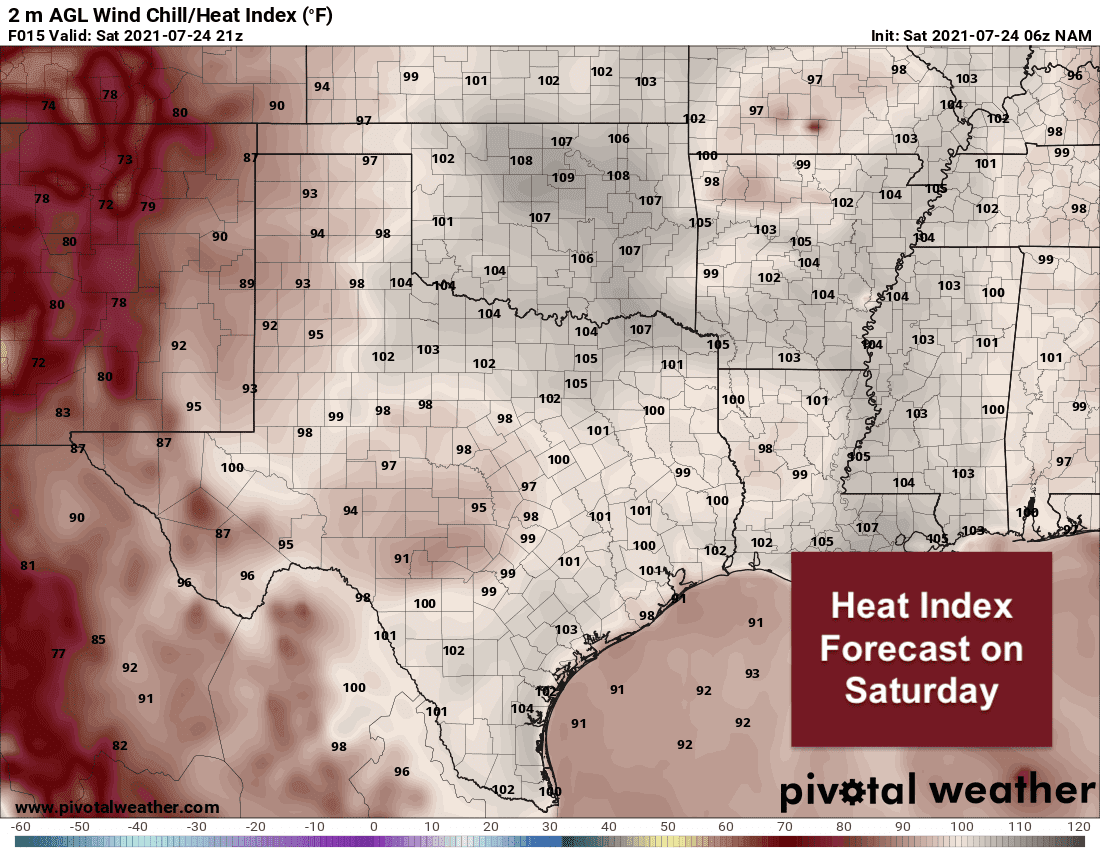
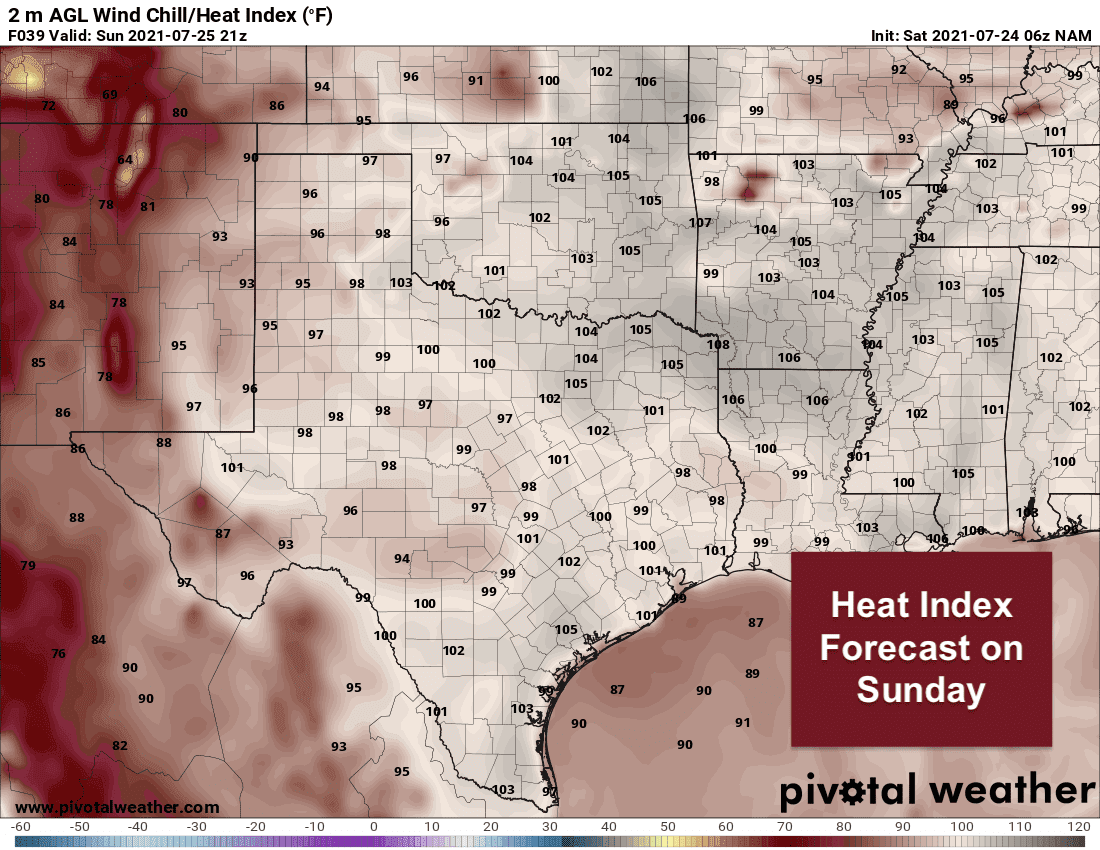
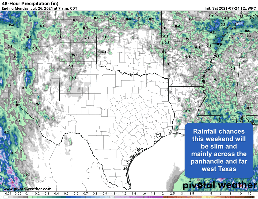
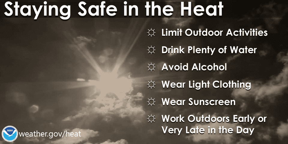
Mother Nature is turning up the furnace this week as we shift from a cooler and wetter pattern into our typical hot, humid and dry mid summer pattern. A dome of high pressure over the central and southern plains will be firmly in place for the next week or so which will translate to highs in the upper 90s and low 100s during the next several afternoons, and warmer overnight lows. For at least the next several days, humidity will be an issue for folks mainly along and east of the I-35 corridor resulting in heat index values above 100 each afternoon. While we had a few days back in June with upper 90s and a few 100s, the cooler and wetter end of June into July has left us rather unequipped to deal with heat of this nature. That said, don’t be surprised to see Heat Advisories issued within the next 24 to 48 hours. Our bodies need time to adapt, so take extra precautions if you’re planning to be outdoors during peak daytime heating. Precipitation will be sparse this weekend and into next week as well with a majority of rain chances across the panhandle and far western Texas where daily monsoonal thunderstorms are expected. Even those chances will be scattered with little accumulation. In summary…WELCOME TO SUMMER IN TEXAS!!!
Forecast Highs Today and Tomorrow
Forecast HEAT INDEX (feels like) Temperature Today and Sunday
Forecast Rainfall This Weekend
HEAT SAFETY TIPS


0 Comments