
A cold front will drift into north Texas tonight bringing with it a chance for thunderstorm activity tonight and again on Sunday. The Storm Prediction Center has highlighted the Red River counties of North Texas with a Slight Risk (Level 2), and further south into north central Texas, northwest Texas and the southern Texas Panhandle/rolling plains region with a Marginal Risk (Level 1), for severe storms later tonight into early Sunday.
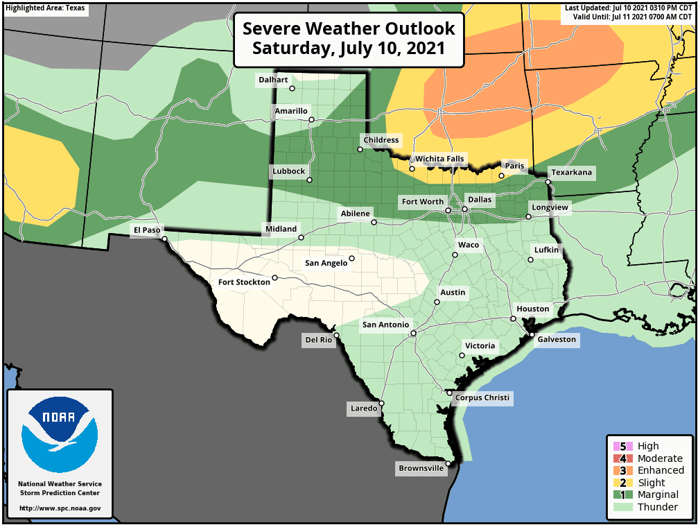
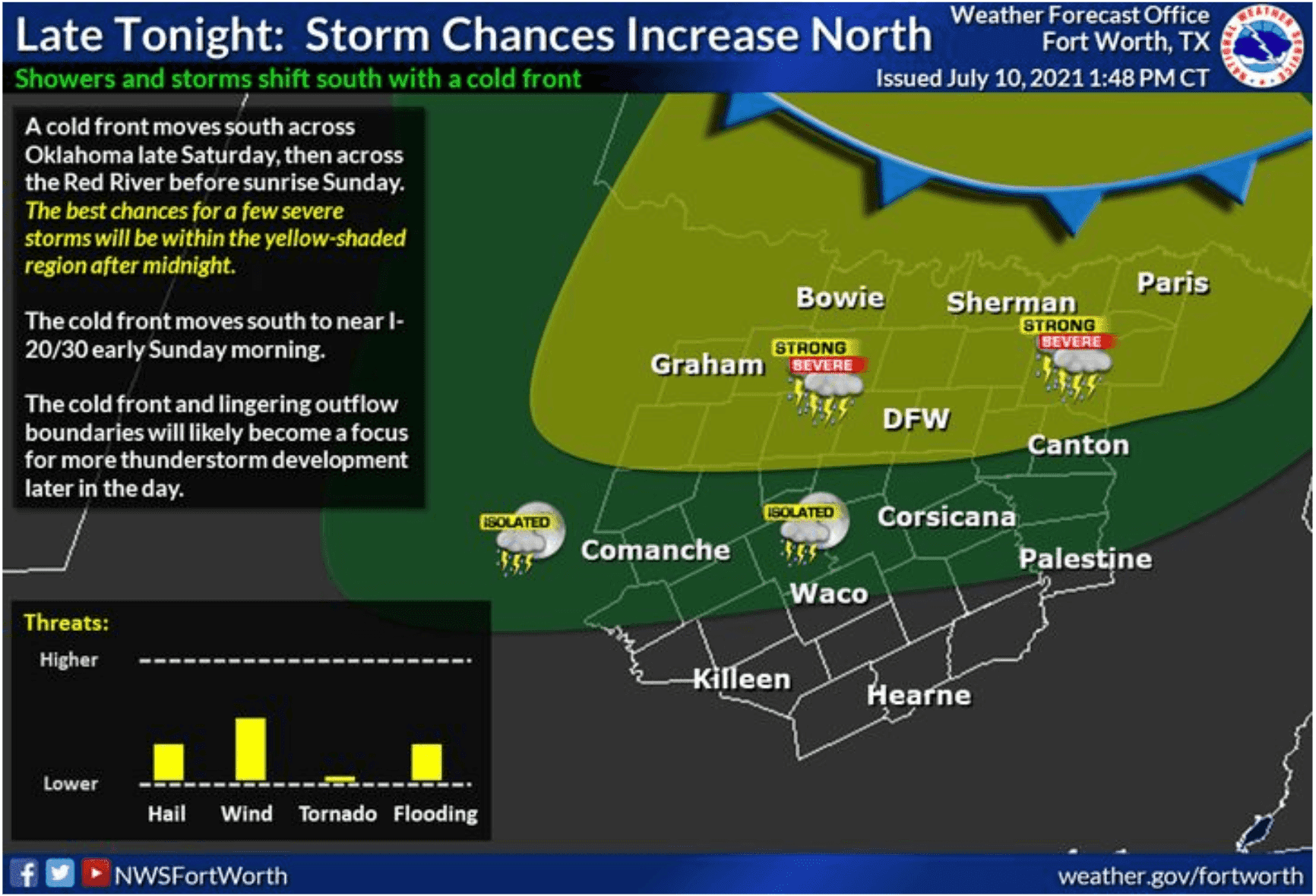
The front is not expected to cross the Red River until after midnight tonight but it is expected to bring with it a line of strong to severe storms and the threat for damaging wind, frequent lightning and periods of torrential rainfall. The tornado threat is pretty much zero with low level veering wind profiles making it unfavorable for tornadic development. Still this is Texas, so we can’t completely rule out a quick spin-up somewhere along the line, but again, that’s very unlikely to happen. The line itself is expected to weaken as it drifts south of the Red River into parts of north and northwest Texas overnight, but we could still experience a few cells on the stronger side survive into Sunday morning before most of the storm activity comes to an end.
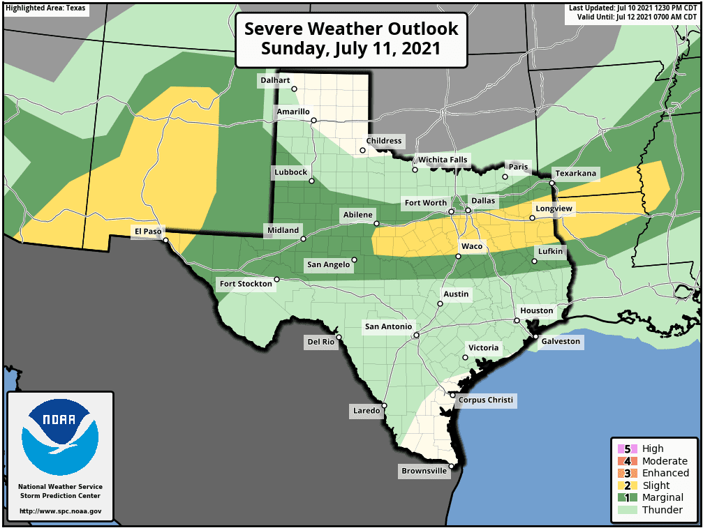
For Sunday afternoon, redevelopment of scattered to widespread storm activity is expected along the frontal boundary. The old frontal boundary by tomorrow afternoon is currently forecast to be located just south of the DFW metroplex, so that will mean most areas south of the I-20 corridor from eastern Texas into central Texas and over into parts of western Texas will have the best chance for seeing the redevelopment of storms tomorrow afternoon. The Storm Prediction Center has outlined a portion of central Texas into eastern Texas with a Slight Risk (Level 2) and this area will have the highest probability of severe weather. Once again, wind profiles will make it unlikely for tornadic development on Sunday, but damaging wind gusts, frequent lightning and perhaps some small hail will all be possible within any of the stronger storms that develop. If you have plans to be out and about tomorrow afternoon within the Slight Risk or Marginal Risk areas, keep an eye on the sky and have a way to receive weather alerts!


0 Comments