
Multiple rounds of heavy rain are expected over the next two days near the Texas Coast. A particular concern for very heavy rainfall amounts does exist around the Middle Texas Coast. Nine to fourteen inches of rain may fall by Friday between Corpus Christi and Port Lavaca. Such excessive rainfall will result in considerable flash flooding. During the heaviest storms, rainfall rates may exceed three to four inches per hour.
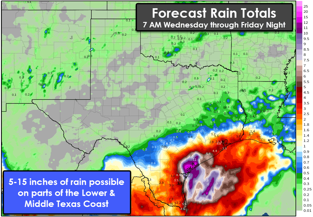
Widespread additional rain totals of two to five inches are expected in the Rio Grande Valley, South Texas, Coastal Plains, and along the Upper Texas Coast. Localized rain totals (from this morning through Friday and not including what fell yesterday) may exceed seven inches. Flash flooding will likely be a problem where those heaviest rains fall, especially when they coincide with urban areas.
Rapid rises on streams, creeks, and rivers are also expected – with those hazards continuing through the weekend as flood waves move downstream. It goes without saying, but the next several days will not be the most pleasant along the Texas coast, though it won’t rain 100% of the time. Soils are saturated and any new rain will runoff into drainage systems. For ongoing and forecasts for river flooding, see the West Gulf River Forecast Center (WGRFC) here.
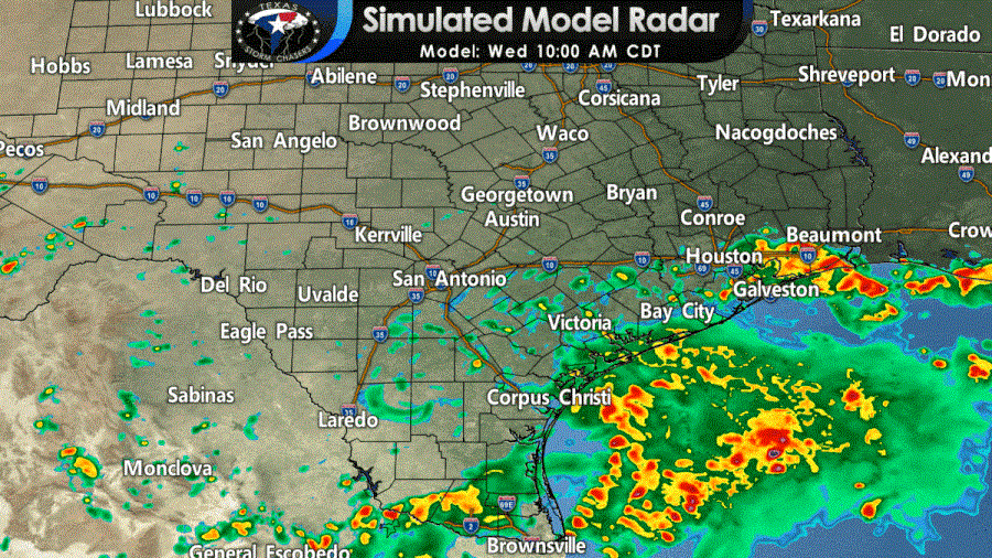
Popup storms further inland
We’re focused on the flooding threat near the coast. Widespread rains will struggle to progress north of Interstate 10 over the next few days. We will have the usual (as of late) scattered afternoon popups further inland. Even if you end up under one of the popup storms, they should not last more than an hour or two. As usual with summer storms, they could drop a quick inch or two of rain before dissipating.


0 Comments