
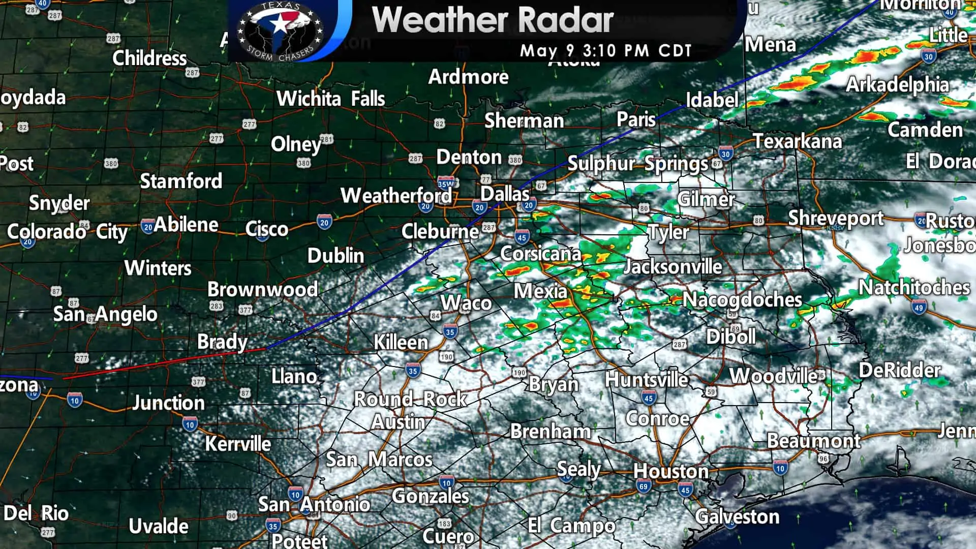
We’re starting to see our first storms of the afternoon bubble up in southern North Texas and East Texas. At 3 PM, a cool front extended from near Clarksville to Waxahachie to Hamilton to Menard. Visible satellite imagery shows severe clear north of the front with a much drier airmass filtering in. South of the front, we’ll be watching for thunderstorm development this afternoon. Today will not be 100% coverage of thunderstorms, and not all storms will be severe.
Severe thunderstorm watches are now in effect from the Hill Country northeastward to the Ark-La-Tex and Northeast Texas. These watches run through the mid-evening hours. I do anticipate another watch later this evening for East Texas. The strongest thunderstorms may produce very large hail up to the size of a baseball, damaging straight-line winds up to 70 MPH, and localized minor flooding. Today’s tornado threat is very low, but not entirely zero.
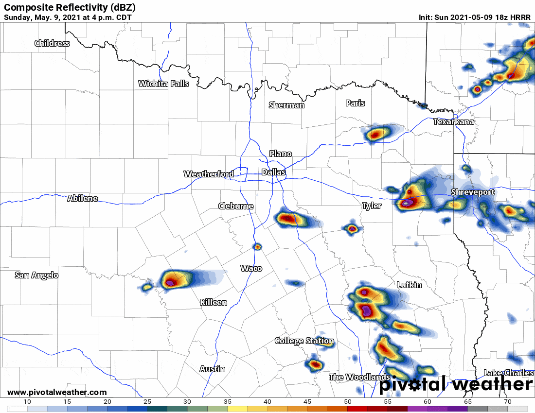
Simulated weather model radar this afternoon through tonight. Keep in mind; this is only a simulation of what might occur. Don’t expect this model to have storm locations/timing exactly correct.
Scattered thunderstorms will be possible through the mid-evening as the cool front slowly moves south. We may see a higher concentration of thunderstorms this evening in East Texas – where better lift and a weaker cap will exist. Today’s severe weather setup isn’t your classic ‘May setup’ with a dryline and discrete supercells.
Instead, we have a slow-moving cool front with an early summer airmass. These setups tend to produce some hailers with strong winds versus tornadic supercells. Indeed, low-level wind shear is weak today – greatly limiting the tornado threat. A summer airmass also means we’ll have to watch for localized minor flooding since there’s plenty of moisture to squeeze out of the atmosphere.
You can watch our live storm chasing video here.


0 Comments