
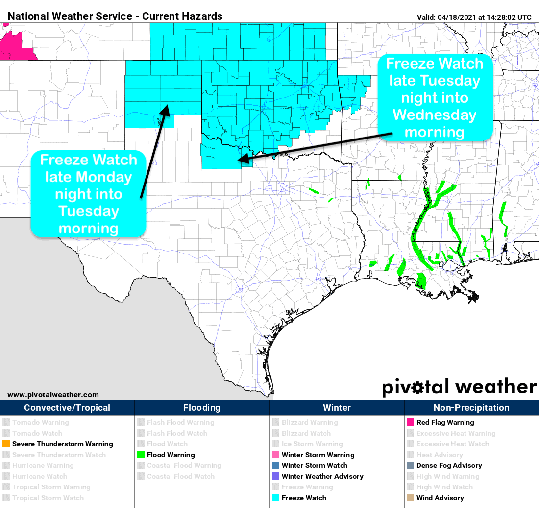
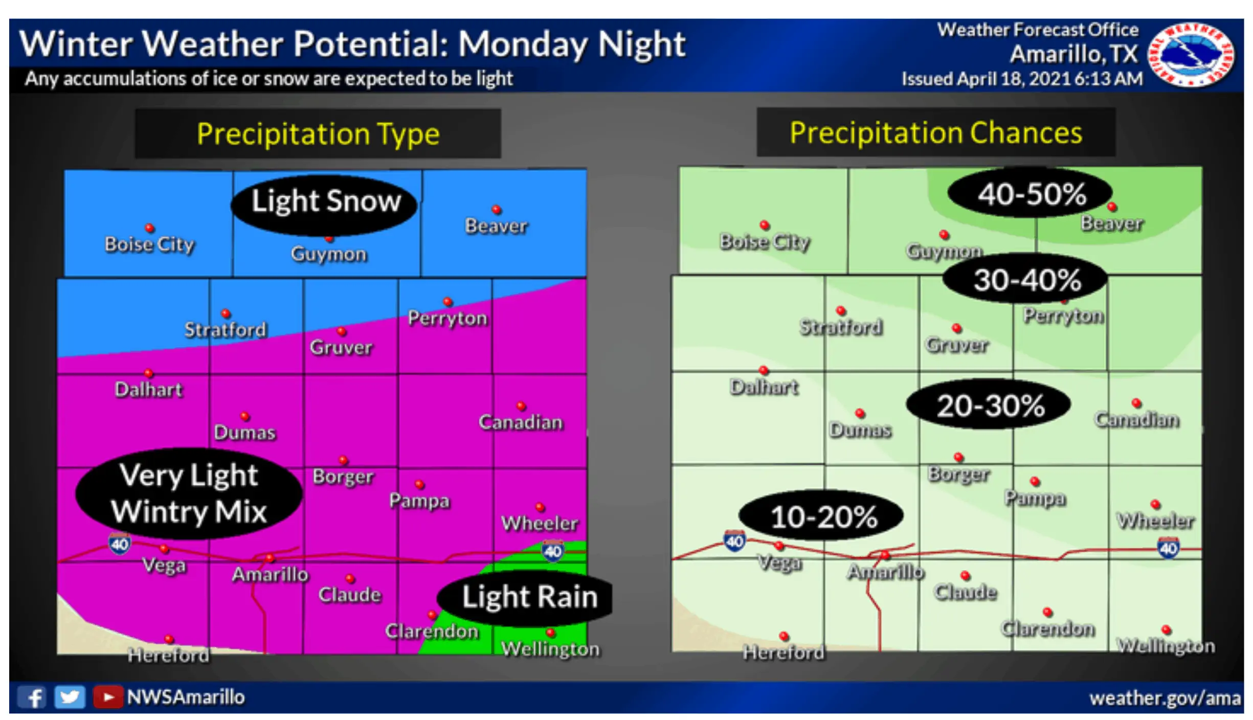
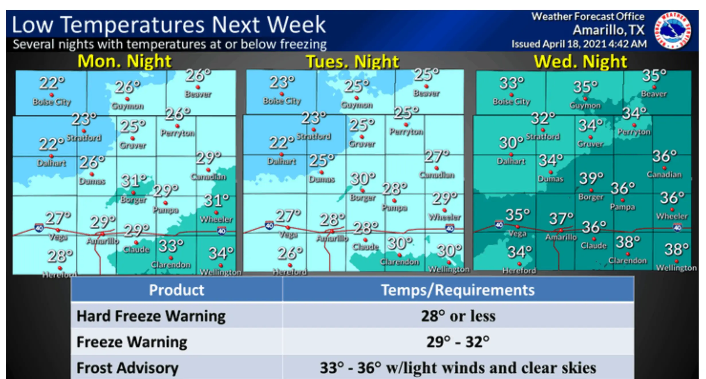
We hope everyone hasn’t put their winter clothes just yet!!! A strong late season cold front is expected to push into the state beginning Monday night moving through the state Tuesday and arriving across our coastal counties by late Tuesday night into Wednesday morning. This front will be largely storm and rain free except for the chance of light wintry precipitation across the northern panhandle. Still, we could see a few record lows for mid-April and a reminder that winter like conditions can still take hold from time to time this late in April. Currently, we have Freeze Watches in place for much of the Texas panhandle for Monday night into Tuesday morning…and for parts of northwest Texas Tuesday night into Wednesday morning. Freeze Watches have not yet been issued for north central Texas or the DFW metroplex, and at this time we are not expecting them to be, but we certainly could see temps close to, or right at, 32 degrees for a couple of hours across our Red River counties early Wednesday morning. Below freezing temps are not expected anywhere south of the I-20 corridor after the cold front arrives, but temps will be unseasonably chilly both Wednesday and Thursday mornings with widespread 30s and 40s for just about everywhere except deep south Texas. Behind the front, daytime highs will rebound pretty quickly by Wednesday and Thursday…so the effects of this strong cold front will not linger for long. As far as winter weather impacts for the panhandle region, they are expected to be minimal early Tuesday with just a light wintry mix, if anything, expected for the Amarillo area during the Tuesday morning commute hours. A light dusting of snow is expected further north, but travel impacts are expected to be minimal. As always, just watch your driving on elevated roadways, bridges and overpasses as these would be the first to experience icy conditions.
Summary of current Freeze Watches
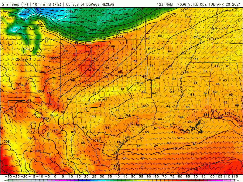
Cold Front Timing – 7pm Monday through 7pm Wednesday

Local NWS Graphics


0 Comments