
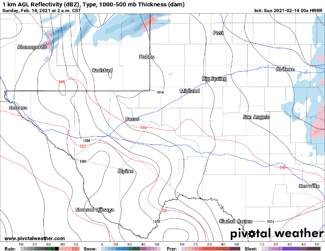
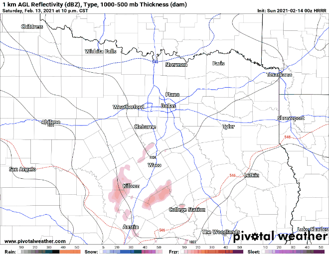
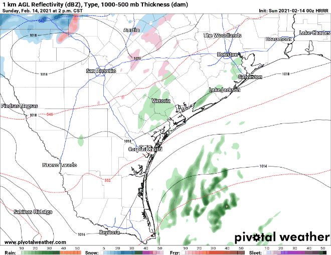
A high-impact winter storm will ramp up overnight and get going full speed on Sunday across a majority of Texas. At this point, I feel like we’ve covered most of the forecast in extreme detail with our morning blog post. For simplicity’s sake, I will share a few images of a simulated radar from this evening’s run of the High-Resolution Rapid Refresh model. I don’t want folks to take the timing and locations verbatim, but this model generally does a good job.
Note: Replaced regional images with GIF animations instead of MP4. Hopefully, that lets folks see them! 🙂
Western Texas
Northern Texas
Southern Texas
Forecast Snow Totals
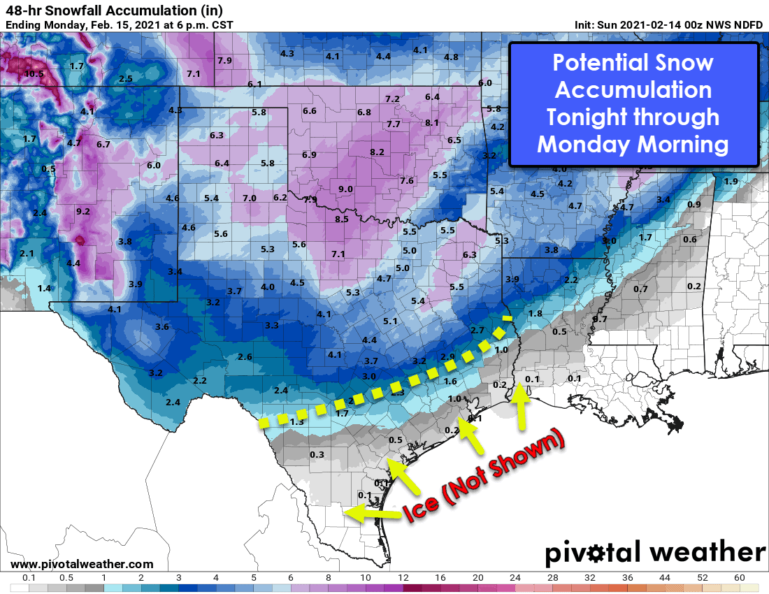
This graphic was generated using the latest forecast data from the National Weather Service. Use this as a general ‘range’ of snow possibilities. Don’t expect the specific numbers to verify, but it shows where the highest snowfall is expected. We note ice is NOT shown on this map but will be an issue south of where we see snow. Some just-arriving data indicates temperatures may end up being a tad bit colder across Southeast Texas and the Coastal Plains. If colder temperatures verify, snow and sleet would be more likely farther south versus just freezing rain and sleet. Even though we’re getting it within 24 hours, some changes (or, as mother nature calls them, trolling surprises) can be expected.
Winter Storm Impacts
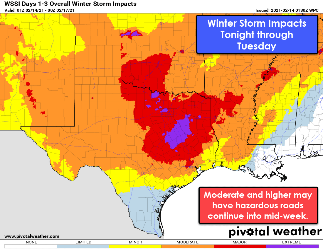
Significant travel impacts are expected from this weekend’s winter storm across much of Texas.
Perhaps more useful than an accumulation map is a winter storm impact graphic. The impact graphic takes into account all the winter precipitation. Clearly, most of Texas is going to see considerable impacts from this weekend’s winter storm. The brutal cold will filter in as the winter storm is departing – resulting in the coldest temperatures some of Texas has seen since the 1980s (or earlier) on Monday and Tuesday.
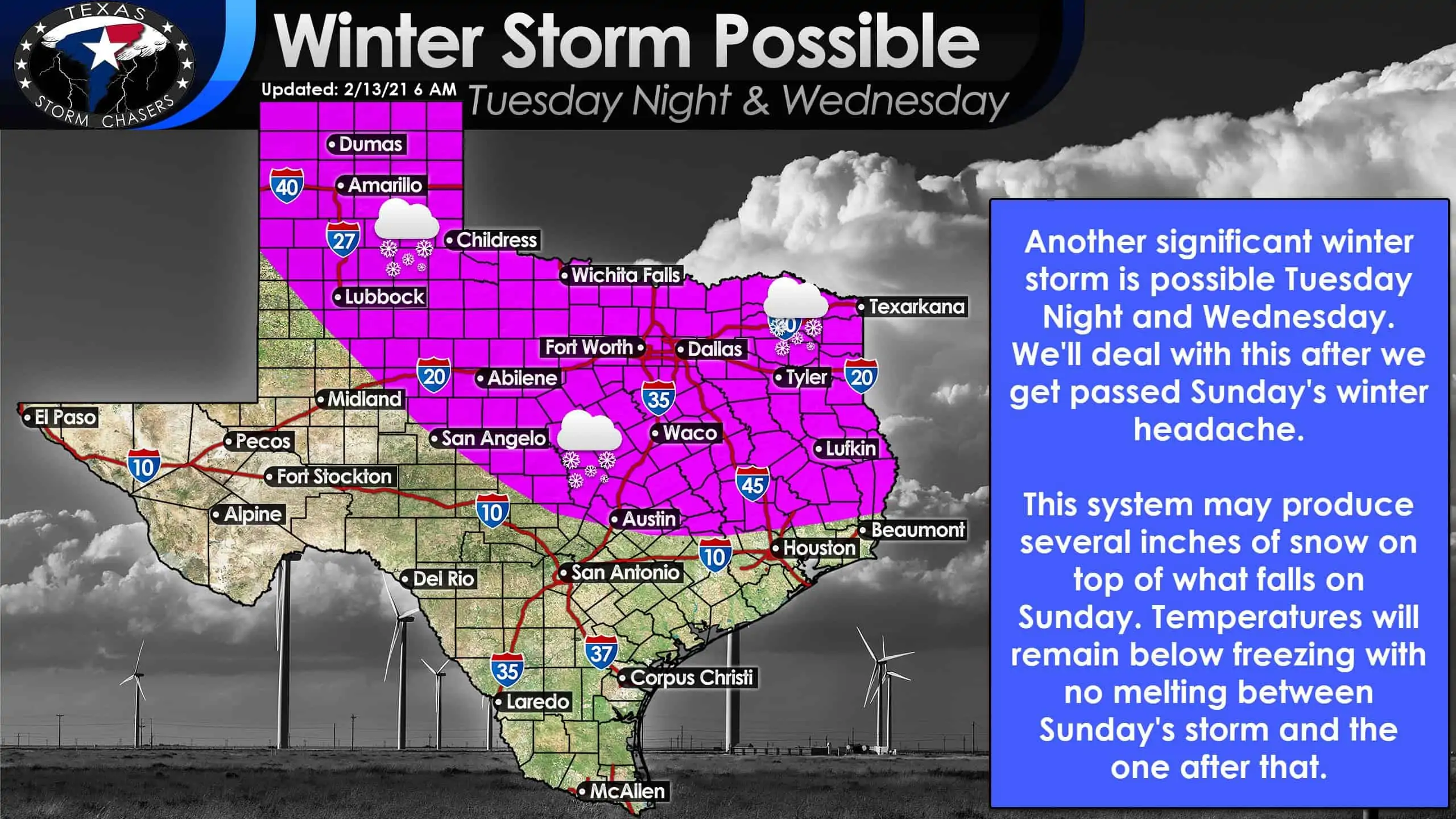
Another significant winter storm is possible Tuesday night and Wednesday. Click the image for a full-screen view.
Another significant winter storm is expected Tuesday night and Wednesday. We’ll deal with that one after we get past tomorrow. Several inches of snow accumulation may occur along with another messy ‘winter mix’ situation farther south.


0 Comments