
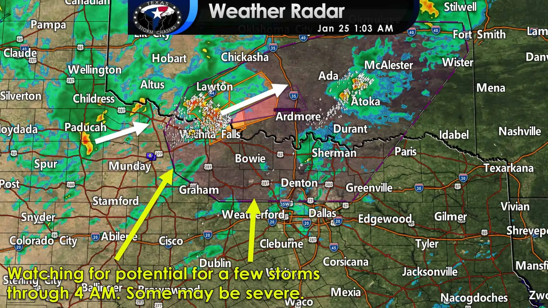
A fast-moving severe storm just moved north of the Red River after bringing hail to Burkburnett and wind damage to Seymour. Another strong storm is just east of Guthrie and is moving northeast at a brisk 65 miles per hour. It may bring small hail to Vernon in the next hour as it crosses Highway 287. Otherwise, we’re in relatively good shape at the moment storm wise.
However, we’re watching the Big Country and North Texas to see if additional severe storms may develop this morning. Strong wind shear is in place, and a special weather balloon sounding taken in Fort Worth at midnight showed the cap weakening. The strongest upper-level lift should remain north of the Red River. It remains unclear if we see many storms attain ‘severe’ limits this morning as the cold front moves east across the aforementioned regions.
I think a thin line of showers and storms are a good bet, but whether those can evolve into a more mature squall line with a wind/hail threat remains unclear. It is also worth noting that if any discrete storms can develop in North Texas, they may produce a tornado. A low-probability, high impact situation for sure, but we’ll be watching! If we don’t get enough upper-level lift south of the Red River, we might not have to deal with more than a thin line of showers and storms this morning in North Texas.
Here is the full short-term discussion issued by the Storm Prediction Center around 12:45 AM this morning…
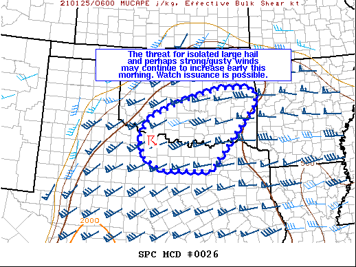
SUMMARY… The threat for isolated large hail and perhaps strong/gusty winds may continue to increase early this morning. Watch issuance is possible in the next couple of hours.
DISCUSSION… An elevated supercell that has recently strengthened over western north TX is likely producing large hail as of 0640Z. As a shortwave trough continues to eject northeastward across the south-central Plains early this morning, additional storms may form in a favorable low-level warm advection regime across this region. It appears that most convection may tend to remain at least slightly elevated above a near-surface stable layer noted on the 06Z observed sounding from FWD. 700-500 mb lapse rates around 7 C/km were also noted on this sounding, with nearly 2000 J/kg of MUCAPE available. The presence of 50-60+ kt of deep-layer shear will support elevated supercells capable of producing isolated large hail. Current expectations are for most convection to remain to the north of a surface warm front oriented generally east-west across north TX. If storms can develop along an eastward-moving cold front later this morning and become near-surface based, then the potential for strong to perhaps damaging winds may also increase. Uncertainty remains regarding the overall coverage of severe, elevated supercells, which will determine watch potential.


0 Comments