
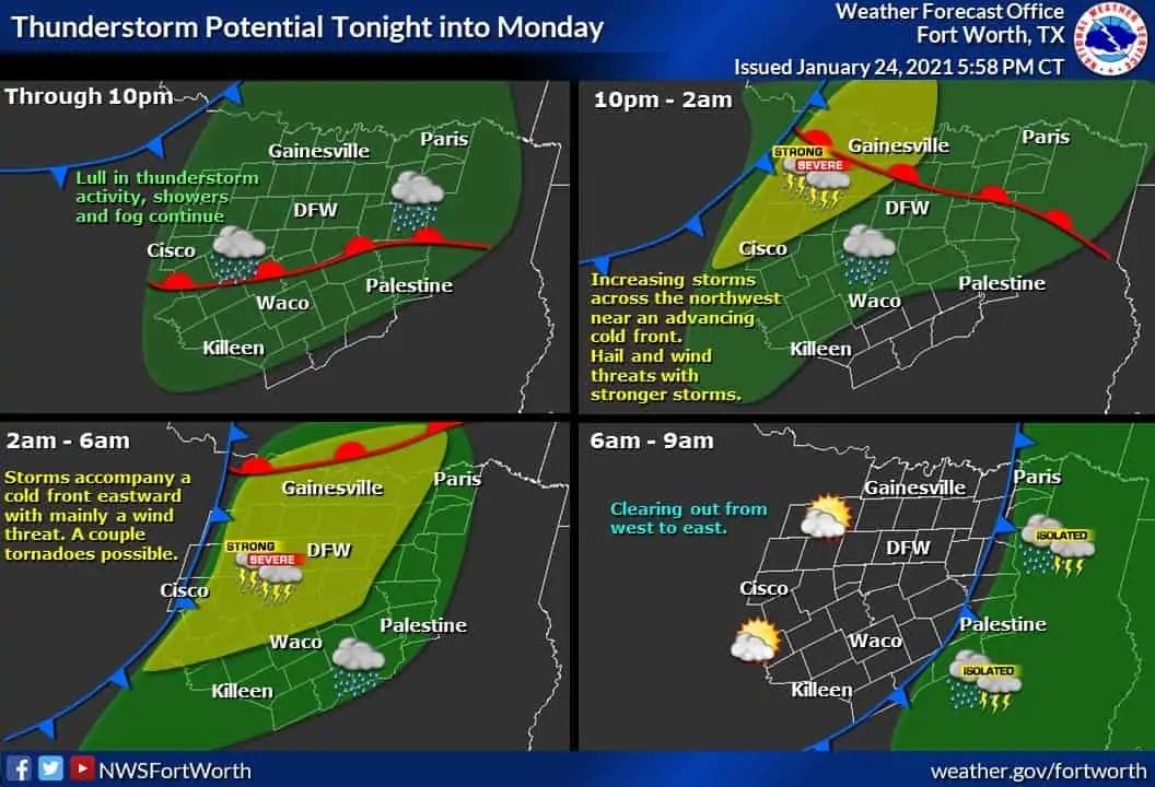
A few storms managed to get going this afternoon in Dallas & Collin counties. Those storms raced off to the northeast while producing small hail. At the time of this posting, those storms have moved into southern Arkansas. Spotty showers, along with misty garbage, will continue through the t across Texas’s eastern two-thirds. Simultaneously, a cold front will move from west/northwest off to the east/southeast. Weather conditions will improve behind the cold front with a noticeable drop in humidity levels.
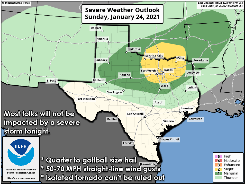
The Storm Prediction Center maintains a risk for isolated severe storms tonight and pre-dawn Monday. The western edge of the risk starts between Lubbock and Midland and goes east through Texoma, North Texas, Northeast Texas, and up into the ArkLaTex. SPC has highlighted a small ‘elevated’ risk across North Texas and Texoma, but I don’t want folks to get hung up where risk lines are drawn or what risk level you might be in. Any risk level means you have at least some chance for a stronger storm in your area tonight. We note that while the chance for showers and storms is high tonight with the cold front, most folks will not be impacted by a severe storm. Quarter size hail and wind gusts over 58 MPH are the criteria for a severe thunderstorm.
We should remain quiet in the thunderstorm department for a few more hours. We might see a few storms try and get going after 8 PM through midnight in the Big Country and Northwest Texas. If those more isolated storms fire up, they could produce large hail up to the size of golfballs as they race off to the northeast.
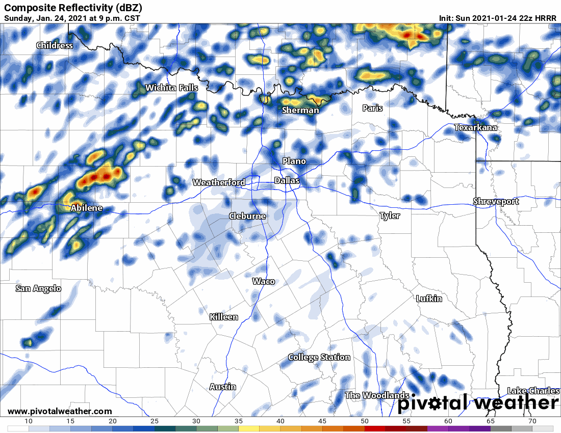
Thunderstorms will increase in coverage along a cold front late this evening across West Texas. We expect a squall line to get going pretty quickly as the cold front pushes the storms east tonight. There is a conditional risk, assuming we can get stronger storms to maintain themselves, severe weather late tonight and Monday morning in the Big Country, North Texas, and Texoma. The weather-model simulation shown above shows storms struggling to maintain themselves as the cold front moves east across North Texas. 3 AM to 5 AM would be the timeline for most D/FW Metroplex, with precipitation ending by 6 AM.
Assuming the model is right, we’d have to deal with a few stronger storms producing hail, but most folks would only have a brief period of rain. Weather models are more aggressive with the squall line’s strength in the Big Country and Northwest Texas tonight. The strongest storms within the squall line may produce quarter to golf ball size hail along with localized wind gusts of 50 to 70 MPH.
We anticipate most thunderstorms will remain elevated above a capping inversion located a few thousand feet above the surface. As long as storms remain ‘elevated,’ they will pose little risk of producing tornadoes, and it’ll be more difficult for higher-end wind gusts to reach the surface.
Thunderstorms will be widespread overnight in Oklahoma, where the upper-level lift will be strongest. South of the Red River will be more favorable for severe storms, but the lift will be weaker. It’ll be a fight to see if there is enough lift to keep thunderstorms going overnight as the cold front pushes east. Most storms should remain ‘elevated’ above the cap, resulting in large hail being the primary concern with the strongest storms.
If, and this is a big if storms can become surface-based overnight, the threat for a few tornadoes would increase. Low-level wind shear is impressive, but if storms remain elevated, it’ll be a moot point. It’s a situation where the most likely solution is one without much of a tornado threat, but there is a low chance we might have to deal with a few brief tornadoes and damaging straight-line winds. Hence, we’re advertising the potential for some hail and gusty winds with the most intense storms tonight, along with a low chance for a brief tornado.


0 Comments