
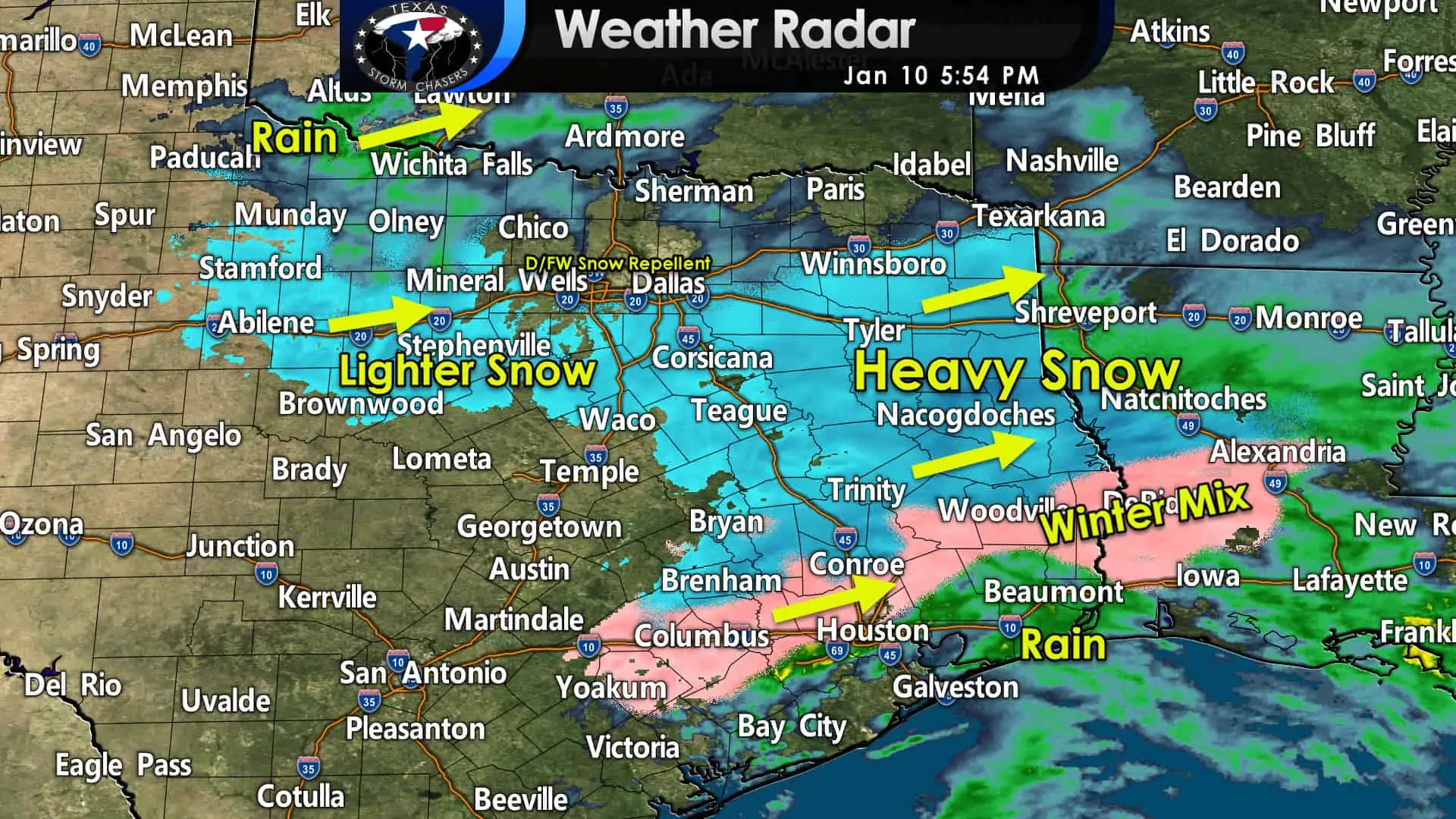
Accumulating snow has concluded for most of Central Texas and points west. Snow will be concluding in Bryan & College Station within an hour. Light snow or drizzle will remain possible this evening across North Texas. Little snow accumulation is expected in North Texas this evening, but perhaps a few folks will get a dusting yet. Moderate to heavy snow is falling across East Texas, the eastern Brazos Valley, and just north of Houston.
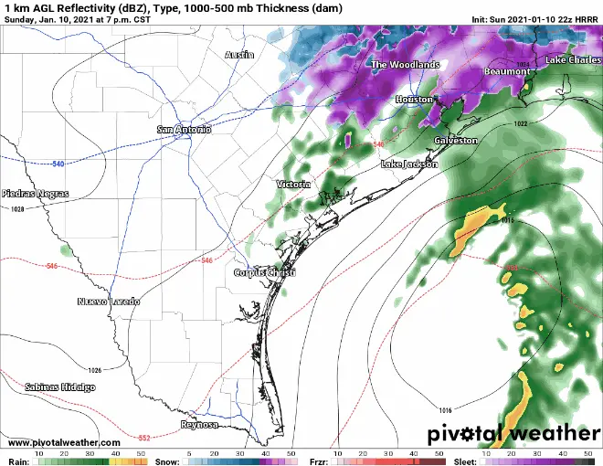
22Z HRRR: Simulated weather model radar from 7 PM through early Monday morning.
Snow will continue for several more hours across East Texas. Some snow will be heavy and rapidly accumulate. A mixed bag of winter precipitation is ongoing across the north side of Houston. Rain mixed with sleet and snow will remain possible in Houston through about 11 PM. Accumulating snow may occur in The Woodlands and points north. There may be a quick dusting of snow in Houston proper this evening, but more substantial accumulations should stay north of the city.
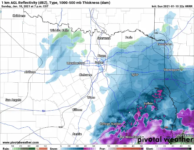
22Z HRRR: Simulated weather model radar from 7 PM through early Monday morning.
Heavy snow should conclude in Tyler and Lufkin around 10 PM, with lighter snow possible through midnight. Snow is forecast in the Piney Woods of East Texas through about midnight. Thereafter light snow could continue through 2 AM. Only pockets of snow showers should remain after 2 AM across Northeast and East Texas.
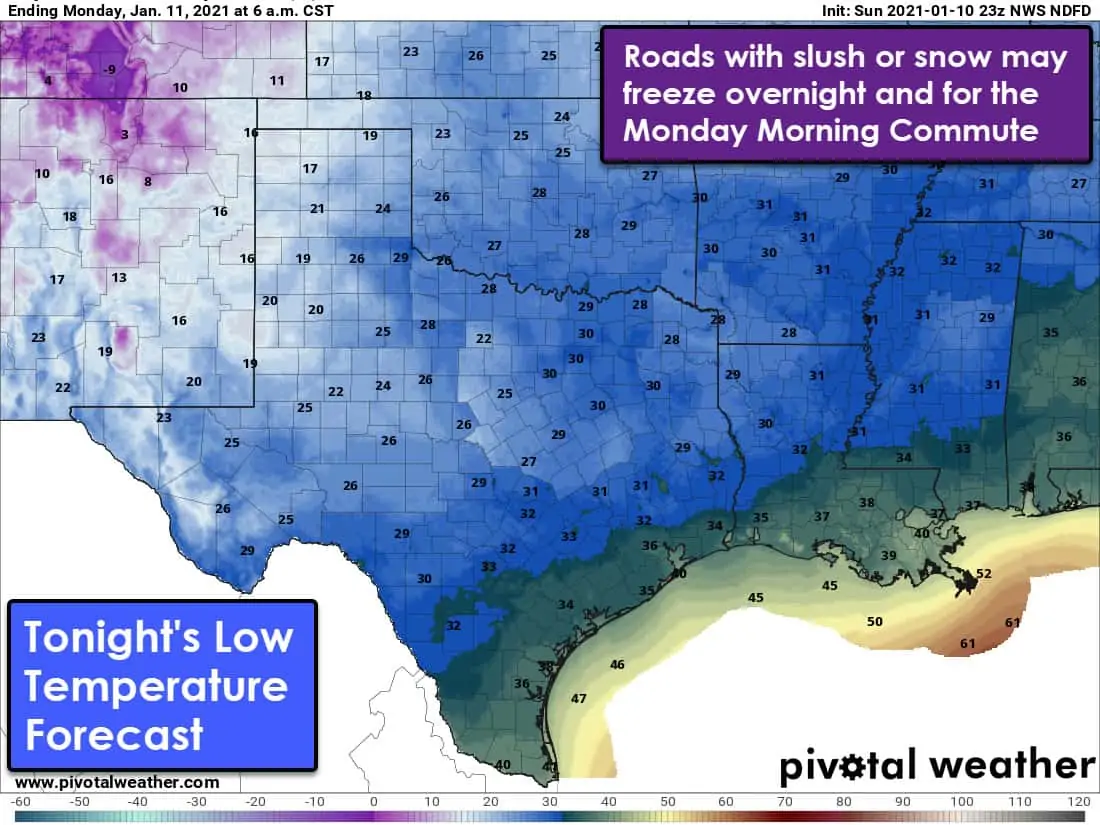
Tonight’s low-temperature forecast for Texas
Given today’s relatively widespread snowfall and associated snowpack, the overnight low-temperature forecast has dropped. Where temperatures fall below freezing overnight in conjunction with slushy or snow-covered roads, we expect slick and hazardous conditions. Slush may freeze up into ice. Some roads may remain slick through the Monday morning rush hour.
You can keep tabs on the winter storm with our free interactive weather radar on our website. Mobile app users can click on the ‘radar’ button below.


0 Comments