
Why hello there, and congratulations on making it to the fourth Friday of 2020. We’re starting on the cool side this morning. Still, truthfully temperatures are right around where they should be for a winter’s morning in Texas. Some folks are dealing with patchy fog. However, any fog is much more localized than what was experienced yesterday. We do not have any arctic outbreaks in our forecast over the next five days. Temperatures will remain near or a bit above average. While the temperature-department isn’t going to be swinging up and down, we will be playing on the ‘wet, dry, wet, dry’ pendulum over the coming week.
Since my last blog post earlier in the week, we’ve seen weather model data trend upwards in the intensity of an upper-level storm system arriving Saturday night. Unfourantely, trends require the removal of the dry/pleasant weekend forecast, at least for some. Outside of the Rio Grande Valley, the daytime hours on Saturday should be mostly dry across Texas. A fast-moving upper-level shortwave (storm system) will result in a rapid increase in rain coverage Saturday night. As ‘usual,’ rain chances will increase east of Highway 281 (Texoma south into the Hill Country). Saturday Night looks to be wet and stormy across eastern North Texas, Northeast Texas, East Texas, Southeast Texas, the Brazos Valley, the Coastal Plains, extending back west to the Interstate 35 urban corridor. Since the upper-level system will be fast-moving rain chances should be moving east out of Texas by late Sunday afternoon.
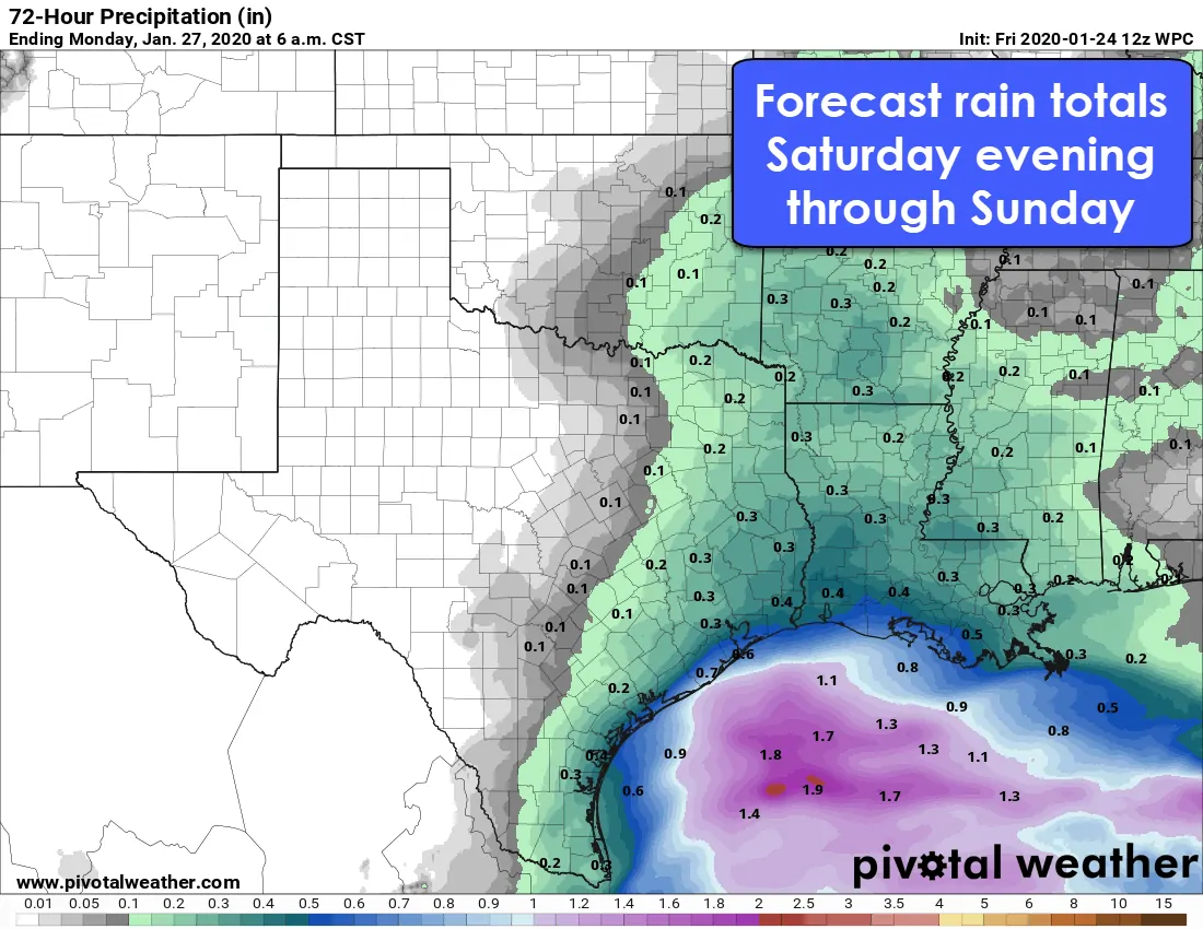
Potential rain accumulations with the Saturday Afternoon & Sunday system. Click the image for a larger version.
Our Saturday night system does not appear to be one capable of producing severe thunderstorms inland. We could see some gnarly boomers off the coast, but that’s only a problem for the fishies and those with interests offshore. Temperatures will be far too warm for winter weather, and we’re not anticipating any notable flood potential. The highest rain totals look to be near the coast where one half to perhaps one inch of rain may fall. Totals should range from one-tenth of an inch up to one-half inch locally farther inland. We may see a few streams briefly rise due to soils being saturated from the rains earlier in the week. Still, forecast rain totals do not raise alarm bells in the flooding department.
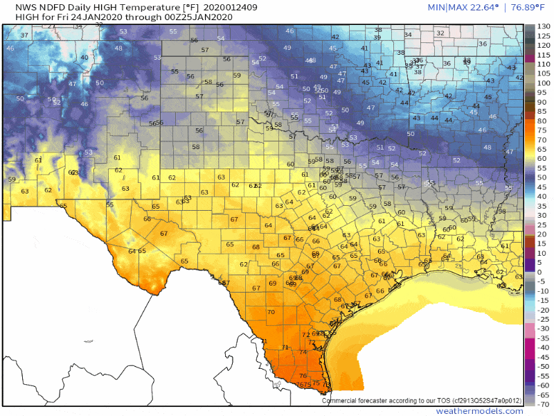
Forecast high temperatures over the coming week from the National Weather Service. Click the image for a larger version.
The ‘dry, wet, dry, wet’ cycle looks to continue next week as a moderately active weather pattern persists. Tuesday and Thursday could feature precipitation chances across parts of Texas. While there may be a bit of snow in the Panhandle Tuesday morning, temperatures as a whole look to remain ‘warm’ by January standards. Notable winter mischief is not forecasted. Weather model data at the time of this writing also is not showing much (if any) severe thunderstorm threat with the upcoming systems. I guess I’ll have to work on expanding my vocabulary when it comes to describing rain chances.


0 Comments