
Ten days before Christmas and we have a temperature spread of nearly 70 degrees across Texas. Earlier this afternoon, the wind chill in Amarillo was 23 degrees while South Texas is setting new record high temperatures near 90 degrees. A strong cold front continues to sag south slowly. While many of our stronger winter cold fronts tend to blow through Texas, this one is taking a more leisurely journey. It won’t make it to the Rio Grande Valley until tomorrow evening. Before then, we have a few relatively localized weather impacts to discuss.
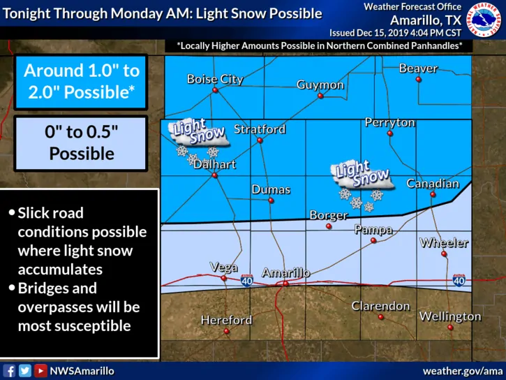
Light snow is possible tonight through Monday morning near and north of Interstate 40 in the Texas Panhandle. Snow accumulations will remain light, but we may see around an inch closer to the Oklahoma Panhandle. Those in the Oklahoma Panhandle may have heavier banding, and thus, snow accumulations may locally be 2+ inches. Temperatures well below freezing will result in any snow sticking to roadways. Slick roads could occur Monday morning, where that snow falls. This should be a minor winter weather episode.
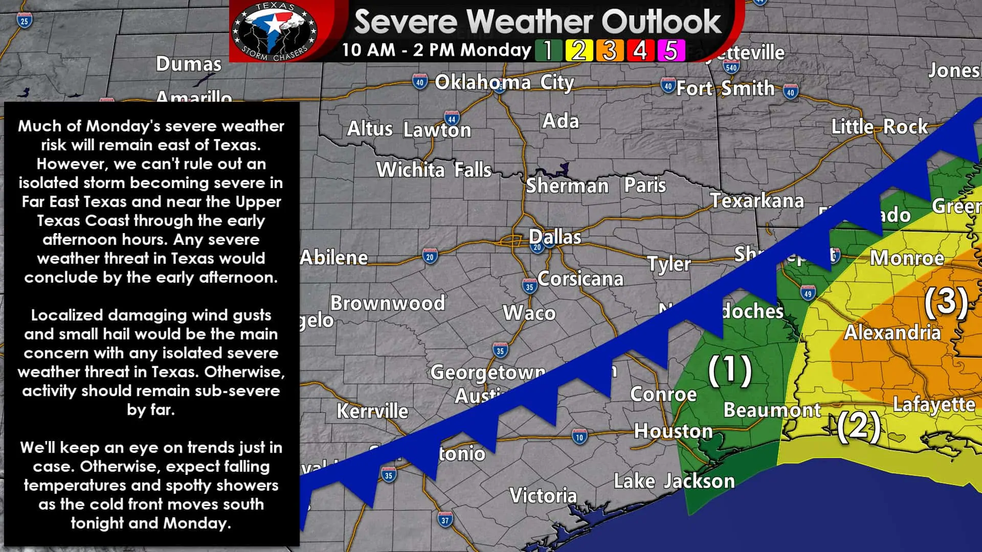
Much of Monday’s severe weather risk will remain east of Texas. However, we can’t rule out an isolated storm becoming severe in Far East Texas and near the Upper Texas Coast through the early afternoon hours. Any severe weather threat in Texas would conclude by the early afternoon. Localized damaging wind gusts and small hail would be the primary concern with any isolated severe weather threat in Texas.
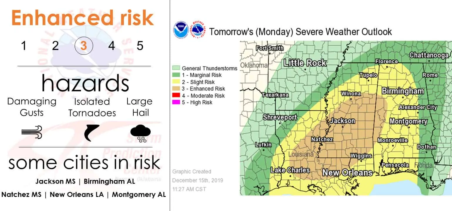
Otherwise, activity should remain sub-severe by far. We’ll keep an eye on trends just in case storms can form a bit sooner and farther west here in Texas. Otherwise, expect falling temperatures and spotty showers as the cold front moves south tonight and Monday. Lousiana, Mississippi, and Alabama are facing a higher threat of severe thunderstorms tomorrow. Those traveling or with interest in those states should stay abreast of any weather warnings on Monday.
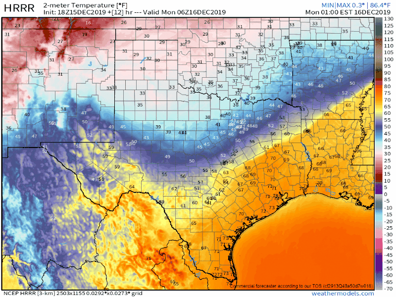
Model animation of the cold front’s expected progression south on Monday. Times are in the top-right corner of the graphic (EST).
South of the cold front temperatures will once again approach prior records with 70s and 80s expected tomorrow afternoon. Once the cold front arrives at a given location, the temperature will quickly fall into the 40s and 50s with gusty north winds. By dinner-time, the cold front should be pushing south of the Rio Grande Valley and the Gulf of Mexico. High temperatures on Monday will likely occur just before the front’s arrival. Temperatures will probably fall for the remainder of the day after that. Gusty north winds will make it feel ten to fifteen degrees colder. Secure outdoor Christmas decorations so they don’t go flying!
Clear skies, light winds, and a very dry airmass will allow temperatures to drop Tuesday night quickly. By Wednesday morning, the freezing line is going to be very near the coast from the Coastal Bend to the Golden Triangle (Upper Texas Coast). Those in Deep South Texas and the Rio Grande Valley should remain above freezing, although more sheltered locations inland may make a brief dip toward freezing. The northern three-fourths of Texas should be in the teens or twenties by sunrise Wednesday, but there shouldn’t be much wind. We’ll start a slow warming trend during the day Wednesday through the end of the workweek and into next weekend. Another storm system will approach by the upcoming weekend, but limited moisture looks to preclude appreciable precipitation chances.


0 Comments