
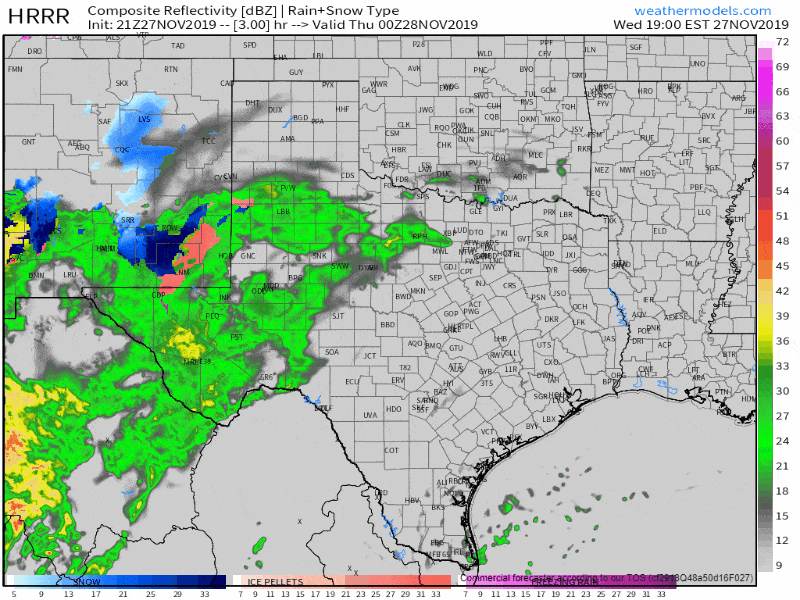
Simulated weather model radar this evening into Thanksgiving morning
Our second storm system of the week will arrive tonight and into Thanksgiving Day. This one won’t be much of a (powerful) wind maker, but it will bring winter precipitation to the same areas that had fast-moving wildfires yesterday. Thanksgiving itself will be damp and relatively chilly (for the northern two-thirds of Texas). However, no severe thunderstorms are expected.
Winter weather will begin later tonight in the Texas Panhandle and portions of West Texas. Weather model data has come in a bit colder again, so we’ve seen an uptick in accumulation forecasts for snow in the western Texas Panhandle. Freezing rain will be more likely across the central Texas Panhandle south/southwestward toward Lubbock and Denver City. The highest impact by far will be to those traveling later tonight and Thursday morning.
Roadways could become slick and hazardous in places like Amarillo and Lubbock – plus all the various highways in those regions. Precipitation intensity will decrease after sunrise Thursday, and temperatures will start to rise above freezing. However, winter weather impacts may continue in the northwestern half of the Texas Panhandle into Thanksgiving Afternoon. Remember that it only takes a trace of ice accumulation to turn roads and bridges into skating rinks.
Tonight and Thanksgiving will not be the most pleasant in the weather department. Excluding the winter weather discussed previously, we are *not* expecting severe thunderstorms or flooding on Thanksgiving. Precipitation will be highest in coverage across the northwestern half of Texas. However, spotty showers and some ‘misty’ weather can be expected farther south. Rain amounts will generally remain light. A few pockets in the northwestern half of Texas and into Oklahoma may pick up around one-half inch of rain locally. A lull in steadier showers should occur late tomorrow afternoon through about midnight.
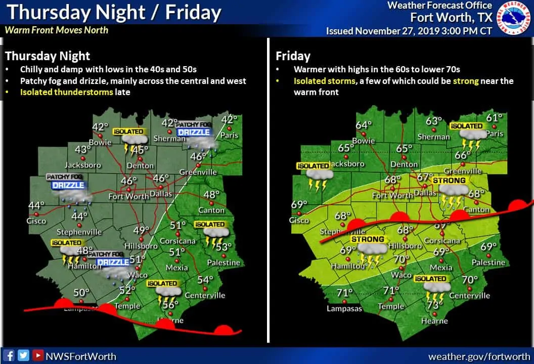
Our third and final storm system of the week will bring another chance of showers, thunderstorms, and gusty winds Friday evening through Saturday afternoon. The severe weather portion of this upcoming system isn’t locked in, but we may see some stronger winds and perhaps hail. Let’s get through tonight’s winter weather and enjoy Thanksgiving Day before we dive too much into Friday night and Saturday. I will say that the timeline has been pushed back six to twelve hours compared to forecasts earlier this week.


0 Comments