
November is upon us, and so are the pre-6PM sunsets. I’ve never enjoyed those just because it makes chasing storms more complicated (you see how much you like trying to identify storm features in the dark visually). Nevertheless, it is a sign that we’re heading toward the holidays and hopefully, a fun time in the winter weather department. Don’t get your hopes up for some big snowstorm forecast in this post, though. We’ll be having none of that!
Temperatures across Texas for your Monday and Tuesday will be near average for early November. High temperatures will top out in the 60s, 70s, and 80s. Tuesday will be a bit cooler as cloud cover increases, and some of those clouds start spitting. There will not be much measurable precipitation on Tuesday. That will change on Wednesday as a cold front begins to sag south into Texas.
Chance of precipitation (mostly rain)
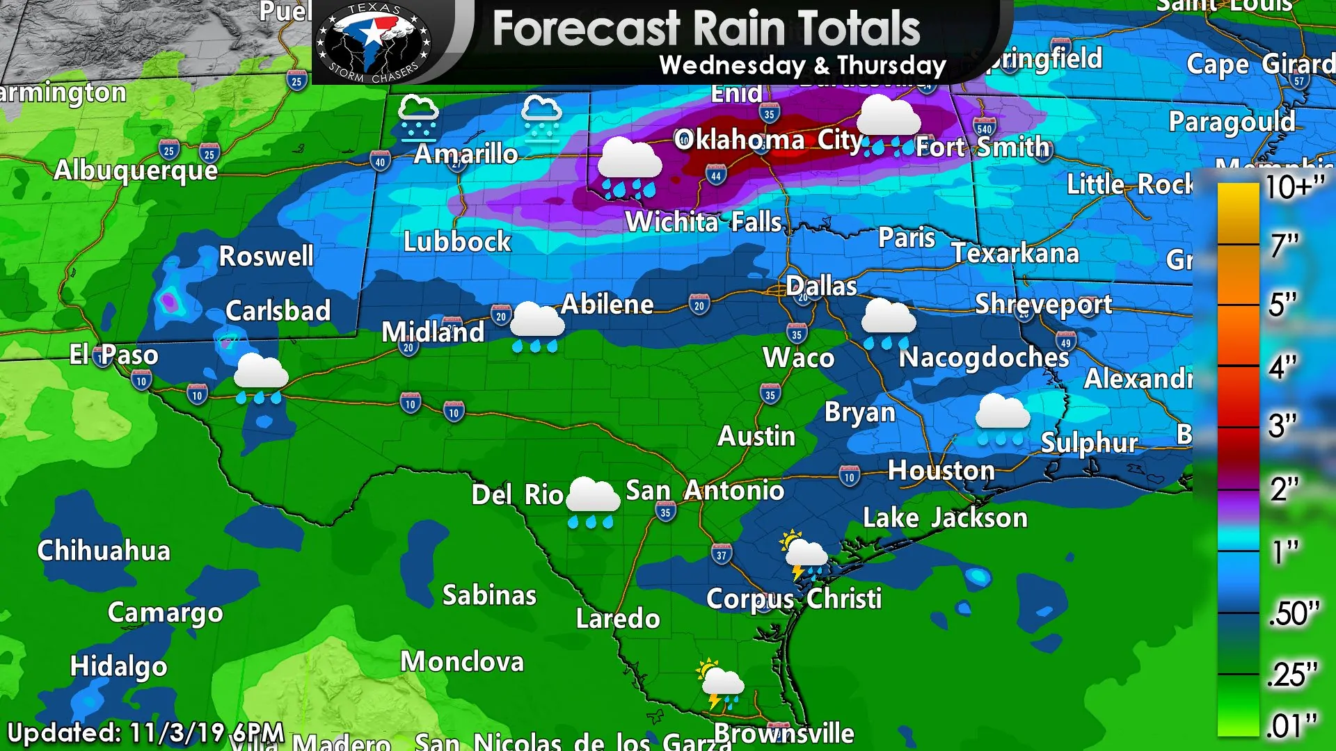
Forecast rain totals
Precipitation forecast
Tuesday and Tuesday Night will be gross across parts of Texas with low-level overcast and increased amount of ‘spitting clouds.’ More measurable rains will likely hold off until we get into Wednesday afternoon as a cold front sags south into Texas. The highest rain chances and intensities will be within one hundred miles of the front. We’ll see rain chances spread south Wednesday Night and into Thursday as the front itself finally starts to push past the Caprock and Texoma. A few thunderstorms are possible, but limited instability values should keep the severe weather threat quite low (at least that is what the current data indicates).
A few stronger thunderstorms may occur on Thursday or Friday closer to the Coastal Plains, where we *may* see a more unstable airmass develop. That’s conditional thunderstorm threat is still way too far off in weather model voodoo land and is far from a certainty.
Icy fun in the Texas Panhandle on Thursday?
Surface temperatures may fall just below freezing on Thursday, while precipitation is still in progress across the northern half of the Texas Panhandle (I-40 and north). Weather model data would indicate the precipitation type, mainly being in the form of freezing rain if surface temperatures fell below freezing. Sub-freezing surface temperatures plus freezing rain would set the stage for some minor ice accumulations. We’ll keep an eye on trends as we get closer to Thursday, but don’t be surprised if there is a bit of ice in the northern Panhandle on Thursday. Likewise, a slightly warmer solution would keep everything only wet (albeit cold, but not icy cold). It will be one of those forecasts where one or two degrees will be a big deal to the forecast. Winter precipitation is not anticipated farther south due to warmer temperatures.
Cooler weather for Thursday and Friday
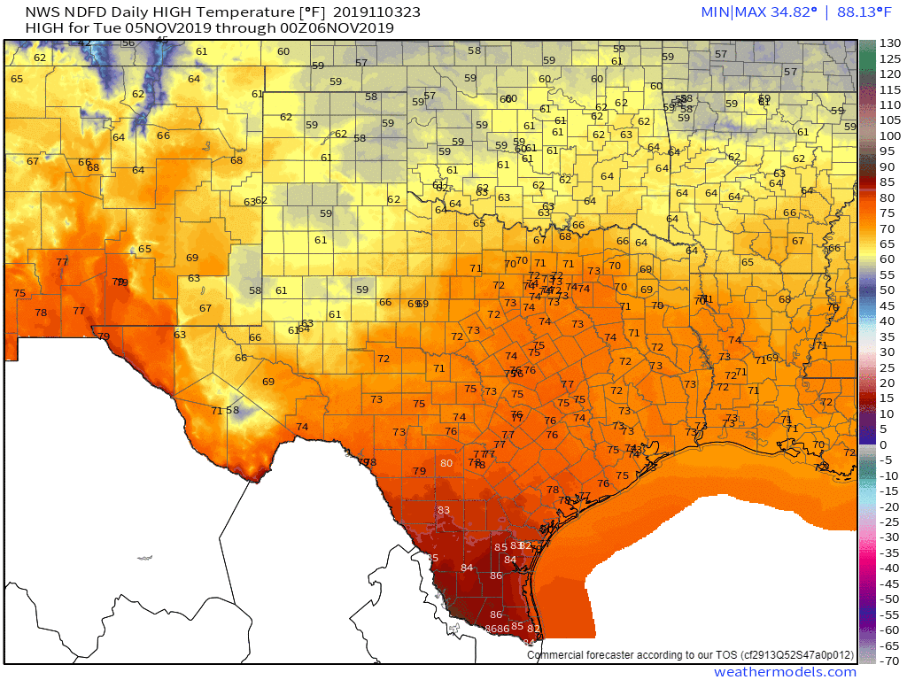
National Weather Service temperature forecasts from Tuesday afternoon through Sunday morning.
A cooler air mass will filter in behind the rains and cold front for Thursday and Friday. This burst of cooler weather does not look to be on par with the early-season arctic intrusion experienced in Texas last week. Our slide down the thermometer will be short-lived as we start a quick climb back up the temperature rollercoaster on Saturday.


0 Comments