
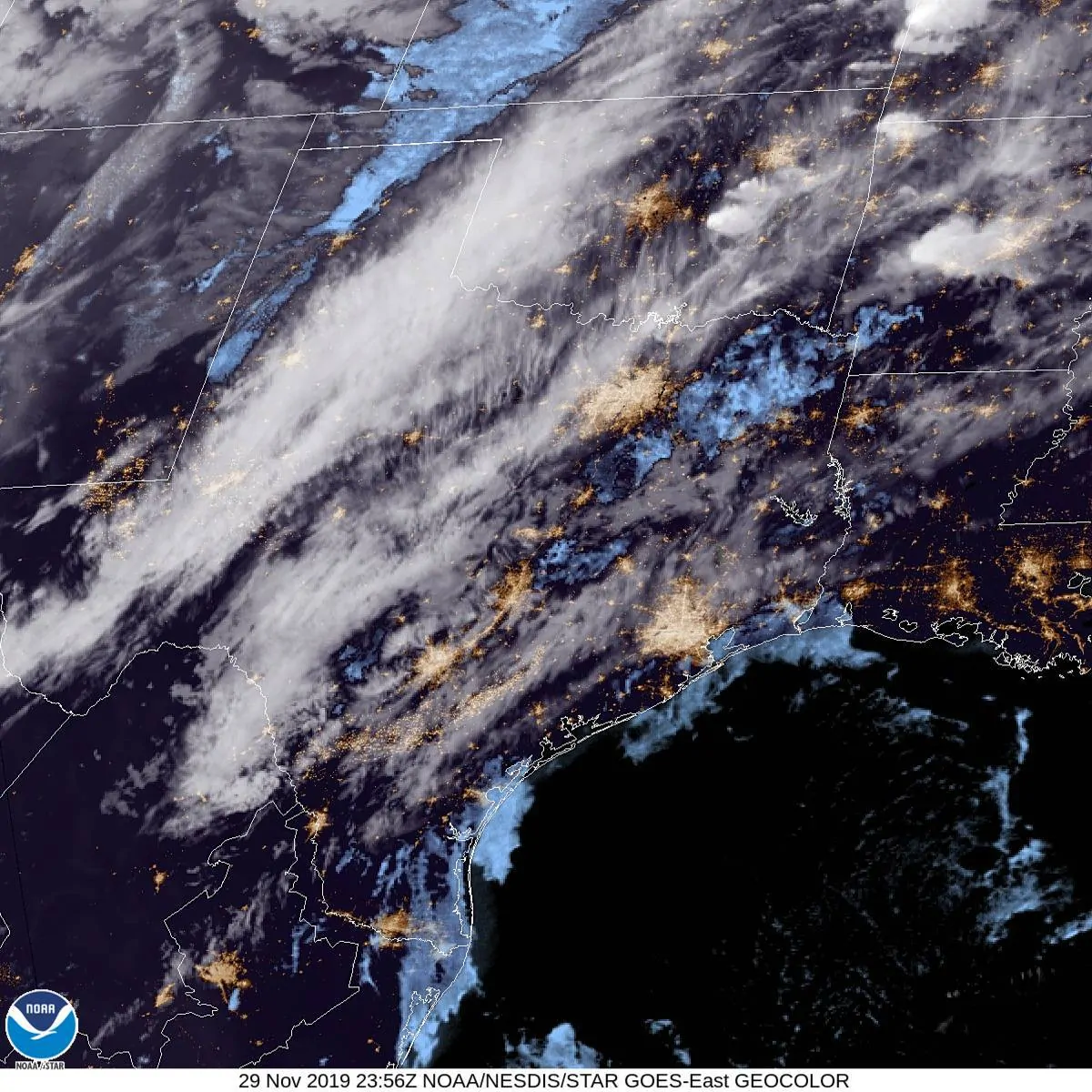
While some in Texas saw the sun today by far most remained cloudy. We had isolated showers and even a thunderstorm or two in North Texas earlier in the day. Now that the sun has set we anticipate a majority of Texas will by overcast with areas of mist and fog through the overnight hours. In other words – it’ll be a rather unpleasant night to be outdoors. Southerly winds will continue pumping moisture north this evening ahead of a southward moving cool front. Temperatures won’t fall more than a degree or two – and in some cases, will slowly rise overnight.
An isolated stronger thunderstorm is possible late tonight through the pre-dawn hours Saturday.
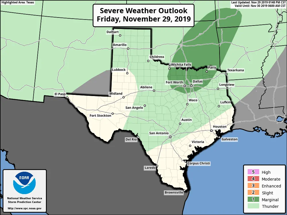
Spotty showers and a few thunderstorms are expected this evening through pre-dawn Saturday across the northeastern third/eastern third of Texas. I can’t rule out a stronger storm capable of producing small hail and lots of cloud to ground lightning. Widespread severe weather is not expected.
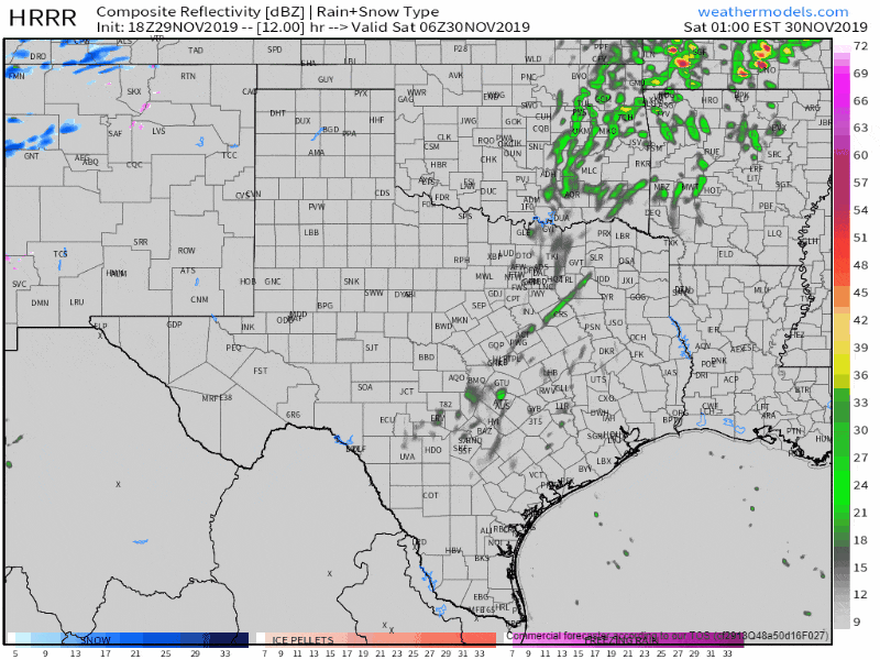
Simulated weather model radar from midnight tonight through 12 AM Sunday.
A cool front will push south through much of Texas on Saturday. This front will be a focal point for potential thunderstorms in East Texas continuing toward the Mississippi River. We are not confident in a sustained severe weather threat here in Texas. The weather model animation above shows why. That model isn’t particularly aggressive in developing thunderstorms along the front or ahead of it in Texas. We could see a few stronger thunderstorms in far East Texas late Saturday morning into the early afternoon hours. Those storms could be stronger with localized damaging wind gusts, quarter size hail, and even a tornado or two. The storms will be flying east/northeast at over 55 MPH. We may not see more than one or two of those semi-discrete storms in far East Texas – if they develop at all.
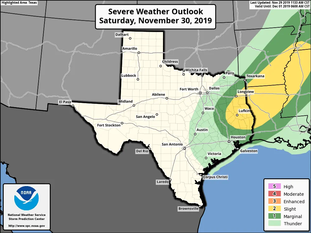
Isolated severe thunderstorms are possible late Saturday morning through the afternoon across East Texas.
A few stronger storms with small hail and gusty winds are possible along the immediate cold front. Weather models indicate most of the activity along the front may struggle to organize beyond quick-hitting showers and weak thunderstorms. Precipitation chances will end not long after the cool front arrives at any given location. Expect gusty northwest winds after the front’s arrival. Wind gusts over 55 MPH are possible (again) on Saturday across the Texas Panhandle and West Texas.
A few severe storms are possible in East Texas late tomorrow morning through the early afternoon, but as described above, it is conditional on several factors.


0 Comments