
The first of three upper-level storm systems to impact our weather in Texas this week arrives today. Many of you will notice the influence of this first system by the late morning hours. It won’t be snowing, it won’t be storming, but it will be a-blowing.
Winds will become quite strong across the western half of Texas by lunch-time. Some wind gusts will likely exceed 70 MPH in the Texas Panhandle south into West Texas. Those are damaging winds capable of producing some damage. Humidity values will be plummeting in conjunction with those powerful winds. Blowing dust is a good bet across western Texas today. I wouldn’t be surprised if some of that dust makes it into Oklahoma City by tonight.
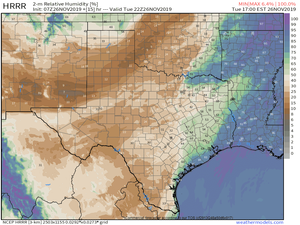
Projected relative humidity values around 4 PM today as the dryline continues to move east. These will be slow to recover (increase) after sunset.
There will be a very high risk of grass fires today in Texas west of Interstate 35/35W. Any fires that ignite could rapidly spread. We are lucky that we’re not dealing with a more volatile fuel load. Otherwise, today would feature catastrophic wildfire danger. As it stands, the combination of powerful winds and low relative humidity values will create problems for firefighters.
The strongest winds will occur behind an eastward-moving dryline today. Winds will be out of the west to the west/southwest. As a cold front moves south/southeast tonight, we’ll see winds shift out of the northwest.
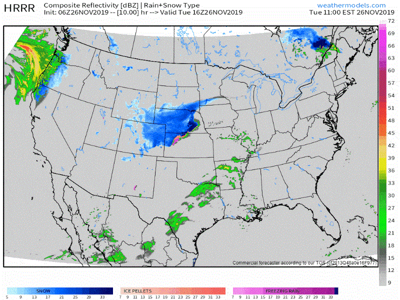
Simulated weather model radar from the HRRR from 8 AM this morning through midnight tonight.
East of the dryline will be a relatively humid and warm air mass. Some will say it feels like thunderstorm weather. Those folks would be correct. Luckily for us, it appears that we’ll be spared from having to deal with any severe thunderstorms in East Texas today. A few showers and perhaps an isolated thunderstorm are possible this afternoon in Northeast Texas and East Texas. I
can’t rule out a stronger storm on the Arkansas or Lousiana state lines, but the ‘main show’ looks to be closer to the Mississippi River this evening. You can keep tabs on that activity with our free interactive weather radar here on our website and in our mobile app.
The forecast for Wednesday Night and Thanksgiving has not changed much from my blog post last night. For local weather forecasts, please visit the National Weather Service’s website at weather.gov. We’ll get another blog out this evening to discuss the latest on the storm system expected on Friday and Saturday.


0 Comments