
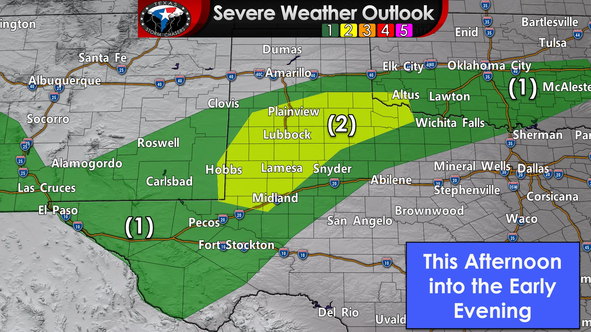
A level two risk of severe weather has been introduced for the northern Permian Basin and portions of West Texas. This upgrade is due to increased confidence that scattered storms may produce large hail later this afternoon and early this evening. Isolated damaging wind gusts and a brief tornado cannot be ruled out. The strongest storms may produce hail up to the size of quarters, perhaps a bit larger if the storms get overenthusiastic.
Looking at the bigger picture
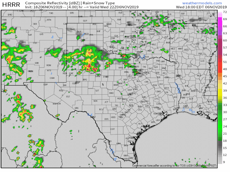
Simulated weather model radar from 4 PM this afternoon through 7 PM Thursday. Remember: This is a simulation, not a guarantee.
Thunderstorms will increase in coverage tonight. Widespread showers and thunderstorms will move east across the Trans-Pecos, Permian Basin, West Texas, Northwest Texas, and into North Texas and the Big Country by Thursday morning. A few stronger storms are possible with small hail, but widespread severe weather is not expected. Heavy rainfall could occur with localized flooding.
Did someone say snow?
We do note those pink, purple, and blue colors of wintery mischief showing up in parts of the Texas Panhandle for Thursday morning. Minor accumulations of ice and snow are possible, but this won’t be a winter wonderland scenario. A few slick bridges could occur.


0 Comments