
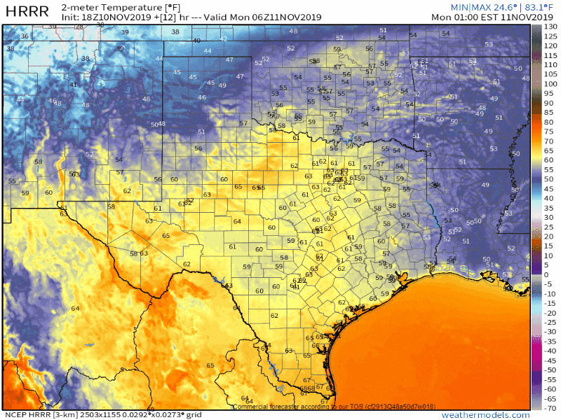
Crashy the cold front is going to blow in and through much of Texas tomorrow and tomorrow night. North winds gusting up to 45 MPH are expected across a large chunk of the state in the cold front’s wake. Most folks in Texas are going to wake up tomorrow wondering what in the world we’re talking about. Temperatures will be comfortable south of the front tomorrow, much like those experienced this weekend.
Do not let tomorrow’s pre-frontal warm conditions fool you. A twenty to thirty-degree drop in temperatures can be expected within an hour of the front’s arrival at any given location. Winds will quickly increase and become strong out of the north. Those strong winds and rapidly dropping temperatures will contribute to wind chill (or ‘what it feels like’) temperatures being considerably lower. East-west roadways will result in dangerous driving conditions for high-profile vehicles.
Rough estimates on cold front’s arrival on Monday (give or take an hour or two)
- Amarillo by 2 AM
- Lubbock by 4 AM
- Midland, Odessa, Abilene, and Wichita Falls by 7-8 AM.
- D/FW Metroplex between 10 AM and 12 PM
- Waco around 1 PM
- Austin and Tyler around 2 PM
- San Antonio and Bryan/College Station between 3 PM and 4 PM.
- Del Rio and Houston around 5 PM
- Corpus Christi around 6 PM
- Beaumont, Port Arthur, McAllen and Brownsville around 9 PM to 10 PM
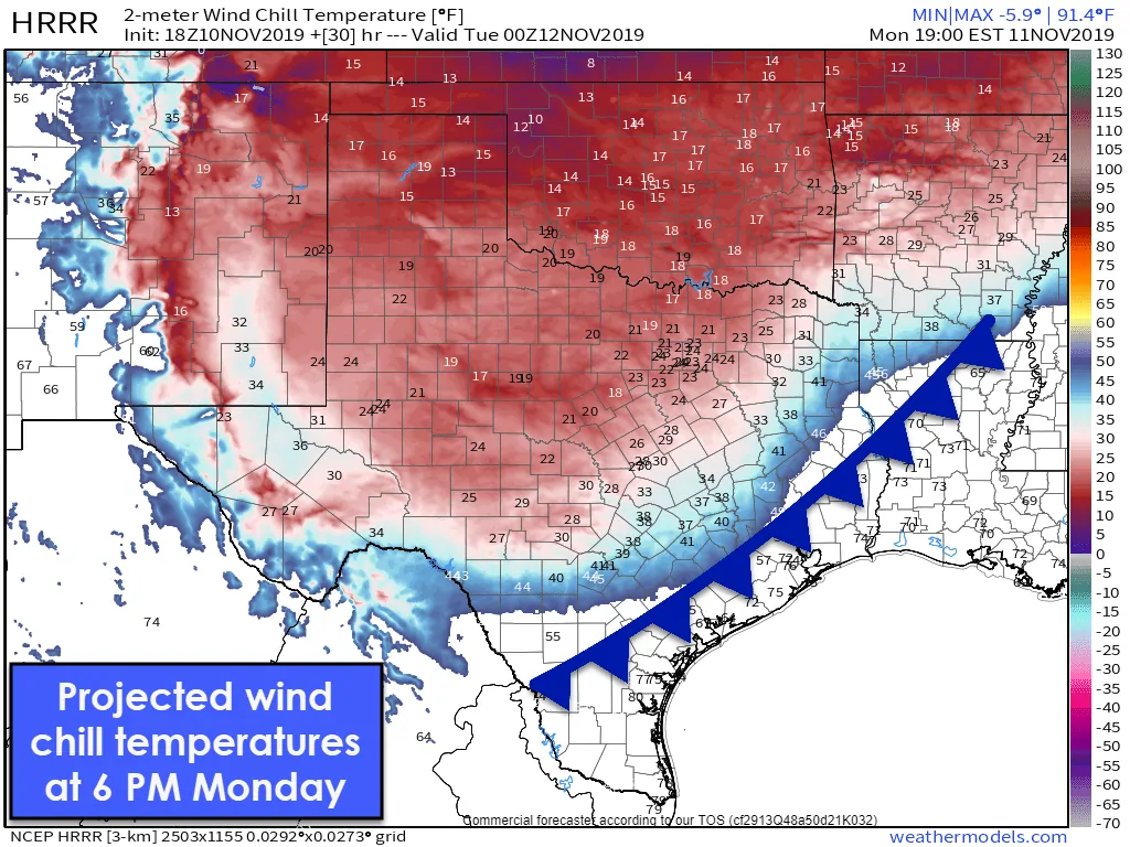
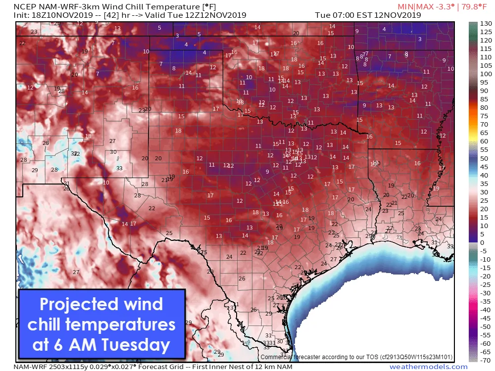
Wind chill temperatures behind the cold front will become quite unpleasant tomorrow afternoon into Tuesday morning. If you’re in Texas you’ll want to have your winter clothing and fireplace ready to go tomorrow night.
Rain, Freezing Drizzle, and Sleet… Oh yay

Scattered showers and perhaps isolated thunderstorms can be expected behind the cold front tomorrow and tomorrow night. Anticipated rain totals have decreased compared to yesterday’s forecast. The highest rain totals should be in the Rio Grande Valley, Deep South Texas, and South Texas with one-quarter to one inch of rain that may occur. No flooding or severe thunderstorms are expected with the activity tomorrow.
A brief period of light freezing rain may occur in the Texas Panhandle tomorrow morning. Widespread accumulations aren’t expected, but given the cold temperatures expected, roads may become slick in spots. Freezing drizzle has a way of causing significant travel problems when we may not necessarily expect it. Going from triple-digit heat in September to yet another winter weather threat a few weeks later. What fun 2019 has been in the weather department.
Rain may mix with sleet or freezing drizzle Monday night across portions of the Edwards Plateau, Hill Country, and South-Central Texas. This scenario is very conditional and dependent on how quickly drier air filters in from the north. Any accumulations of ice would be very light and probably confined to elevated surfaces. However, it only takes a trace of ice on a bridge or elevated overpass to cause problems. The possibility of light freezing rain/sleet tomorrow night will be monitored in future forecast updates.
Cold to record low temperatures for Tuesday and Wednesday
Once the cold front arrives it’ll be a cold couple of days. Tuesday morning and Wednesday morning will both threaten prior low-temperature records in some cities. By Wednesday morning temperatures look to fall down to freezing all the way to the coast in Southeast Texas and the Coastal Plains.
We’re a few weeks early by seasonal averages for the first freeze on the coast. Those with plants will want to plan accordingly for a freeze Tuesday night if located in the northern two-thirds of Texas.
Below-average temperatures will continue for the remainder of the workweek, but with a slow warming trend beginning Wednesday.


0 Comments