
 A strong arctic cold front continues to quickly move south across Texas this evening. It only has to move south through the Rio Grande Valley and the Golden Triangle this evening before all of Texas is under its influence. In the front’s wake strong northerly winds have brought frigid wind chills and a 40-degree drop in temperatures compared to yesterday, or even this morning in some cases.
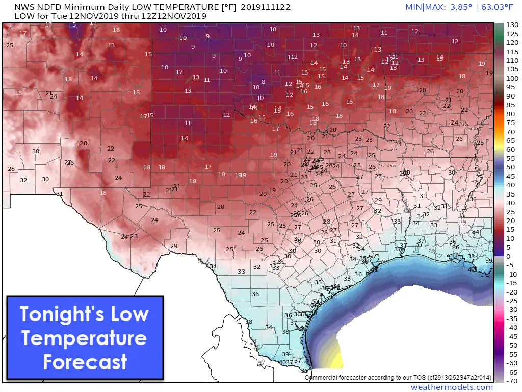
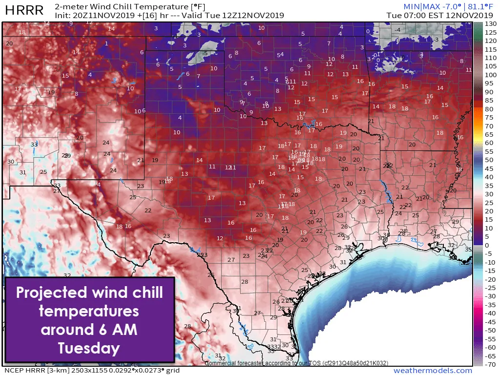
Temperatures will fall into the lower teens and upper single digits by morning across the Texas Panhandle. The Trans-Pecos, Concho Valley, Central Texas, Northeast Texas, and points north will see temperatures fall into the 20s tonight. Wind chill readings will be in the single digits and teens – even as winds decrease toward morning. The remaining portions of Texas will experience falling temperatures overnight with unpleasant wind chill temperatures.
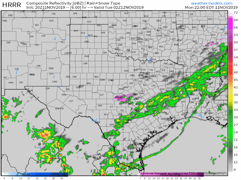
Weather model simulated weather radar this evening and into the morning hours Tuesday
Scattered showers are expected overnight and on Tuesday morning across South Texas and in the Rio Grande Valley. Up to one inch of rainfall may occur. Severe thunderstorms and flooding are not expected. Temperatures across those two regions should remain safely above freezing through the night. A few sleet pellets may occur north of an Eagle Pass to Rockport line. No accumulations are expected. We’ll keep an eye on the freezing line in case the cold front overperforms tonight.

Farther north into far Southwest Texas, the southern Concho Valley, and parts of the Hill Country temperatures are expected to fall below freezing tonight. Freezing drizzle or light sleet may occur. Very light ice accumulations are possible on exposed objects. Widespread travel difficulties are not anticipated, but slick bridges and overpasses are certainly possible.
At this time that ‘icy bridge’ threat should stay west of the Interstate 35 corridor in Central/South-Central Texas. If drizzle continues while temperatures fall below freezing then there may be an icy spot or two in the morning in Austin and San Antonio.
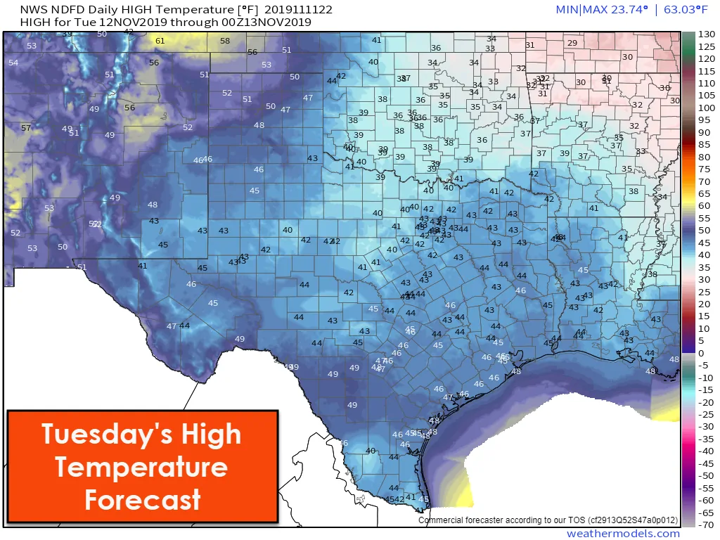
Tuesday will feature well below-average temperatures for the 12th of November. High temperatures will remain in the 30s and 40s across all of Texas. El Paso (Borderland) and Dalhart (the northwestern Texas Panhandle) may both manage to briefly make it into the lower 50s tomorrow afternoon. Winds will be less potent than today, but wind chill temperatures will still be a few degrees lower than the actual air temperature. It will be a cold day.
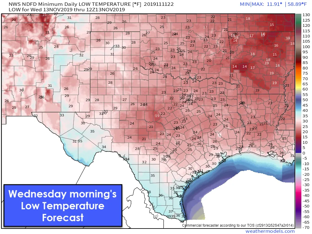
Clear skies and light winds on Wednesday morning will result in the freezing line making it nearly to the Gulf Coast from the Coastal Plains northeast to the Golden Triangle. Temperatures should remain a few degrees above freezing in South Texas and the Rio Grande Valley, but it’ll still be cold for those lower latitudes. Houston’s average first freeze of the season typically does not occur until December 3rd (December 24th at Hobby). Galveston’s average first freeze typically occurs January 2nd, but they’re currently forecast to remain just above freezing tomorrow night.
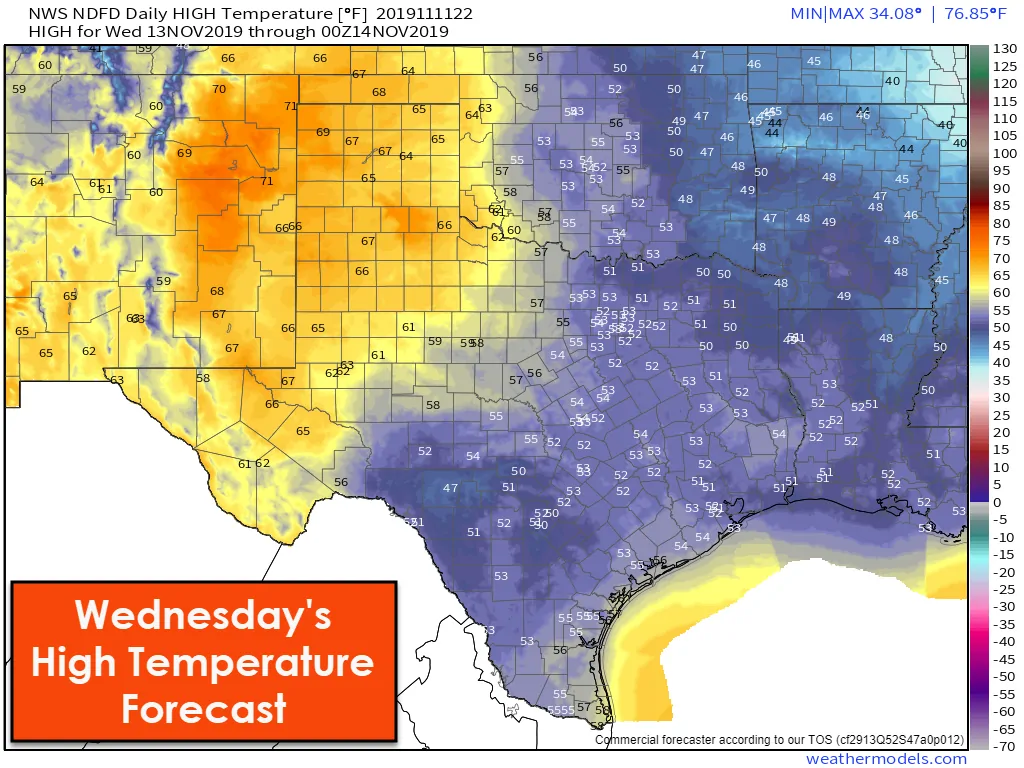
The western third of Texas will experience a rapid warmup on Wednesday while the eastern two-thirds of Texas remain on the cool side. A weaker cool front will result in a more uniform temperature spread beginning Thursday. Temperatures will remain on the cool side, but with a gradual warming trend as we head toward the weekend.


0 Comments