
Things are starting a bit early this evening so I’ll keep this short and sweet. We’ll be doing live severe weather coverage here on our website and in our free mobile app. You can watch that coverage here or by clicking the ‘live video’ button in our mobile app. You can also keep tabs on the storms with our free HD interactive weather radar here.
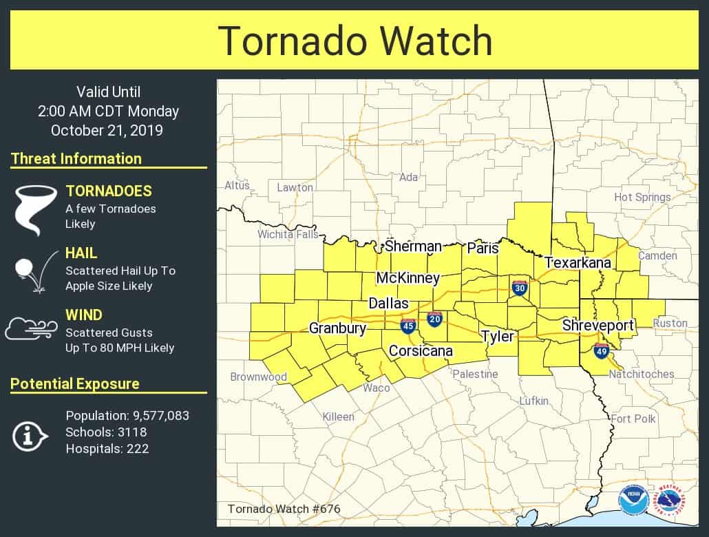
A tornado watch is now in effect until 2 AM for much of North Texas and Northeast Texas. This includes all of the D/FW Metroplex, Sherman, Paris, Tyler, Corsicana, and Texarkana. A fairly large area.
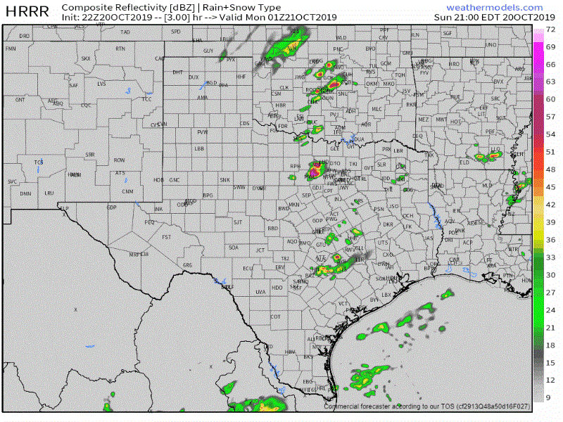
HRRR Simulated weather model radar from 8 PM through the night.
We continue to expect the most widespread storm activity to occur after 10PM-12AM and into the morning hours Monday as a cool front moves southeast into Texas. The strongest storms in that squall line may be capable of producing damaging wind gusts over 70 MPH, hail larger than the size of a quarter, and brief tornadoes.
Individual supercellular thunderstorms ongoing now and continuing into the evening could produce very large hail up to the size of baseballs, localized wind gusts over 65 MPH, and also be capable of producing tornadoes. While the tornado threat is not expected to become widespread, there will be an enhanced risk with any sustained, intense supercell that can continue over the evening hours.


0 Comments