
I’m done with the summer heat and the summer humidity. I’m just done with it! I want fall weather and I want to be able to keep the car windows open without it turning into a sauna. There is little doubt in my mind that many of you reading this post are in the same boat. Fortunately, we finally have our first strong fall cool front in the five-day forecast.
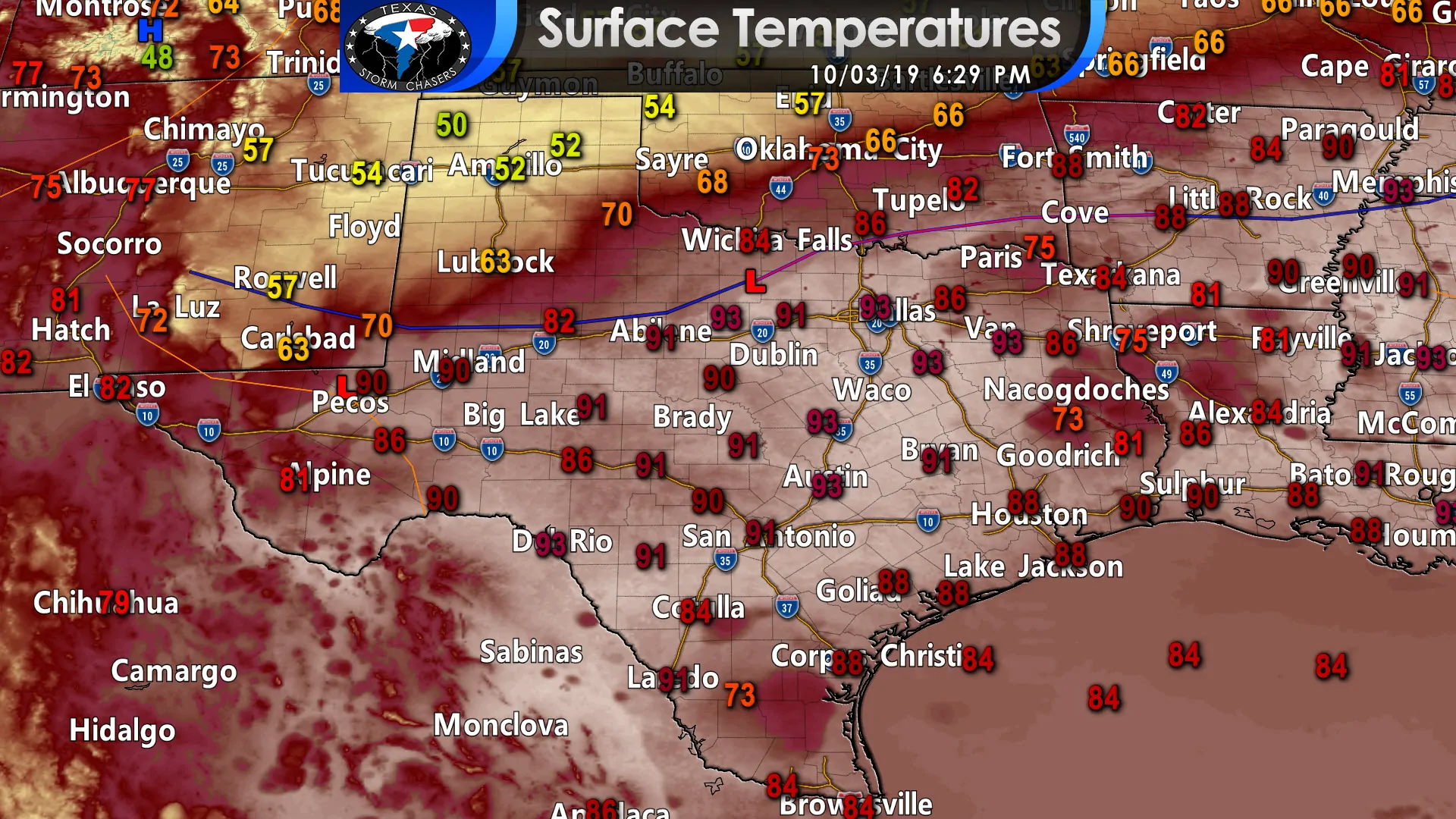
I do want to mention with as little jealously as possible that the Texas Panhandle and West Texas are already enjoying fall weather this evening. Temperatures in Dalhart, Dumas, Amarillo are right around 50 degrees and have been most of the day. They’ve also had rain occurring in those locations so it truly does feel and look like fall.
Everyone else is in the upper 80s and 90s this afternoon with dewpoint temperatures about the same as they’ve been since July. Sadly the cool front responsible for the Panhandle’s fall weather episode won’t make much more progress to the south tonight before it lifts back north as a warm front on Friday.
Don’t fret though! Much more of Texas will be treated to a taste of fall come Sunday Night and Monday.
It is at that time that a strong cool front is expected to make it south through at least the northern two-thirds of Texas (hopefully more!). We’re not talking about cold weather by any stretch of the imagination, but it will feel ‘cold’ after three months of dumb humidity and triple-digit heat.
Scattered showers and thunderstorms are possible along and behind the cool front Sunday night as it moves south. Widespread severe weather is not expected and rainfall amounts will probably remain below a one-half inch (even under the heaviest activity). Most rain amounts for those who do receive rain will likely only be a few tenths of an inch.
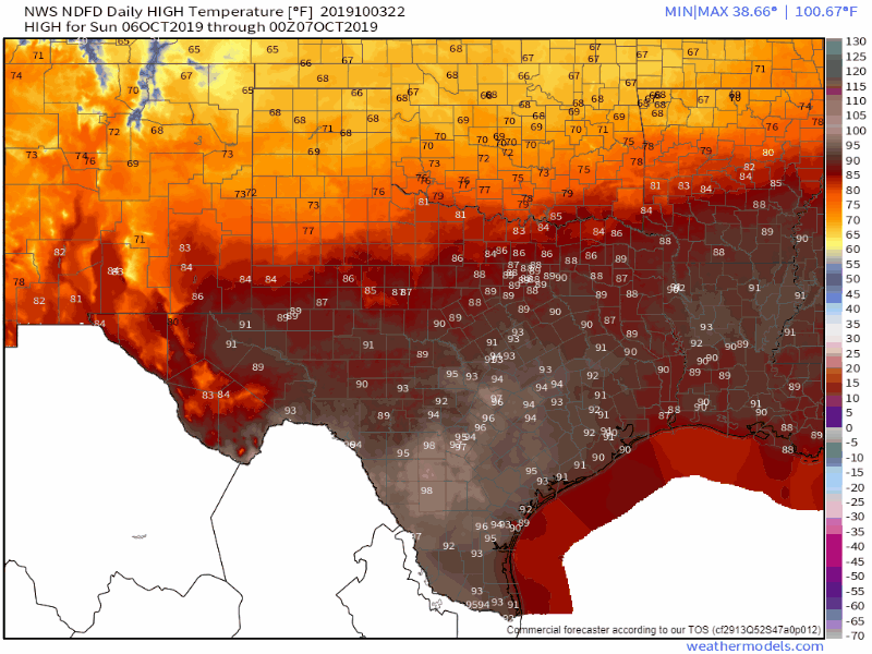
High-temperature forecast daily from Sunday through Tuesday
High temperatures come Monday will be noticeably lower. Those temperatures across Texas will max out from the upper 60s in the north to the 80s in the south. Keep in mind that even the warmer temperatures in the south will be accompanied by a much drier airmass. I think the big story here will be the departure of high dewpoint values and that sticky air.
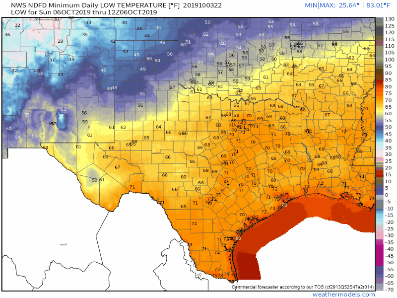
Morning low temperature forecasts daily from Sunday through Wednesday.
Daytime temperatures will be pleasant, but it’s during the overnight hours that one will notice the fall chill in the air. A much drier airmass will allow overnight temperatures to drop more quickly and into values, most of us haven’t seen since last spring. That means plenty of 50s and 60s compared to the 70s and 80s of the summer. Some lucky folks will probably even drop down into the 40s! Like I said – this isn’t ‘cold’, but it will feel glorious and you better enjoy it!
Warmer weather fans shouldn’t fret though. Like most early-season cool fronts this one won’t last too long. Temperatures and moisture values will already begin rebounding by Wednesday and through the remainder of the workweek. Another strong cool front may move into Texas at the end of next week.


0 Comments