
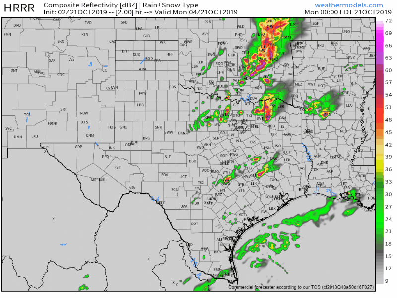
Simulated weather model radar for tonight into Monday morning. This is being used to provide an estimate on arrival of storms at one location. It is a model, so it probably isn’t spot on.
A relatively solid line of thunderstorms now exists from Paris to Cooper to Cumby to Wills Point. The tail-end of that line contains a strong supercell. That supercell is capable of producing very large hail and is being monitored for any signs of producing a tornado.
Thunderstorms are quickly developing in the proximity of a cool front. Storms are located from Saint Jo to Runaway Bay to Mineral Wells to Eastland to Coleman to Sonora. Thunderstorm coverage and intensity will likely increase over the next two to three hours as storms slowly move east/southeast.
Some storms in the squall line could become severe (especially across Central Texas, North Texas, into Texoma) through early Monday morning. THe strongest storms may produce damaging straight-line winds over 70 MPH, quarter to ping-pong ball size hail, and heavy rain. A brief tornado cannot be ruled out, but that threat should be much lower than with the discrete storms earlier this evening.
A tornado watch remains in place until 2 AM for North Texas. New watches are likely to extend past that as the squall line gets going and starts moving southeast.


0 Comments