
The next five days will be the tale of two cool fronts. The first front will move south through the northern two-thirds of Texas today and tonight. The airmass behind said front will be much more appropriate for October with dewpoints dropping from the 60s and 70s (where they’ve been since July) down into the 30s, 40s, and 50s. That’ll mean a much drier and much less humid airmass – along with cooler temperatures! The second cold front that will push south on Thursday and Friday looks to be even stronger. That one could legitimately bring ‘cold’ temperatures to parts of Texas.
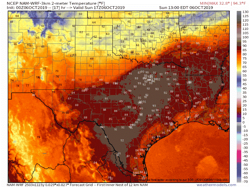
The animation above is courtesy of the North American Model (3KMNAM). I’m sharing this model data to demonstrate the southward progress of the cool front today and tonight. This animation begins at noon today and runs every two hours until 8 AM on Monday.
There will definitely be a noticeable drop in dewpoint values (that sticky feeling to the air) along with falling temperatures.
We shouldn’t see gusty gradient winds out of the north with this front, but winds will become northerly at around 5 to 15 MPH.
The NAM has the initial cool front making it well into South Texas and off of the Southeast Texas coast by 8 AM Monday. That’s on the faster side of the timeline, but this particular model does well with our early season frontal intrusions.
Rain and Thunderstorm Chances Today and Tonight
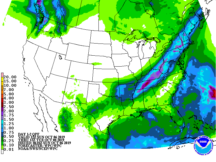
Potential rain totals for Sunday and Monday
Scattered to numerous showers and thunderstorms are expected near and behind the front, as it moves south today and tonight. A few storms in Northeast Texas could become marginally severe with localized wind gusts over 55 MPH and quarter size hail.
Storms farther west from the Permian Basin into North Texas will generally remain sub-severe, but a few storms could briefly put out some gustier winds. All storms produce dangerous cloud to ground lightning.
Overall rain amounts should remain under a one-half inch. This won’t be a drought buster by any stretch of the imagination.
Temperatures behind the cool front tonight into Tuesday morning will be noticeably more pleasant and representative of early October. We’re not talking about temperatures too far below average for early fall and no widespread freezes are currently expected. Those in the Panhandle may see some frost.
Temperatures will rebound upward by Tuesday afternoon through Wednesday as southerly flow returns ahead of our next storm system. That storm system looks to be more potent than the one bringing our first cool front today.
A much stronger cold front arrives Thursday and Friday
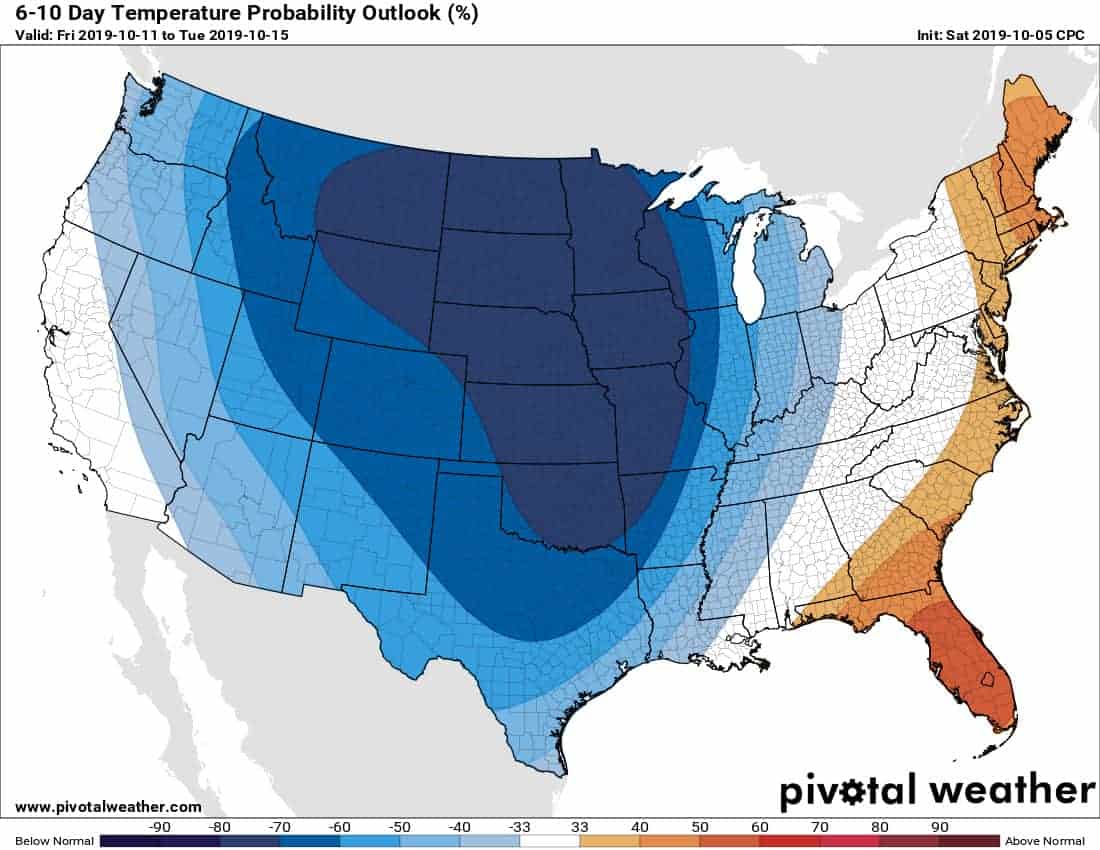
Six to ten day temperature outlook from the Climate Prediction Center. The blues/purples indicate a higher chance of below-average temperatures.
A stronger cold front (yes, I did use the word ‘cold) in conjunction with a more potent upper-level storm system looks to arrive in Texas on Thursday. Showers and thunderstorms are a good bet across the eastern two-thirds of Texas Thursday Night into Friday (perhaps extending into Saturday if the system is slower). We will have to keep an eye out for severe thunderstorms, but that’s still too far off to determine specifics or the extent of any severe weather threat.
Significantly cooler temperatures are expected behind the late-week cold front. This will include the potential for a freeze across the northwestern Texas Panhandle, although we’ll have to keep an eye on trends in case temperatures continue to shift down.
High temperatures on Friday may occur during the morning hours in areas where the cold front arrives during the daylight hours. Falling temperatures can be expected behind the front after its arrival – regardless of the time of day.
Today’s front will bring a hint of fall to Texas. The front later this week will bring fall full-on into your face with gusty north winds and temperatures a good thirty to forty-five degrees lower than those experienced in Texas yesterday.
Those planning on attending various outdoor events on Friday night and on Saturday can expect cool weather. Plan on wearing fall clothing versus the summer clothing of the last four months.
Yes – it is now acceptable to dig sweaters out of the closet. We’ll be able to refine specifics on the late-week front and any associated hazards once we get into Tuesday.


0 Comments