
Scattered showers and thunderstorms developed once again today thanks to a weak upper-level low along with minimal capping. These hit or miss thunderstorms gave some lucky folks much needed rainfall. Most folks didn’t get rain today. The stronger storms through tonight may produce brief gusty winds, a quick one to two inches of rain, and plenty of cloud to ground lightning. Keep tabs on the storms with our free interactive weather radar here on our website and within our mobile app.
A weak cool front will move south into the Texas Panhandle, West Texas, Northwest Texas, and Oklahoma on Thursday and Thursday Night. Scattered to numerous thunderstorms are expected in the proximity of the cool front. Widespread severe weather is not expected. However, a few storms may briefly become severe with quarter size hail and localized damaging wind gusts. Heavy rainfall may also occur. Very localized flash flooding is a marginal threat in West Texas and Northwest Texas. These thunderstorms may progress south into Texoma and the Big Country on Friday. If the storms are able to remain organized they may make their way into North Texas too, but that’s more of a ‘wait and see’ forecast at this time. Temperatures will also be cooler in those areas thanks to that weak front.
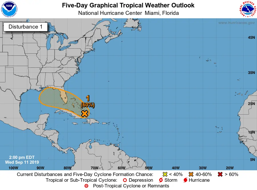
A large area of showers and thunderstorms are located near eastern Cuba into the southeastern Bahamas. Short-term development of this system is not particularly likely. However, conditions will become more favorable for a tropical depression or tropical storm to develop this weekend in the eastern Gulf of Mexico. Regardless, we’ll keep an eye on this tropical disturbance over the next several days. As of this morning, most model data takes this system into the Florida Panhandle or Alabama region early next week. We still need to keep an eye on it though and we will. Moisture from that system may result in an uptick in shower and thunderstorm chances across portions of Coastal Texas next week. Remember: We’re still well within the peak Atlantic hurricane season. Those on the coast from Texas to Florida should be keeping an eye on the tropics.


0 Comments