
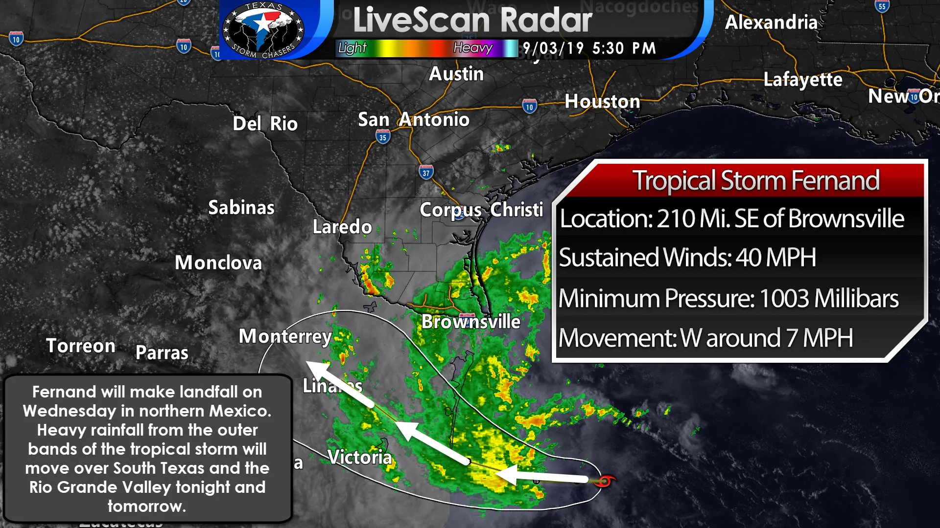
Tropical Storm Fernand developed in the western Gulf of Mexico earlier today. A NOAA Hurricane Hunter aircraft just made their first pass through the system. They located the center of circulation around 210 miles southeast of Brownsville. Maximum sustained winds are around 40 MPH (perhaps a bit higher based off aircraft data). It is moving west around 7 MPH. On that present track, Fernand is expected to make landfall in Northeastern Mexico tomorrow night. We note that landfall is expected to occur far enough south to prevent tropical storm force winds in South Texas and the Rio Grande Valley.
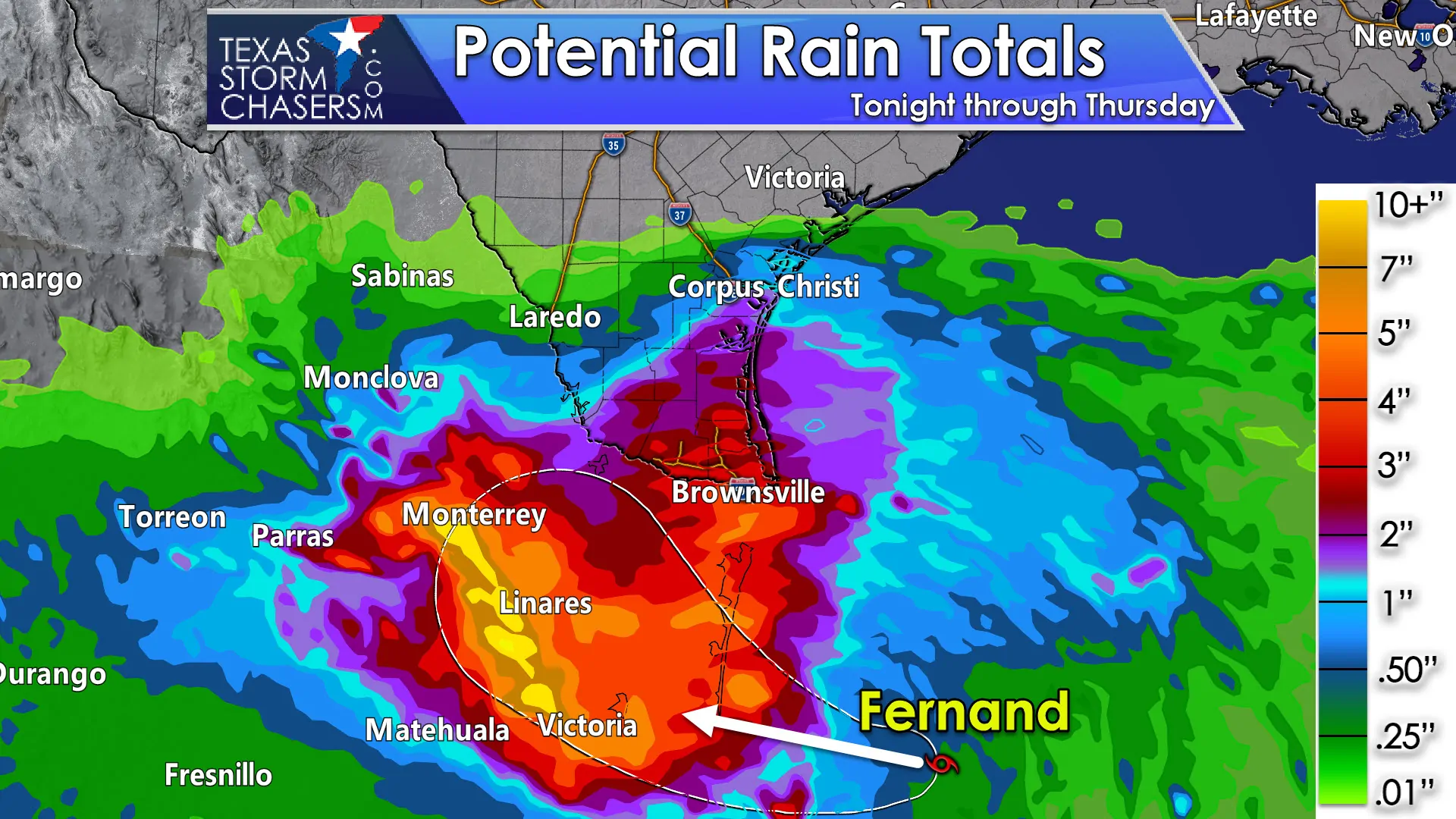
However, outer rain bands from Fernand will bring heavy rain and gusty winds to South Texas and the Rio Grande Valley this evening, overnight, and into the day Wednesday. In fact, these rain bands may continue into Wednesday Night. Some wind gusts over 40 MPH may occur in the heaviest of these rain bands. Rough surf and a high risk of rip currents are also expected. I cannot rule out a few waterspouts trying to become brief tornadoes as rainbands move onshore.
Tropical Storm Fernand is in an environment that could support intensification up until landfall. Again, we are not anticipating any wind or surge related issues in Texas.
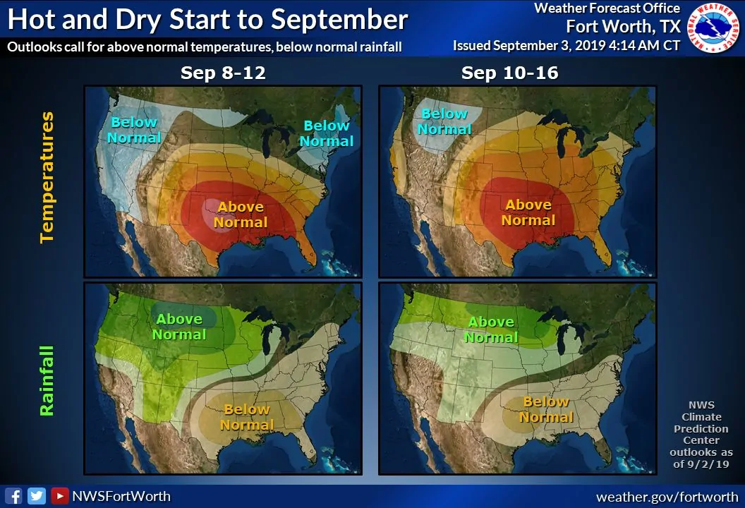
Outside of South Texas and the Rio Grande Valley, we’re expecting dry and hot conditions for the next week. In fact, the Climate Prediction Center is indicating a higher than normal chance for above-average temperatures and below-average precipitation. Don’t get your hopes up for a cold front anytime soon.


0 Comments