
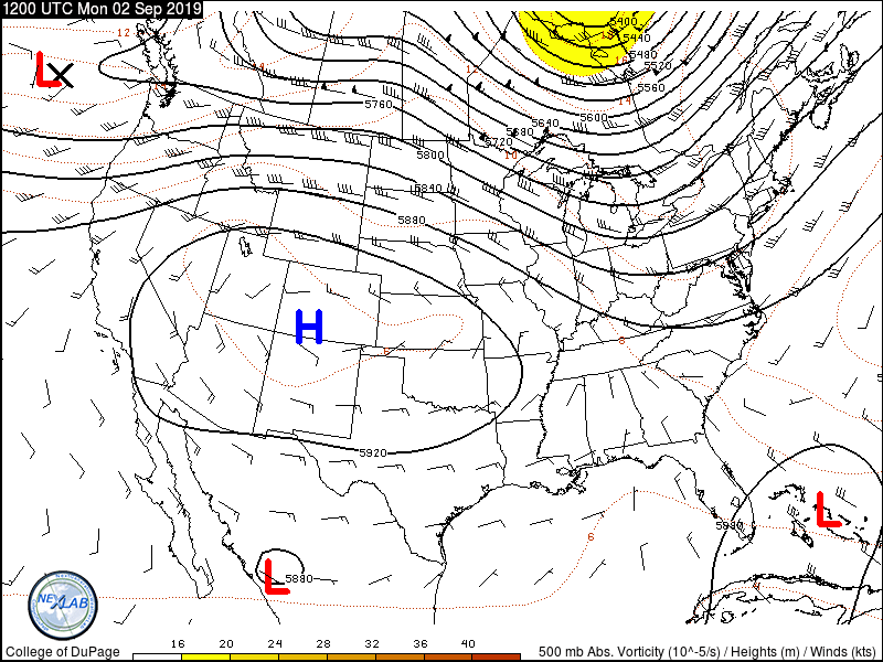
A chart showing pressures and winds at 500 millibars – around 18,500 feet above sea level. A strong high pressure located near the four corner region will keep a majority of Texas hot and dry over the next five days. A clockwise flow surrounding the high will keep a tropical disturbance in the western Gulf of Mexico south of Texas.
We’ve been enjoying relatively quiet weather in Texas over the last couple of days. I say that even though it has been hot, humid, and dry. Many of us need rain, but at the same time, getting meaningful rain in the prime of hurricane season typically involves all sorts of other nasty business. Unfortunately, Dorian has brought devastation and death to the northwestern Bahamas. We haven’t seen the true nature of the destruction yet because there is no way to communicate with the hardest-hit areas.
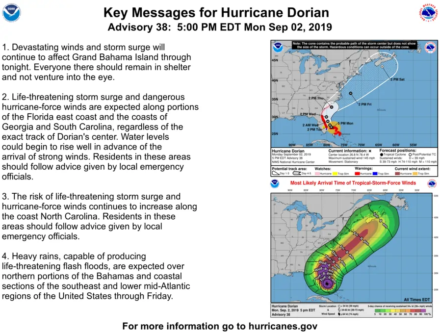
Major Hurricane Dorian is located over Grand Bahama Island and has been nearly stationary all day. A turn toward the northwest is forecast to occur by tomorrow night with a northward motion beginning sometime on Wednesday. This will bring Dorian dangerously close to the Florida Peninsula. Even though the core of Dorian is forecast to stay just off-shore, hurricane-force winds and a damaging storm surge are expected along the immediate eastern Florida Peninsula coast. Thereafter the hurricane is expected to pass near the Outer Banks of the Carolinas. There will be absolutely no impact to Texas.
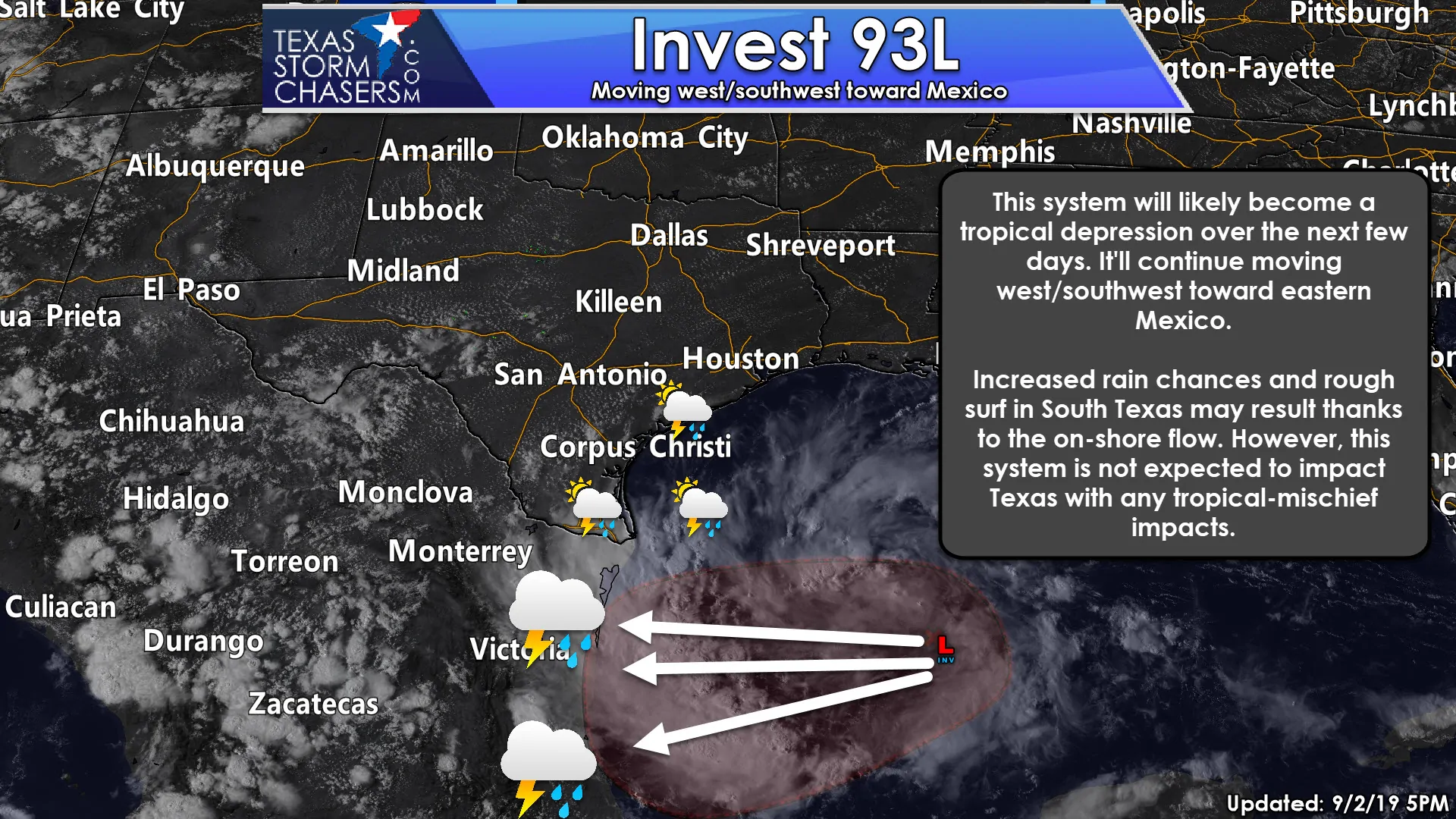
Closer to home we’re monitoring Invest 93L in the western Gulf of Mexico. This disturbance has a high chance of becoming a tropical depression over the next couple of days. While we would normally be quite concerned over a developing tropical cyclone in the Western Gulf of Mexico, we really aren’t in this case. The aforementioned high pressure located near the four-corners is ‘shielding’ Texas. A clockwise mid-level flow will result in Invest 93L moving west to west-southwest until landfall in Mexico later this week. Even though this system will not directly impact Texas we are going to see a few side effects along the coast, South Texas, and the Rio Grande Valley. Increased surf and a high risk of rip currents are expected on all our beaches this week.
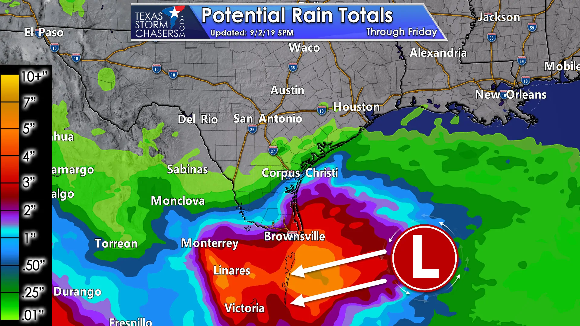
Scattered to numerous showers and thunderstorms are expected tonight, Tuesday, Wednesday, and Thursday across South Texas and in the Rio Grande Valley. Scattered storms are also possible farther northeast up the Middle Texas Coast and into the Coastal Plains. Locally heavy rainfall will be possible with the heaviest rains along the immediate South Texas coast south into the Rio Grande Valley. We can’t rule out localized flooding given some spots may receive over 3 inches of rain. Tropical funnel clouds and waterspouts are also possible over the next few days.
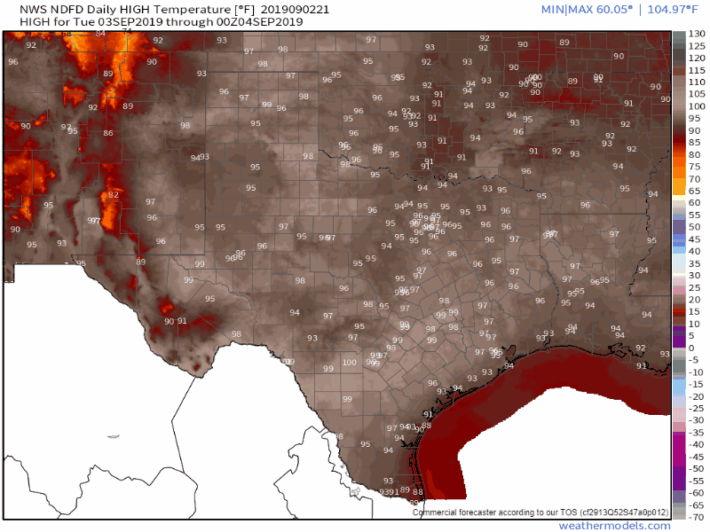
Forecast high temperature forecast from Tuesday through Sunday.
Outside of the aforementioned rain chances? Texas will be under the influence of our summer-time heat dome (high pressure). Temperatures along with heat index values will be increasing through the end of the workweek. We’ll probably see heat advisories return for parts of the state along with warmer overnight low temperatures. With high pressure in place, we’re not going to see much in the way of rain chances outside of the tropical influences. These hot and dry conditions will result in rapid drying of surface fuels and an uptick in the risk of wildfires.


0 Comments