
Tropical moisture flowing northeast from the Pacific along with a series of upper-level storm systems will make for a wet two-day period across the Borderland, West Texas, and the Texas Panhandle. One could reasonably compare the upcoming round of rain to an atmospheric river of sorts. Very impressive tropical moisture values from a tropical cyclone in the eastern Pacific is flowing northeast into the United States. Not only will the aforementioned regions have rain chances, but this river of tropical moisture will extend northeast all the way up to Lake Michigan.
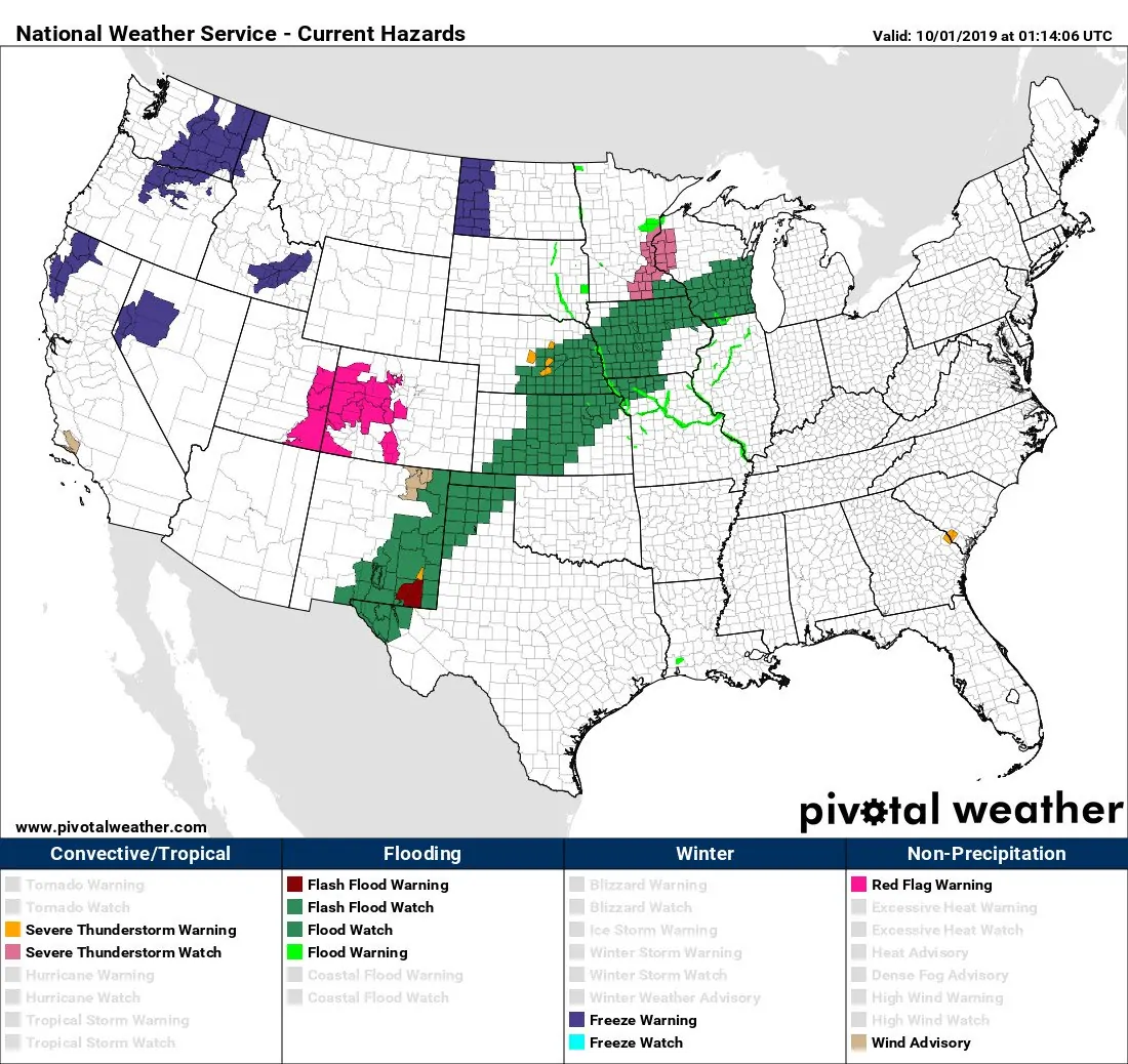
Flash flood watches are in place for the Borderland (El Paso area), the Trans-Pecos, much of eastern New Mexico, and the northwestern half of the Texas Panhandle. Those flood watches continue northeast all the way toward the Great Lakes. The watches actually visually depict the ‘moisture river’ quite nicely.
Timeline and threats
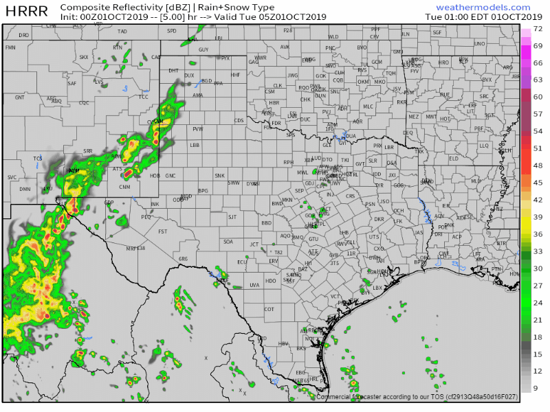
The 0Z run of the High-Resolution Rapid Refresh (HRRR) model depicting simulated weather radar from midnight tonight through dinner-time Tuesday.
We expect an uptick in precipitation coverage and intensity overnight across the Borderland, Trans-Pecos, and eastern New Mexico. Hourly rainfall rates could be fairly impressive given record-high moisture values for early October (we are indeed hours away from October 1st). Topography will also place a large role in any localized areas of flash flooding. Please be mindful of areas that may flood more easily if you’re traveling overnight or on Tuesday.
That large area of rainfall will spread east/northeast into West Texas and the Texas Panhandle on Tuesday. There may be a few stronger storms with gusty winds, but we don’t expect much in the way of large hail or destructive winds. Instability values will be limited with a tropical air mass in place. Heavy rainfall will be the concern with this precipitation event. The threat of flooding could increase on Tuesday into Tuesday night across West Texas and portions of the Texas Panhandle. A flood watch is in place generally along and west of a Muleshoe to Dimmitt to Amarillo to Borger to Lipscomb.
Expected Rain Totals
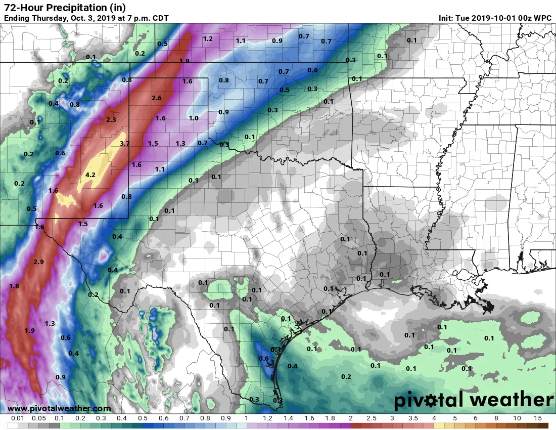
Potential rain accumulations from tonight through Thursday afternoon
Widespread rainfall accumulations are expected to be in the range of one to three inches. Those values themselves won’t be conducive to widespread flooding. However, some spots (especially closer to New Mexico) could have rain totals closer to four or five inches. It won’t be raining constantly tonight, tomorrow, or tomorrow night.
Wednesday and beyond with fall cold front finally arriving next week
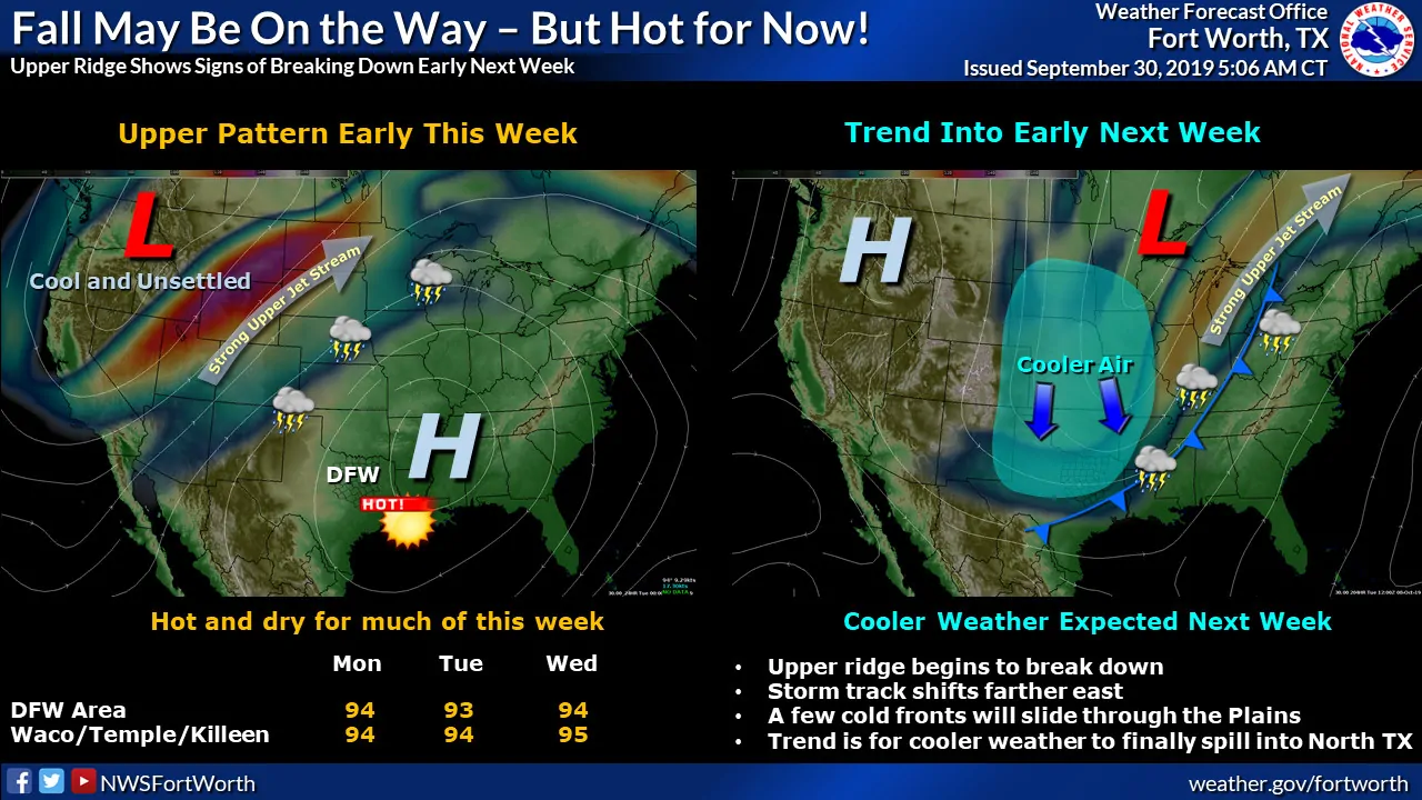
Beyond Wednesday morning the small-scale uncertainties will play a larger role in the forecast. At least scattered showers and storms could continue beyond that time across the Panhandle and West Texas. However, a significant cool down is expected across the Panhandle for Thursday. High temperatures will struggle to get past the lower 60s with lows Friday morning well down into the 50s. It’ll feel like fall for those lucky folks. For the rest of Texas? Well, we finally have a light at the end of this annoyingly humid summer. A fairly potent cold front looks like it’ll move south well into Texas in about one week (six to eight days). That should bring a much less-humid and fall-like air mass to Texas. We’ll have to keep an eye out for thunderstorm chances with that front too.
Free HD Interactive Radar can be found here on our website and in our free mobile app (link at the top of this page).


0 Comments