
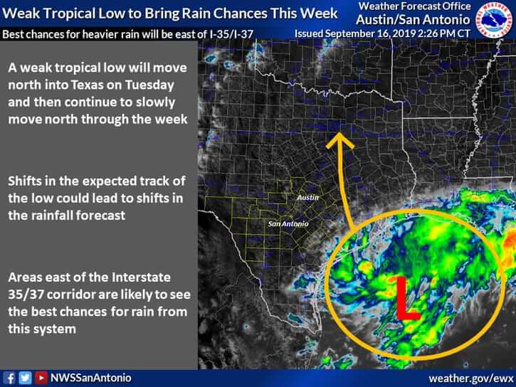
A tropical low pressure will be the primary concern in the weather department for the next several days. That low is currently sitting off-shore the Southeast Texas coast. This system has some chance of becoming a tropical depression, but even if it does, the excessive rain aspect of this system would remain the most significant hazard. The area of low pressure will move inland on Tuesday. However, it won’t be in any hurry whatsoever and will only slowly drift northwest/north through Southeast Texas, the Brazos Valley, into North Texas through Thursday.
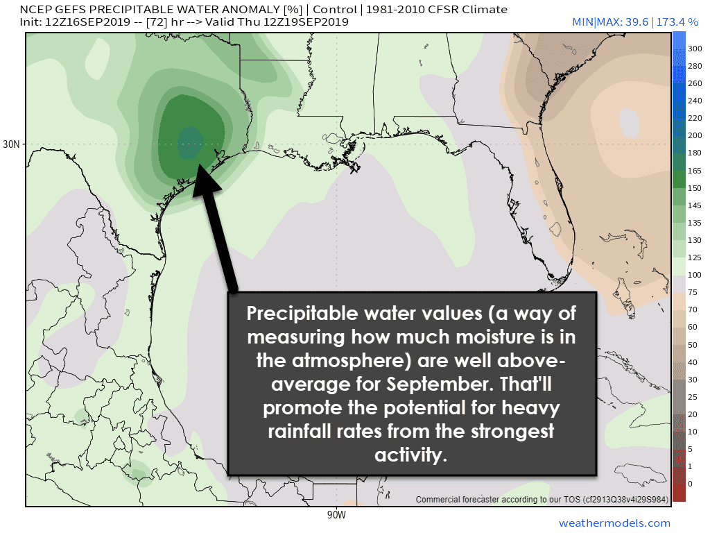
With this low originating from tropical origins it isn’t much of a surprise that it’ll bring a tropical airmass inland with it. That means we’ll have a copious amount of moisture available. In other words, showers and thunderstorms will be efficient rainfall producers. The strongest convection may produce hourly rainfall rates of two to three inches per hour in the coming days. That’s not to say that all activity will be that heavy, but a tropical airmass will certainly be in place. Combine that with a slow-moving storm system and you’ve got an excessive rain scenario setting up.
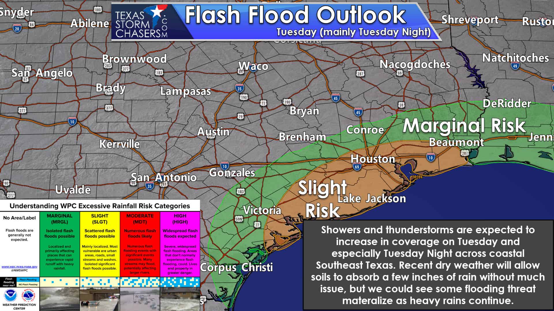
Rain chances will increase on Tuesday and Tuesday Night across the Coastal Plains and Southeast Texas. Rain chances will initially be highest along the immediate coast, but those chances will spread inland into the night. Some rainfall will be heavy, but the dry weather of late will allow soils to absorb initial rains fairly well. That’ll go out of the window if rainfall rates are closer to 3 inches an hour in an urbanized area.
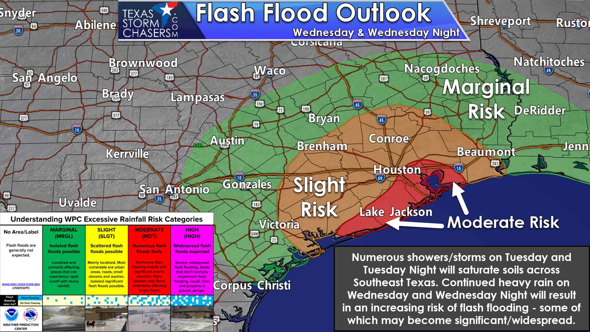
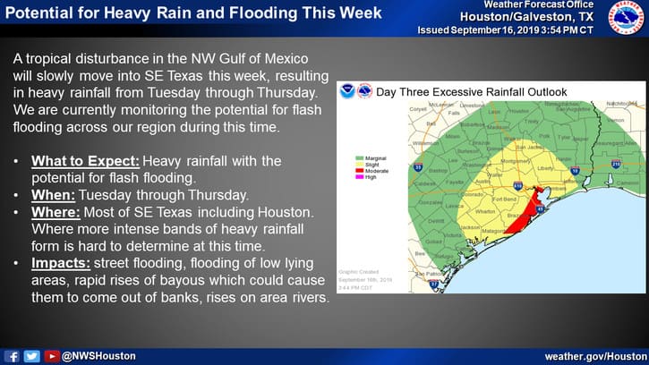
Numerous showers and thunderstorms are expected on Wednesday, Wednesday Night, and Thursday across the Coastal Plains, Southeast Texas, and the Brazos Valley. While soils will initially be able to absorb heavy rains, that’ll change as soils become saturated. Thus we expect an uptick in runoff and thus a threat of flash flooding. If very heavy rains ‘train’ or set up over the same areas we’re going to see a substantial flash flood threat materialize.
A moderate risk of excessive rainfall (flash flooding) has been issued for coastal Southeast Texas. This heightened risk runs up into Harris County and the Houston metro. We note that any heavy rain that falls in that area by Wednesday will likely do so on very saturated soils – with any rain running off and probably causing more rapid rises on the bayous. A moderate risk is significant and indicative that a more significant/widespread flooding threat may occur.
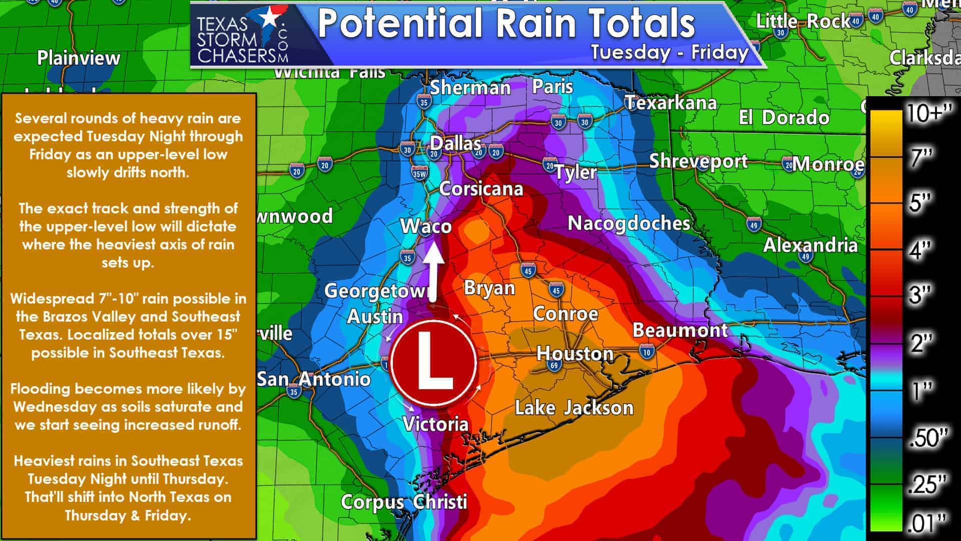
Rain chances will increase Wednesday night, Thursday, and continue into Friday farther north into the Brazos Valley and North Texas. The axis of heaviest rainfall will greatly depend on the track of the upper-level low. However, an axis of three to six inches of rain could certainly accompany the low as it tracks north through the Brazos Valley and eastern North Texas. Some flooding could certainly occur – especially if we see some of those rain totals occur within a short period of time (a distinct possibility).
Widespread rain totals of five to ten inches are expected across Southeast Texas. Localized rain totals up to 15 inches are possible – and that would cause significant flooding. Obviously any of those heavier rain totals over the urbanized zones would cause higher impacts.
Some changes to the forecast are expected so we’ll likely have to adjust the axis of rain totals and the totals themselves. Regardless, it’s going to be wet this week in the aforementioned regions. On the bright side, all that rain will keep temperatures down.
We’ll have another detailed blog posted tomorrow morning or sooner if necessary. You can download our free TSC app (top of the page) and get notifications of our updates. Our app also includes a free interactive weather radar.


0 Comments