
Good morning! It is Friday, September 6th, 2019. While our northern neighbors look forward to a frost this weekend we in Texas will be dealing with above-average temperatures. Unfouranetely, the forecast includes more triple-digit heat through the weekend. If you’re wanting a taste of fall head up into the Rockies, the Dakotas, or Minnesota. They’ll be dropping into the lower and middle 40s for morning lows this weekend.
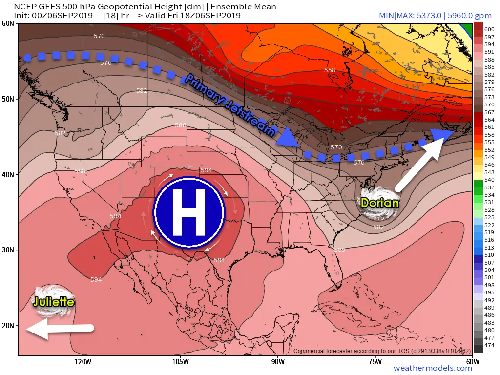
Our pesky upper-level high pressure remains strong and continues to bring subsidence (sinking air) across much of Texas. That results in low precipitation chances and hot temperatures. We note that not only have day-time temperatures been warm, but overnight lows have been on the toasty side too as drought conditions have resulted in dry soil. Soil that is dry is able to hold more heat and thus keeps the ground warmer at night (versus allowing more latent heat to disperse into the atmosphere). Minus my nerdy terms – it’s hot and there ain’t no rain.
Our upper-level pattern won’t change too much through Saturday, although some changes will occur by Sunday across the Borderland. That means more triple-digit heat, more humidity, and more concern over the strain on the electric grid across Texas. Some folks may actually manage to get near record high territory simply because we’re in September now versus July or August. That doesn’t mean much after the hot last six weeks, but still, we weather folks do tend to notice such things. We don’t have anything better to do most of the time in the summer.
Fast forward into next week and we do notice some changes in the upper-level pattern. Our upper-level high pressure, also known as the heat dome, shifts east into the Southeastern United States. Be happy that happens after Dorian is out of the picture. Had this pattern developed last week it would have supported Dorian moving farther west and probably into the Gulf of Mexico. Alas, that did not happen and we don’t anticipate any tropical mischief in the Gulf of Mexico for the next week (at least).
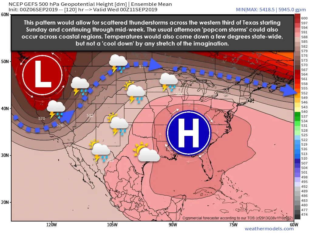
With the upper-level high shifting east we should see temperatures across Texas drop a few degrees. We’ll also see the return of daily ‘popup thunderstorm chances’ along the coast and for folks just inland. How far inland those isolated popup showers/storms may it daily will depend on how aggressive the sea-breeze is each day.
Another feature to note is a decent upper-level storm system that should move onto the West Coast of the United States by early next week. That system will generally remain northwest of Texas, but it’ll result in a weak southwesterly flow aloft across the Borderland, Trans-Pecos, Permian Basin, West Texas, and in the Texas Panhandle. We’re not talking anything impressive, but scattered thunderstorms could return to those regions beginning Sunday and continuing daily through mid-week.
Widespread severe weather doesn’t look likely, but it doesn’t take too much to get a strong storm or two during the summer months. Lightning igniting grass fires will have to be a thought to emergency management and fire personal given the dry fuel load.
If I didn’t mention your region in the above two paragaphs I’m afraid the chance of measurable precipitation isn’t high over the next five to seven days. We’re looking out in model voodoo land for signs of our first nice fall cold front. As of now that ‘relief’ looks to be weeks away with little hope over the next ten days.


0 Comments