
I don’t post too much during the repetitive stretch of summer heat just because its… repetitive. I suppose I could conjure up some creative way to phrase the same forecast day after day, but that desire has eluded me. We’re going to get a brief respite from the summer weather normalcy tomorrow evening into Wednesday as a ‘cool’ front sags south into Texas. I’m afraid this front won’t bring true relief from the summer heat. However, we should see temperatures across the state generally drop five to ten degrees for Wednesday through Friday. Hey, if we can have the mid 90s instead of the 100s for a few days, I’ll take it. Summer fronts, no matter how weak they are, can often bring summer thunderstorms. Wind shear aloft is typically weak to non-existent, but all that heat in the atmosphere is prime fuel for microbursts (very localized damaging wind gusts). That will be a threat with the strongest storms today, Tuesday, and on Wednesday. More about those storm chances below.
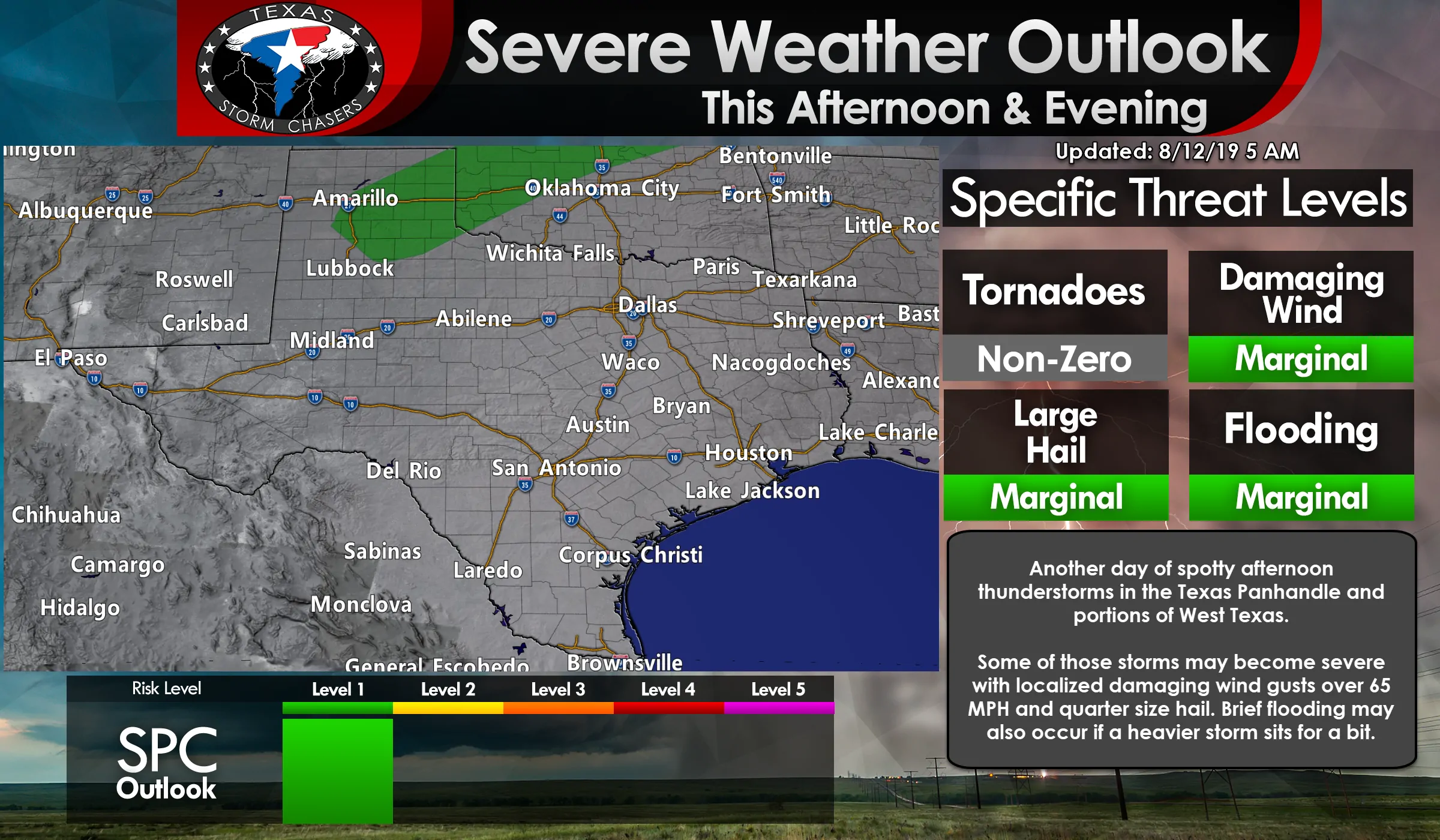
The summer monsoon continues with another chance of afternoon thunderstorms across the Texas Panhandle and portions of West Texas. Most folks aren’t going to be getting wet, but I say that and how many storms have impacted Amarillo over the past week? Similar to the last few days the strongest storms may be capable of producing localized damaging wind gusts over 65 MPH and quarter size hail. Brief heavy rain is also possible, but don’t expect that to be a widespread phenomenon. Those who are lucky enough to get a storm will also have the added benefit of temperatures falling into the 80s. Otherwise, it’s gonna be a hot dog kind of day. Try out our free HD interactive weather radar here on our website to keep tabs on the rain (and temperatures).
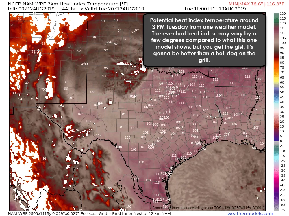
The main story for Tuesday will be the heat. Tomorrow looks to be the hottest day of 2019 thus far for the eastern half of Texas. High temperatures will make it up into the 100s, but we’re also going to see moisture pooling ahead of that surface front. With dewpoints remaining in the 70s and temperatures climbing above the century mark it seems probable that we’ll have heat index values exceeding 110 degrees across Texoma, North Texas, Northeast Texas, the Coastal Plains, and South Texas. Heat index values may stay just below 110 degrees across the Concho Valley, Central Texas, Brazos Valley, and Southeast Texas, but we’re literally talking about a few degrees. It doesn’t make that much difference. Not only will be it hotter than a hot dog- you’ll probably be able to cook one on the hood of your car. (No, I haven’t tried to do that so I can’t actually confirm that you could cook a hot dog on the hood of your car.)
Outside of tomorrow’s very annoying and dangerous heat index values, we also get to talk about the chance of thunderstorms. That weak front should be moving into North Texas, Texoma, and Northeast Texas late tomorrow afternoon. Isolated to scattered thunderstorms may develop by the late afternoon or early evening hours in the proximity of that front. Given surface temperatures in the triple digits, there will be plenty of juice to support stronger storms.
High cloud bases combined with those very hot temperatures will likely give birth to a damaging wind threat with the most intense storms. Localized damaging wind gusts over 65 MPH are certainly possible with storms tomorrow evening across North Texas, Texoma, Northeast Texas (and wherever else they may develop). Some storms may even produce some marginally severe hail. At this time thunderstorm coverage looks to be between 25 and 50 percent. I’ll put together another post for this evening that’ll be more specific on storm timing, locations, etc for Tuesday.
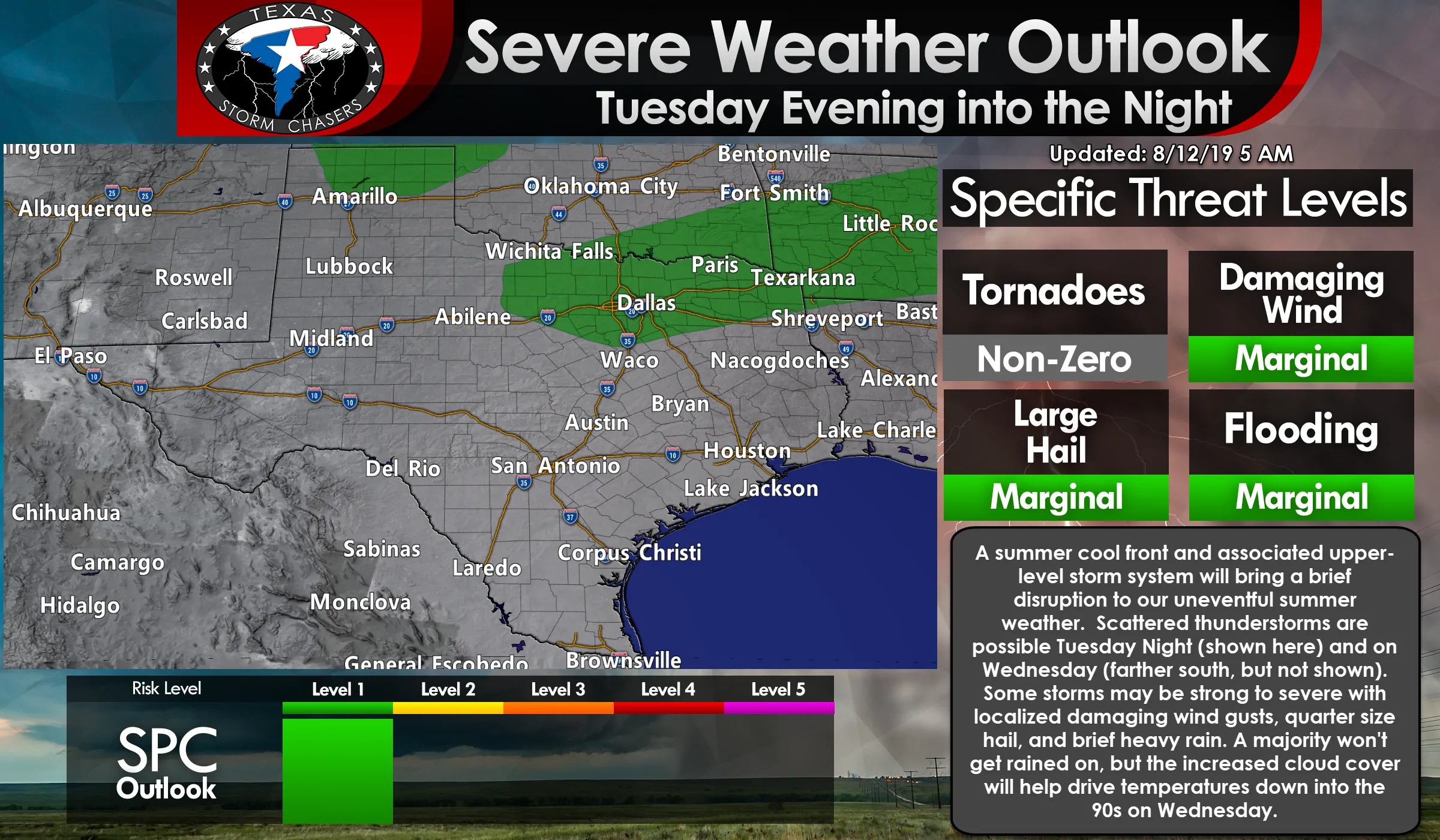
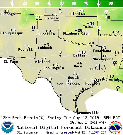
Isolated to scattered thunderstorm chances will continue on Wednesday across the northern half of Texas. They’ll spread into South and Southeast Texas Wednesday night. Some storms may be capable of producing very localized damaging wind gusts, brief heavy rain, and perhaps some hail. Widespread severe weather is not expected on Wednesday, nor is widespread heavy rain, flooding, or flying llamas. Can you tell I watched Jimmy Neutron and Emperor’s New Groove as a kid?
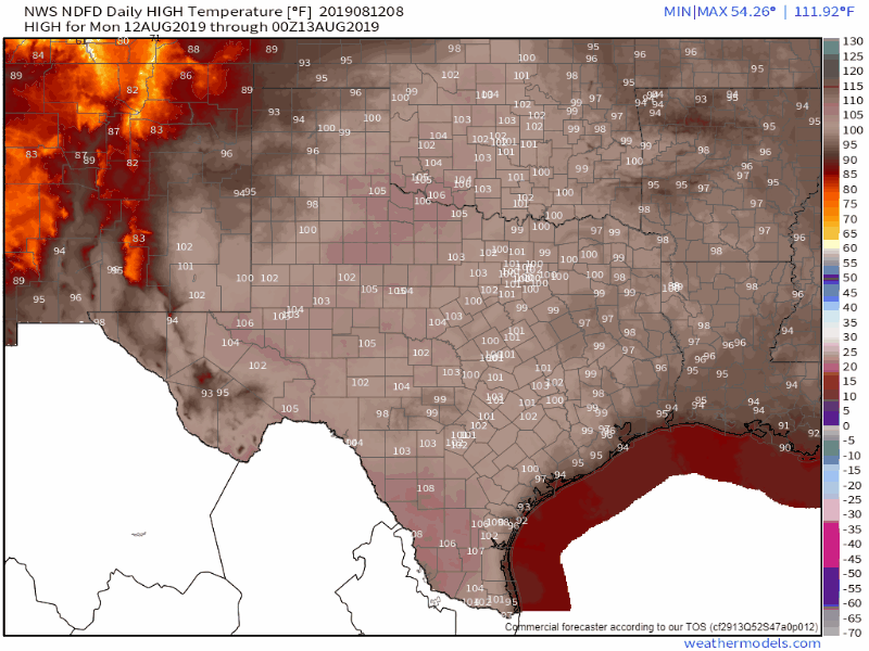
High-temperature forecast over the next five days
Today and tomorrow should be the hottest days this workweek across Texas. While it’s still going to be hot thereafter, we should see a few days of ‘comparatively lower’ temperatures thanks to increased cloud cover and our upper-level heat dome shifting west. Summer is far from done though. Heat dome of doom build back in this weekend it appears. The only way we get out of typical summer weather for more than a day or two is from a tropical cyclone… or October. Maybe September if its a good year, but I don’t think this is going to be one of those years.


0 Comments