
July has arrived and we’re well within our typical summer weather pattern deep in the heart of Texas. That typically involves little to no winds aloft as the jet stream is typically up in the Canadian providences. July and August bring severe weather to portions of Saskatchewan, Manitoba, and even parts of Ontario. Let’s be honest – our spring severe weather season lasted about 3 to 4 weeks longer than what we’ve seen in recent years. We needed the break from weekly severe weather events. Now we have been dealing with some summer thunderstorm activity, but that is driven by diurnal processes versus kinematics (storm systems aloft, wind shear, etc).
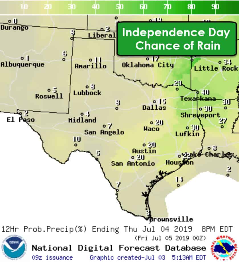
Those of you visiting our mighty blog are probably wondering about the forecast for fireworks tomorrow evening. I’ll save you the trouble of reading further (which isn’t smart, since if I waited until the end, you’d scroll down and read the entire post). Alas, as I said, it was a long storm season. Tomorrow night’s fireworks should be good to go. There may be isolated day-time popcorn storms, but coverage will be lower than today and the last several days. The highest ‘relative’ chance for afternoon showers will be in Northeast Texas and East Texas. Those should be dissipating by 8 to 8:30 PM, although I can’t rule out an isolated shower persisting a bit longer.
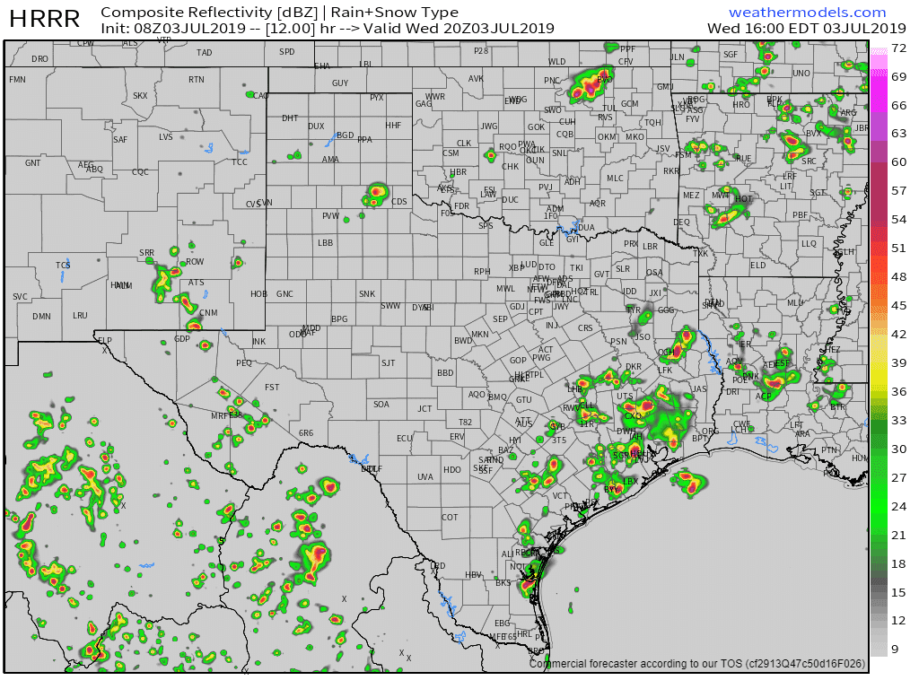
Simulated weather radar from the High-Resolution Rapid Refresh model at 3 PM this afternoon.
While tomorrow is looking good, I can’t say the same for today’s forecast in Southeast Texas. Scattered to numerous showers and thunderstorms will be developing by 10-11AM in Southeast Texas. That activity will slowly move to the north/northeast. Scattered storms will also be possible by the late morning and afternoon hours across South-Central Texas, Central Texas, the Brazos Valley, and in East Texas. We could even see a few storms make it up to the Red River by the late afternoon.
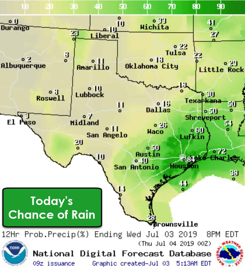
As is usual with summer storms, we should see coverage quickly decrease as we get toward sunset – and thereafter. The strongest storms could produce very localized wind gusts over 50 MPH, small hail, an obvious amount of lightning, and heavy rain.
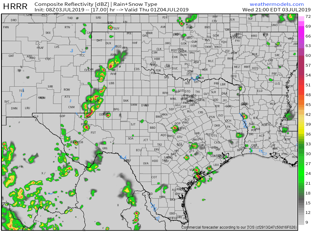
Simulated weather radar from the High-Resolution Rapid Refresh model at 8 PM this evening.
Farther west in the Texas Panhandle, West Texas, and Permian Basin – we may see some thunderstorms move in from New Mexico this evening. Those would tend to move east/southeast. While widespread severe weather is not expected, some of those storms may contain gusty winds, small hail, and heavy rainfall. Blowing dust would also be a threat given those stronger thunderstorm outflow winds.
So there you have it! Summer storm chances continue today, but let off considerably for tomorrow. Tomorrow evening’s weather looks decent for outdoor events and firework shows. It’ll be warm with temperatures around 90 degrees (give or take five degrees) for the fireworks tomorrow evening. At least it won’t be 105 degrees or a giant puddle.


0 Comments