
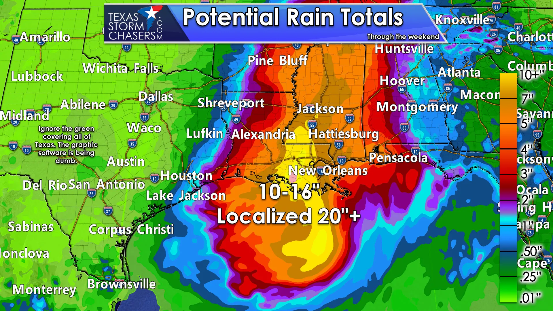
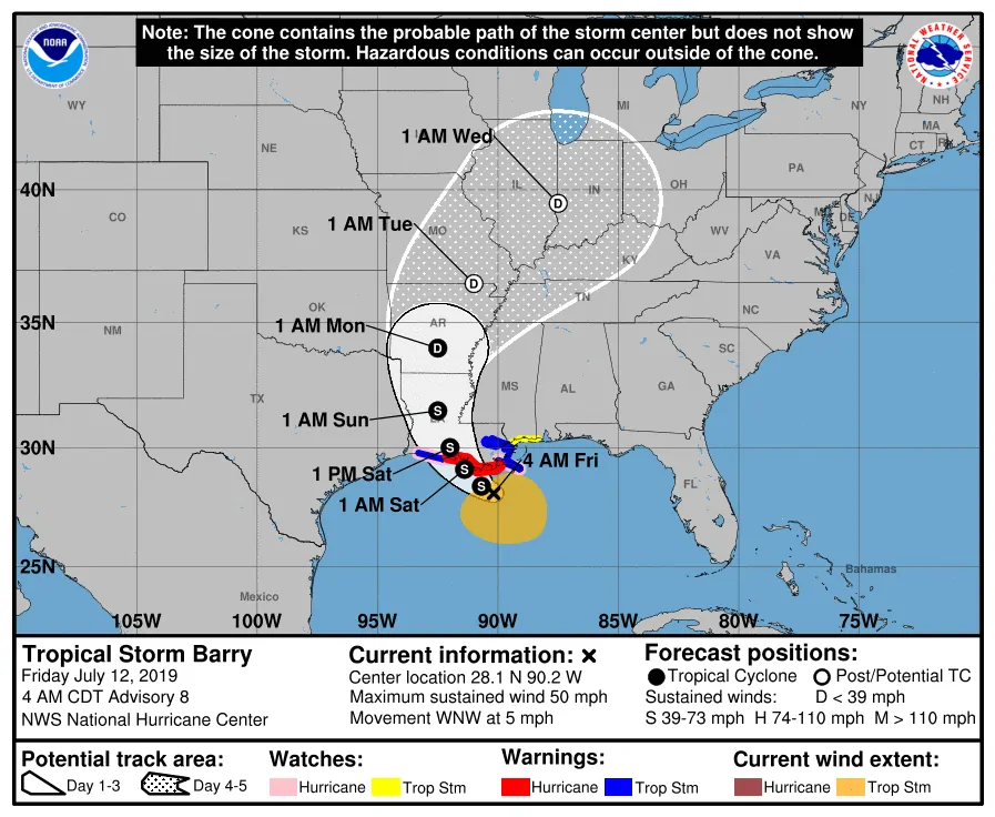
Congratulations on surviving the work week and making it to Friday! Tropical Storm Barry will make landfall in Louisiana tomorrow. Regardless of Barry maintaining tropical storm or minimal hurricane status, the main story will end up being life-threatening freshwater flooding. Rainfall amounts between one and two feet are expected for the eastern half of Louisiana, with heavy rains extending into Mississippi too. There will likely be some bad stories coming out of those areas in the flooding department. You can view the latest forecast on Barry from the National Hurricane Center.
For us in Texas? Honestly, we’re not going to have to deal with too much ‘Barry’ related. The Coastal Plains and Southeast Texas could see some heavier rains tomorrow, and especially on Sunday, but those will only be somewhat related to Barry. More about that below.
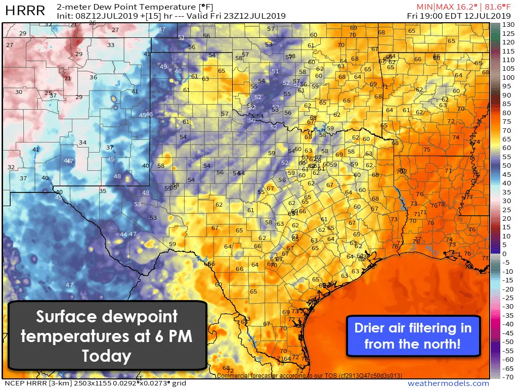
A cool front will continue to progress south through the state today. Temperatures won’t be too much lower (it is July after all), but the dewpoints will be coming down. Some folks in the northern half of Texas will have dewpoints drop into the 50s by the late afternoon. For comparison, they were in the upper 70s earlier this week. That means we’ll switch to more of a ‘dry’ heat and even though it’ll be in the 90s, it won’t actually feel like a sauna outside! Overnight low temperatures will also be more comfortable tonight and through the weekend.
Scattered showers are possible this weekend in eastern North Texas, Northeast Texas, East Texas, and Southeast Texas as Barry moves inland and off to our east/northeast. Most folks should remain dry, but a quick-hitting downpour will be possible. Remember, any thunderstorm in the summer months can produce localized high winds and dangerous lightning. The widespread heavy rainfall and flooding should remain to our east too.
One possible exception to our quiet weather may be on Sunday. It isn’t out of the question that a focused band of heavier rain could form in portions of the Coastal Plains and in Southeast Texas on Sunday. Weather models are in poor agreement on the existence, not to mention the placement, of that feature. It could easily end up being in the Gulf of Mexico, or not happen at all. However, if it does occur onshore, we could see localized flooding develop. That’ll be something to check back on in future forecast updates.
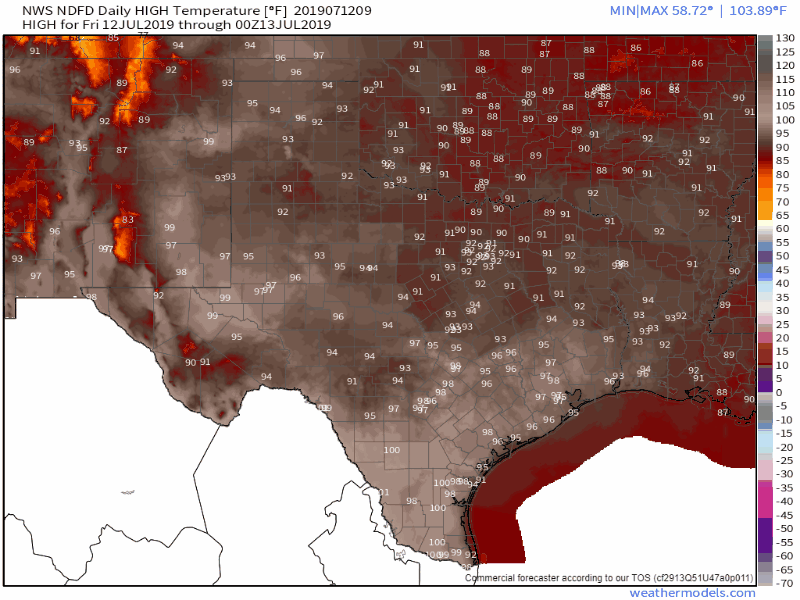
Forecast high temperatures over the next seven days from the National Weather Service
We’ll see a northerly flow continue into Saturday and Sunday as Barry passes off to our east. That’ll help keep dewpoint values a bit lower, and thus keep our heat index and humidity more tolerable too. Barry will exit stage right by Monday. A summer-time high pressure will build back into Texas shortly thereafter. The annoyingly high dewpoint values and heat index values over 105 degrees will probably make a comeback beginning Tuesday and continue for a good chunk of next week. This type of pattern does not support widespread rain chances.
You’ll be able to keep track of Barry’s latest position using our free interactive radar right here on our website and included in our free mobile app.


0 Comments