
Why hello there! It’s been a minute since I last sat down to post a detailed forecast here on the blog. Excluding our nice summer cold front last week and our near-miss with Barry it’s been a quiet month in the weather department here in Texas. That allows us time to catch up on the non-weather related parts of our lives. One such item includes Paige’s broken foot and the ‘fun’ medical-related nonsense that one has to go through when unable to work. Anyway, that aspect will hopefully soon be resolved and you didn’t come here to read about David’s life in July. Let’s chat about the weather we’re expecting this week!
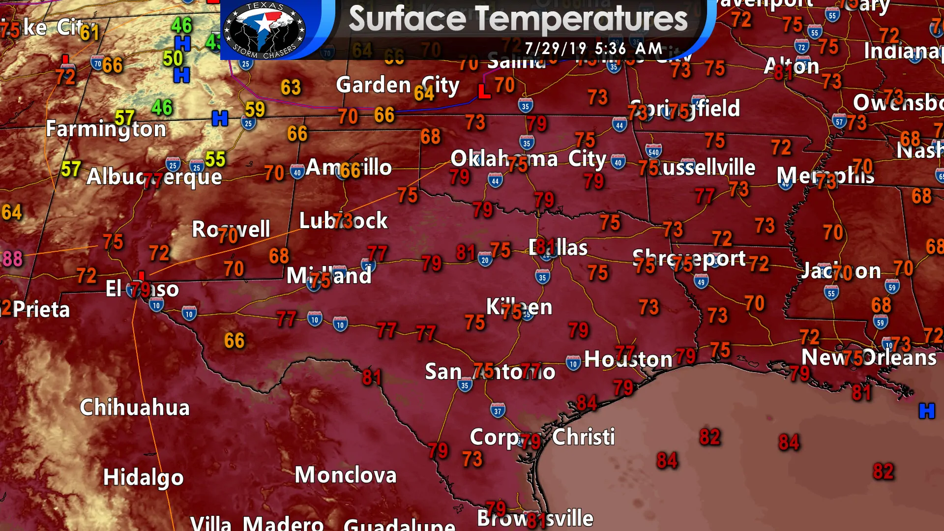
Surface temperatures at 5:30 AM
A weak cool front is moving south into the northern Texas Panhandle eastward into Central Oklahoma this morning. Unlike last week’s front, this one is much more characteristic of what we expect in the summer – a northerly wind shift, some increased storm chances, and hardly any temperature reduction. That front will continue to slowly move south today, tonight, Tuesday, and eventually stall out in Southeast Texas sometime tomorrow or tomorrow night. Scattered showers and thunderstorms will be possible in the proximity of that front and we’ll talk more about that below.
The highest chance for those storms will be near Interstate 20 from Odessa and Midland east/northeast into Texoma and Northeast Texas. Thunderstorm coverage should range from 20 percent to 50 percent (meaning most folks won’t get rained on). There may be a cluster or line of storms by the early evening hours across Southern and Southeastern Oklahoma. Those would be in proximity to that southward moving ‘cool’ front. If that thunderstorm cluster does materialize they could move south across the Red River and into North Texas after 5-6 PM. The highest chance of scattered storms this evening and overnight will be across North Texas, Northeast Texas, and East Texas. Those thunderstorm chances will move south for Tuesday and encompass East Texas and Southeast Texas. An isolated storm could occur in Central Texas. From Tuesday Night onward the best chance for isolated to scattered storms will be across Southeast Texas and the Coastal Plains – as is typical for the summer months.
A few stronger storms are possible today just because of the fact its July and temperatures will be in the 90s. Wind shear values are weak and don’t support a widespread or long-lived severe weather threat. Typically the stronger storms in the summer months produce very localized damaging winds known as microbursts. Some of those winds could briefly approach 55 to 65 MPH, but by far most storms will not have winds that high. Dangerous cloud to ground lightning is a hazard with any thunderstorm – when thunder roars go indoors!
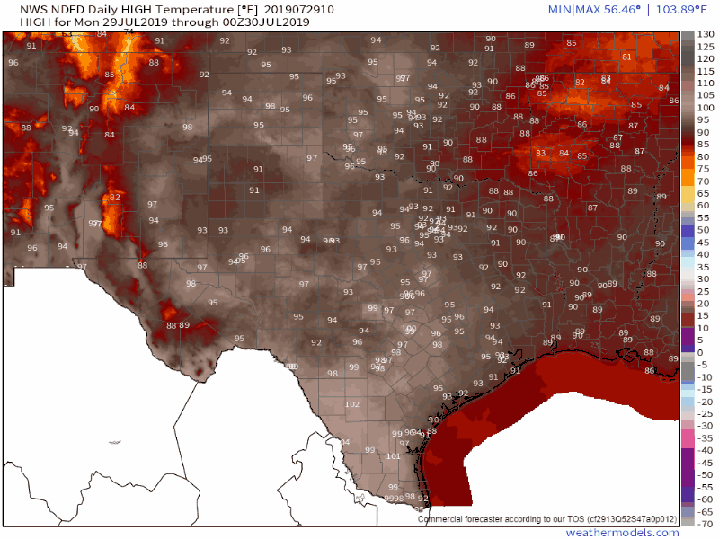
Daily high-temperature forecast beginning today through Saturday (August 3)
There will not be any significant temperature swings this week. High temperatures will generally range from the lower 90s into the lower 100s (100-104 degrees). An exception will be for those who get lucky and have a nearby shower or thunderstorm this week, although the increased humidity will make it feel just as oppressive. Our upper-level high pressure could shift toward the southwestern United States by the weekend. If that occurs we may see temperatures come down a few degrees (still hot, but maybe 3-5 degrees cooler during the afternoons than preceding days). Daily pop-up storms will be possible in Southeast Texas and the immediate coastal regions as the sea-breeze moves inland.
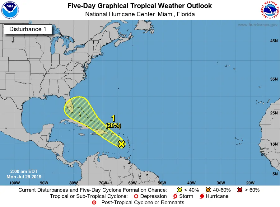
The Atlantic basin remains quiet as we move toward the conclusion of July. We do note that Invest 95L is just west of the Leeward Islands. That system could slowly develop later this week as it makes its way toward Florida. Most longer-range weather model guidance shows a ‘dip’ in the jetstream that would keep this system out of the Gulf of Mexico. We don’t anticipate any weather impacts to Texas from that tropical disturbance. We’ll have to keep an eye out in the Atlantic as we move into August – and we get into the busier months of the hurricane season.


0 Comments