
Hi there and welcome to the end of the work week, albeit a truncated one. This is the time of year where folks in the weather biz across the southern United States come up with intriguing ways to describe the same old forecast – excluding tropical mischief. Hot, humid, a small chance of an afternoon thunderstorm – repeat for the next seven days. Truthfully, while there is a bit more to our forecast than that, that is the majority of our forecast for the next several days. The only change would be to remove the ‘small chance of an afternoon popup storm’ as we get into next week.
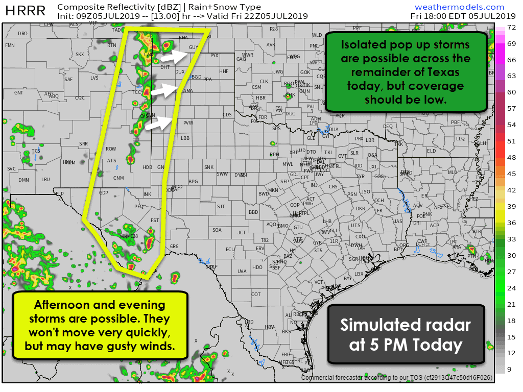
The highest chance for isolated to widely scattered thunderstorms today will be across the higher elevations of the Trans-Pecos, and this evening in the western Texas Panhandle and West Texas (west of Interstate 27, and for those locations bordering New Mexico). These storms will be slow moving and not particularly organized with little in the way of wind shear aloft. By their nature (forming in the afternoon heat) some of the storms could produce localized damaging winds, a ton of lightning, brief heavy rain, and even blowing dust from those gusty thunderstorm outflow winds. Most folks will remain dry. I can’t rule out a stray thunderstorm across the remainder of Texas, but at this point, chances look to be below 20%. Still, summer ‘popup’ storms can happen – and those do tend to produce a significant amount of lightning.
Rain chances will actually be a bit higher this weekend across the Texas Panhandle, West Texas, and Trans-Pecos. While organized severe weather is not expected, the aforementioned hazards with summer storms will remain. Perhaps a few folks can get rain before we enter a dry spell next week. Notice that segway? That’s our transition!
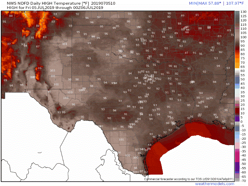
Forecast high temperatures today through much of next week from the National Weather Service
We’re going to be moving into more of a summer pattern next week. An area of high pressure aloft will strengthen and help introduce subsidence (sinking air). That’ll help shut down rain chances and allow our temperatures to warm right up. Several folks will get to hit 100 degrees for the first time this summer. We’re not talking record heat or the ‘why is it so stinking hot’ heat either. I mean, it’ll be hot and humid, but it won’t be 107-110 degrees with overnight lows in the middle 80s (looking at you 2011).

Temperatures will end up being a few degrees above our typical 30-year average next week, but they won’t be threatening records. One anomaly we will have to watch is the abundant soil moisture. Our wet spring could help keep the humidity values a bit higher – which would result in a nastier heat index. Those heat index values could get over 105-110 degrees for some folks next week. Not record-breaking heat, but still not something to laugh off if you work outside in it or overexert yourself. I’ll forgo the heat safety tips because most folks don’t need me telling them to drink water, find shade, take frequent breaks, and don’t turn into a lobster. Now for those record-heat situations? Yeah, I’ll go over all those tips.
So yup! It’s going to be hot next week. Rain chances will probably be NIL, and this is the time of year where we start keeping a close eye on the tropics. There isn’t anything immediate showing up, but with summer underway, we’ll be keeping an eye out on the Gulf of Mexico.


0 Comments