
For years after Ike in 2008 folks were on edge about any inkling of tropical mischief in the Gulf of Mexico. That died down after five years. We’re in the same cycle now after Harvey where any sort of hint of mischief in the Gulf of Mexico turns everyone into a ‘tropical weather expert’ with images of weather models and tropical cyclone track graphics popping up all over the internet. Let me be perfectly clear when I say that just because you can find tropical weather model graphics easily does not mean they should be shared all over social media. Most folks don’t understand how weather models work – not to mention the specifics involved with tropical-only weather models. Please be very picky about who you choose to get your weather information from. Even with that warning, I have no doubt that I’ll be chasing down ‘false rumors’ created by someone sharing weather model graphics without any idea what they’re looking at. If I shared a graphic from the American long-range weather model (GFS) every time it showed a category five hurricane hitting our coast we would literally have monster hurricanes every other day.
Click image for larger version
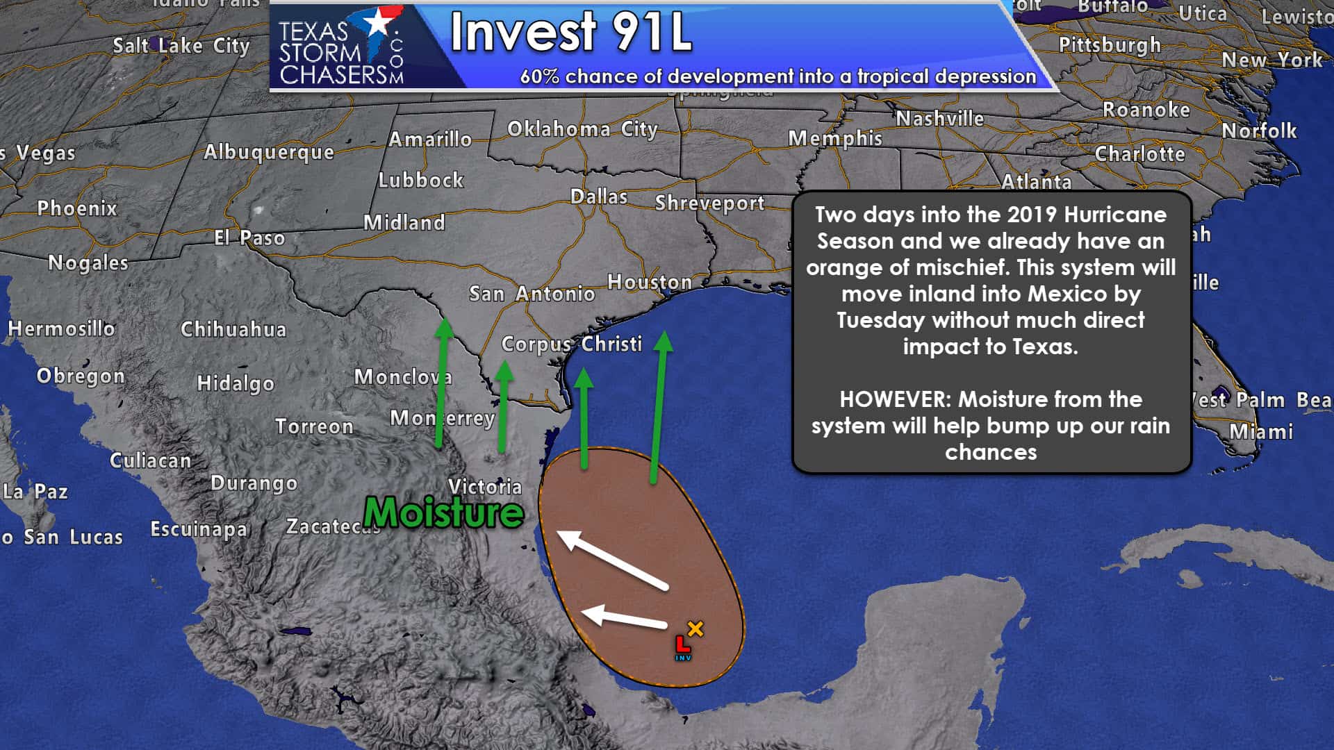
Now that I’ve gotten my sinus infection-induced rant out of the way let’s talk about what we have cooking in the Gulf of Mexico. Specifically, we’re diving down into the Bay of Campeche (or the far southwest Gulf of Mexico). A disorganized cluster of showers and thunderstorms continues to slowly move northwestward toward Mexico. There have been slight pressure drops over the last day which indicates some organization. However, satellite data does not show a well-defined low-level circulation indicative of any organized development.
A tropical cyclone (depression all the way up to a hurricane) must have a defined low-level circulation (or spin) in order to be classified a cyclone. Without that, it’s simply an area of thunderstorms. This system *could* become just organized enough over the next day or two that it could become a tropical depression or a weak tropical storm. It doesn’t have much time since it should be moving on-shore into Mexico on Monday or Tuesday. The Hurricane Hunters are on standby to fly a mission into the system tomorrow afternoon if it shows increased signs of organization. Regardless of development – portions of Mexico are going to get clobbered by flooding rainfall.
Even though this system will be making landfall several hundred miles south of Brownsville we’ll still see some weather impacts up north here in Texas. Plentiful tropical moisture will stream northward into Texas by Tuesday and Wednesday. A somewhat active southern jet stream will bring a series of upper-level storm systems overhead over the following several days. That moisture combined with those pieces of upper-level lift, along with the lack of any capping inversion in the summer, will allow for an uptick in shower and thunderstorm chances. Those won’t impact everyone, but it’ll certainly be a case where someone could get three inches of rain in an hour while the other side of town gets nothing. We’ll be able to refine more specific rain chances once we get into the work week.
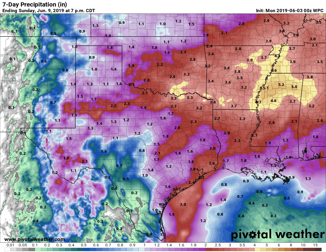
Potential rain totals over the upcoming week. Keep in mind that summer storms can be ‘hit and miss’ and that some folks will see far less – and some could see twice the amount in a span of a few hours. Click on the image for a full-screen version.
We will have to keep an eye on the remnants of the Bay of Campeche storm system after it moves into Mexico. There is some data that shows it moving north into Texas later in the week. It would not make it up here as a tropical cyclone, but it would serve to enhance rain chances (and amounts) near it. Regardless, a more potent upper-level storm system looks to arrive around Thursday and Friday of this upcoming week. That would bring more significant rain chances to northern portions of Texas – perhaps some severe weather as well.


0 Comments