
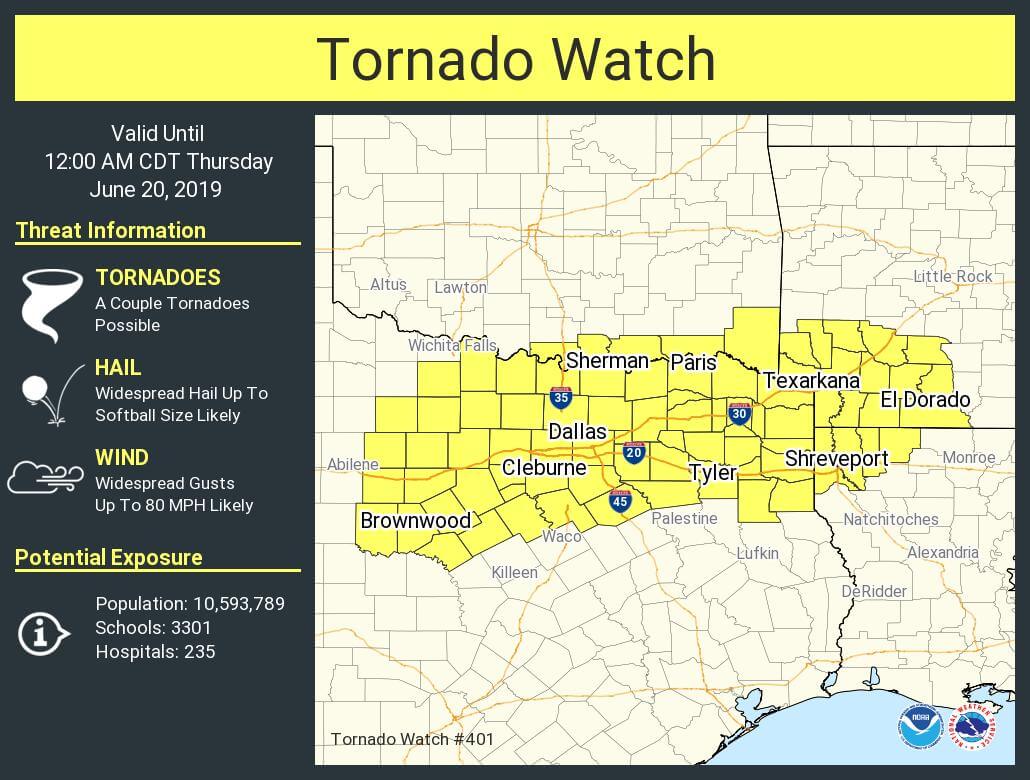
A tornado watch is now in effect for the eastern Big Country, all of North Texas, and Northeast Texas until midnight. This watch includes Brownwood, Graham, Mineral Wells, Granbury, Bowie, Gainesville, Sherman, Denton, McKinney, Fort Worth, Dallas, Cleburne, Waxahachie, Kaufman, Rockwall, Athens, Canton, Bonham, Cooper, Paris, Clarksville, Sulphur Springs, Quitman, Lindale, Tyler, Henderson, Carthage, Longview, Jefferson, and Texarkana. The strongest thunderstorms may produce a few tornadoes, giant hail up to the size of softballs, and hurricane-force straight-line winds over 75 MPH. There is an enhanced concern of wind-driven damaging hail. Not all storms will be intense and not everyone will be impacted by severe storms.
All images can be clicked for a larger version
Tornado Watch Number 401
NWS Storm Prediction Center Norman OK
355 PM CDT Wed Jun 19 2019
The NWS Storm Prediction Center has issued a
* Tornado Watch for portions of
Southern Arkansas
Northwest Louisiana
Southern Oklahoma
North Texas
* Effective this Wednesday afternoon from 355 PM until Midnight
CDT.
* Primary threats include…
A couple tornadoes possible
Widespread large hail and scattered very large hail events to 4
inches in diameter likely
Widespread damaging winds likely with isolated significant gusts
to 80 mph possible
SUMMARY…Severe thunderstorms are expected to quickly develop and
increase through late afternoon and early evening within an
extremely unstable environment across the region. Mid/high-level
winds are strong, particularly by mid-June standards, which will
initially support intense supercells capable of large hail along
with a couple of tornadoes. Over time, multiple
east/southeastward-moving storm clusters may evolve by evening,
particularly across North Texas to far southwest Arkansas/northwest
Louisiana, with widespread wind damage including wind-driven large
hail.
Explosive thunderstorm development is anticipated across portions of North Texas and Northeast Texas in the coming couple of hours. We’re already starting to see signs of initial development across Denton, Cooke, and Grayson counties in the form of agitated towering cumulus. That indicates our cap is just about gone, and with stronger upper-level lift arriving by 5-6PM, we should see supercell thunderstorms rapidly form. We still have a little sinking air in place across North Texas, so storms may struggle initially. That is expected to change in the next one to two hours.
The strongest storms could produce giant hail up (baseball to softball size, perhaps larger), hurricane-force straight-line winds over 75 MPH, and the potential for a few tornadoes. Not all storms will be that intense, but we’ve certainly got the airmass to support very severe thunderstorms. Storms will generally move off to the east, but some may move more southeasterly too. These initial storms should move into Northeast Texas over the next few hours. However, additional storm development may occur back west in North Texas after 7-8PM. Those storms later this evening could grow upscale into a squall line with an enhanced threat for widespread damaging straight-line winds of 70-80 MPH.
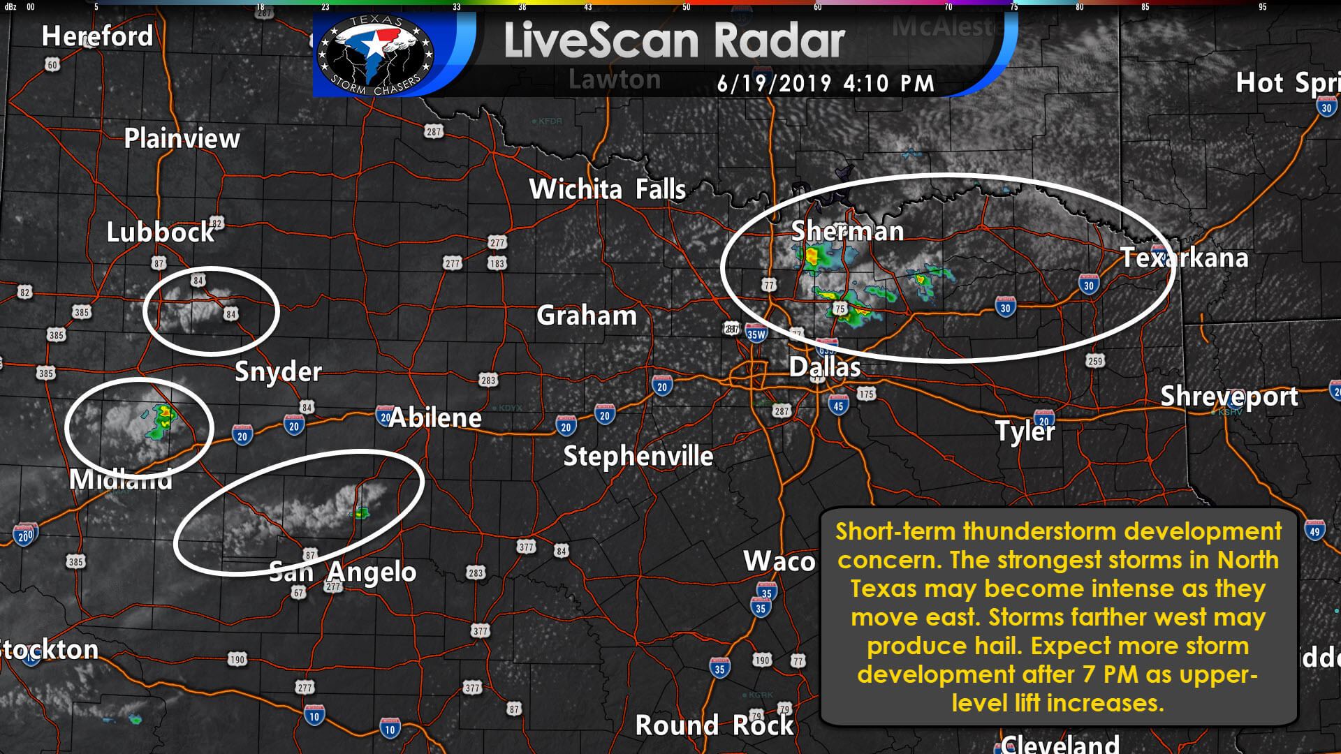
Individual storms will have the highest threat for giant hail and a few tornadoes. Those that grow upscale, or exhibiting ‘bowing’ structures, will have the higher threat of destructive straight-line winds over 75 MPH, but wind-driven large hail and brief tornadoes will remain possible. Remain weather aware this afternoon and evening. I’ve included a video briefing that discusses the severe weather threat and timing over the next few hours recorded at 3:15PM. We’ll be conducting rapid-fire updates on our social media accounts as the event starts to unfold. You can also view those real-time updates here on our website and in our free mobile app. Our interactive weather radar will also be a great tool to keep an eye on today.


0 Comments