
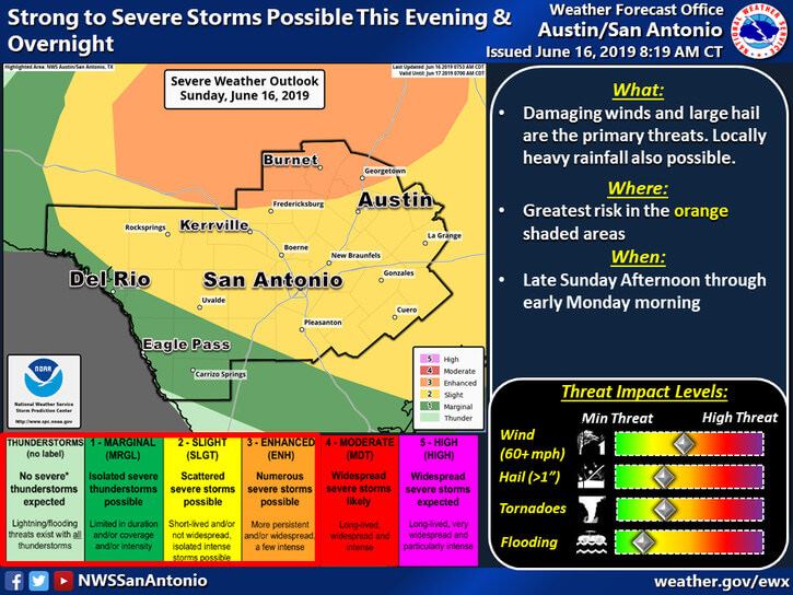
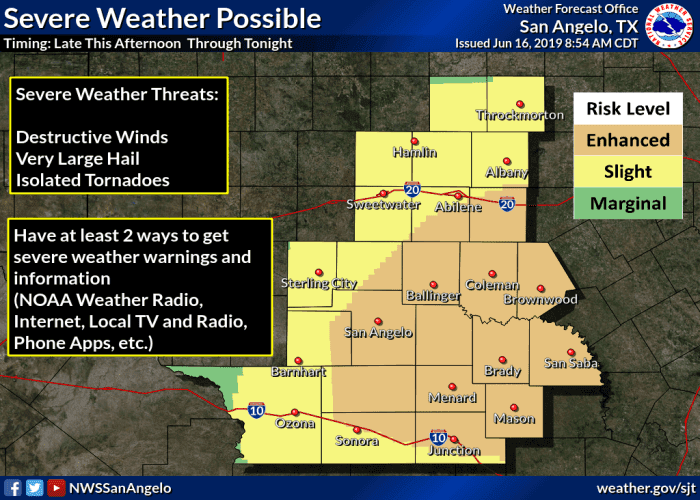
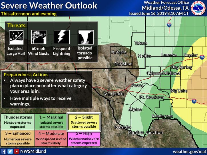
The squall line that pushed through north Texas late last night continues to drift southeast across the eastern half of the state, but we’re not done with the threat for severe weather just yet. Areas south of the I-20 corridor today will be extremely unstable by this afternoon with storm development likely across west central and possibly north/north central Texas by peak heating. Initiation will depend largely on the position of the outflow boundary left behind from last night and this morning’s storms and how quickly the atmosphere can recover behind the outflow boundaries as well. Three main areas for storm initiation will be monitored today…central and west central Texas south of the outflow boundary…along the I-20 corridor from DFW west towards Abilene…and further north across southern OK and north Texas along a weak frontal boundary. Storms that develop later this afternoon are expected to quickly ramp up and congeal into large clusters/squall lines which will carry the threat of damaging wind, destructive hail and torrential rainfall. The Storm Prediction Center has outline the area with the greatest threat for seeing severe storms this afternoon with an Enhanced Risk (Level 3). As these storms mature through the evening, they’ll begin to dive south and towards our coastal counties…mainly from Corpus to Galveston late tonight. Residents in central and west central Texas need to keep an eye on the weather conditions this afternoon…especially those on area lakes or other outdoor activities…and have a way to receive warnings if you’re out and about. 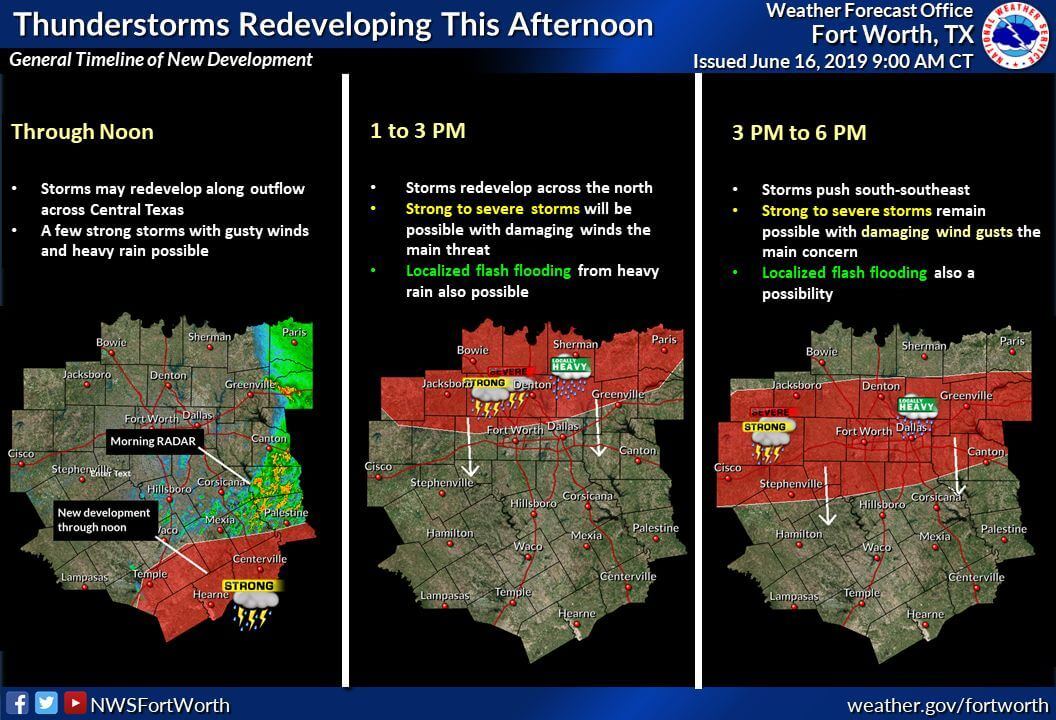

Texas Set To Cool Down And Get Wet This Weekend!
https://youtu.be/tZd6BxRdH_o A strong cold front will bring a little chill back to Texas this weekend with widespread...


0 Comments