
A severe thunderstorm watch has been issued for South-Central Texas, the Coastal Bend, and the Coastal Plains. This runs until 10 PM, although I expect it’ll be trimmed from west to east through the afternoon as storms progress to the east. Austin, San Marcos, San Antonio, Pleasanton, Beeville, Corpus Christi, Rockport, Victoria, and Bay City are a few towns included. The strongest storms may produce hail around the size of golf balls and damaging straight-line winds up to 70 MPH. Isolated flash flooding may occur.
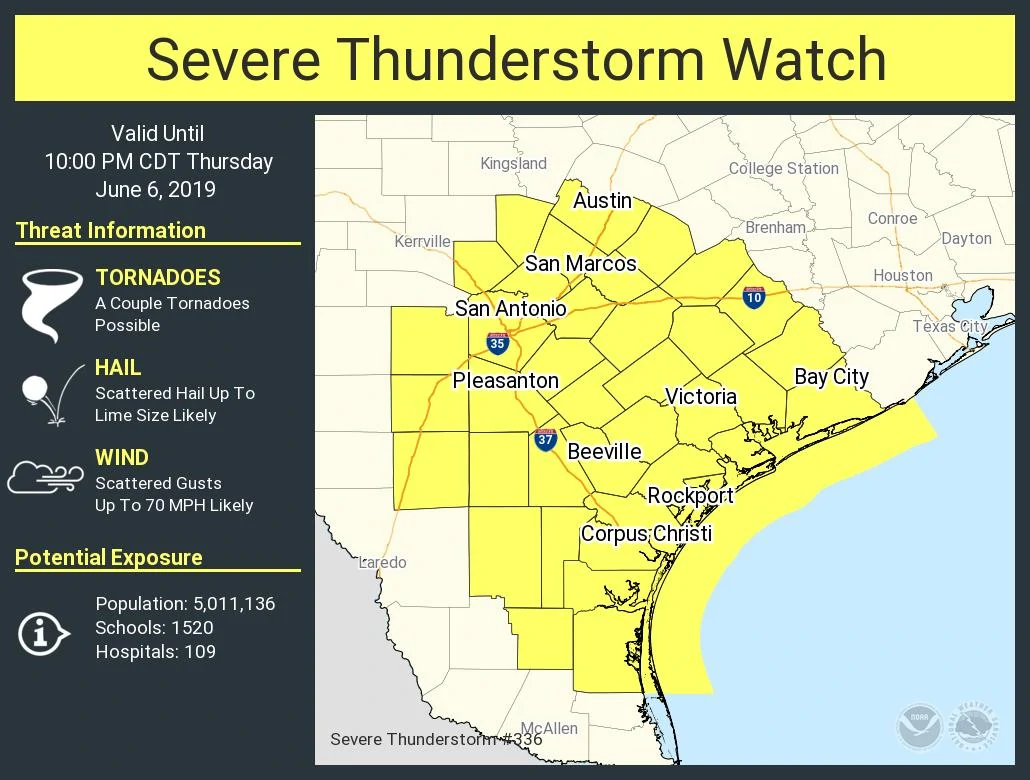
Severe Thunderstorm Watch Number 336
NWS Storm Prediction Center Norman OK
230 PM CDT Thu Jun 6 2019
The NWS Storm Prediction Center has issued a
* Severe Thunderstorm Watch for portions of
South Central Texas
Coastal Waters
* Effective this Thursday afternoon and evening from 230 PM until
1000 PM CDT.
* Primary threats include…
Scattered large hail likely with isolated very large hail events
to 2 inches in diameter possible
Scattered damaging wind gusts to 70 mph likely
A tornado or two possible
SUMMARY…Thunderstorms are expected to intensify across the watch
area this afternoon and evening, in an environment favorable for
damaging wind gusts and hail in the strongest cells.
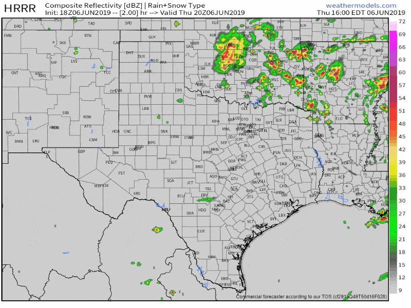
Simulated weather model radar through this evening
Thunderstorms have developed from Johnson City to Bulverde east to Dripping Springs and Sunset Valley. That activity will likely impact the Austin metro within the next one hour. Contrary to our earlier forecast thoughts, confidence into a thunderstorm cluster isn’t as high as earlier. There seems to be some dry mid-level air in place behind the storms from this morning. That dry air is acting as a partial inhibition for storm development and organization. Storms may still grow upscale into a cluster and move southeast, but I can’t guarantee it. Scattered storms moving east toward Interstate 35 from Austin to San Antonio should continue moving east/southeast over the next several hours into the Coastal Bend and Coastal Plains. The strongest storms may produce large hail and damaging wind gusts. If storms are able to grow upscale into a cluster the threat for damaging wind gusts will increase. These storms may also impact portions of the Brazos Valley and Southeast Texas.


0 Comments