
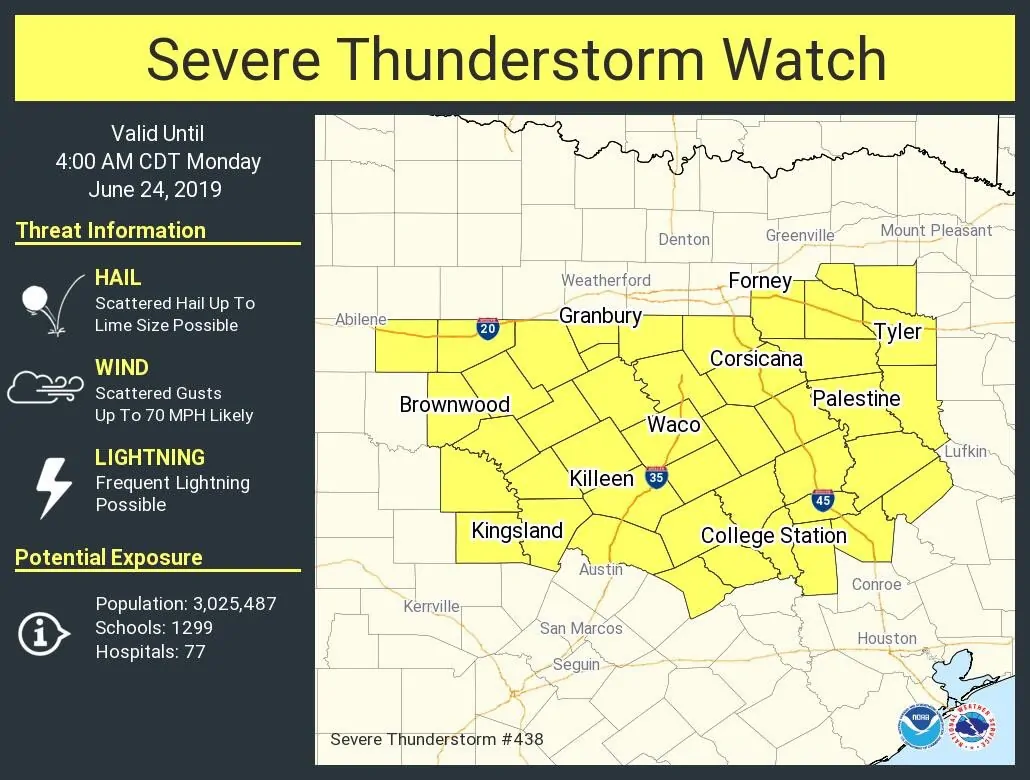
A severe thunderstorm watch is now in place for southern North Texas, portions of central Texas, and the Brazos Valley until 4 AM Monday. This does include Brownwood, Kingsland, Killeen, Waco, Hillsboro, Corsicana, Canton, Tyler, Palestine, College Station, and Georgetown. Austin, San Marcos, San Antonio, Houston, and Longview are not included in this watch. The strongest storms may be capable of producing damaging straight-line winds over 70 MPH, some hail, and localized flash flooding.
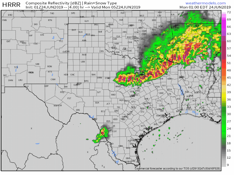
Simulated weather radar through the overnight and morning hours Monday. It is running about 1-2 hours too slow, but otherwise, it shows the general thunderstorm evolution fairly well.
Thunderstorms will continue to move south/southeast overnight and into Monday morning. The line itself will probably make it to the coast in Southeast Texas west to the Coastal Plains by the mid-morning hours Monday. That means a rather wet commute is possible for the Houston metro. Storms should be weakening overnight, so we don’t expect these to be severe when they make it into Southeast Texas and the Coastal Plains in the morning. I cannot rule out an isolated damaging wind gust. Localized flooding may also be a threat.
Also: We need to watch a complex of thunderstorms ongoing in western/northwestern Oklahoma. Weather models are not doing a good job of handling that right now. I can’t rule out those making a run at Northwest Texas and North Texas in the morning, so we’ll be watching for that possibility just in case it happens.
We’ll continue posting rapid-fire updates on our social media channels and likely doing occasional ‘live video’ updates.


0 Comments