
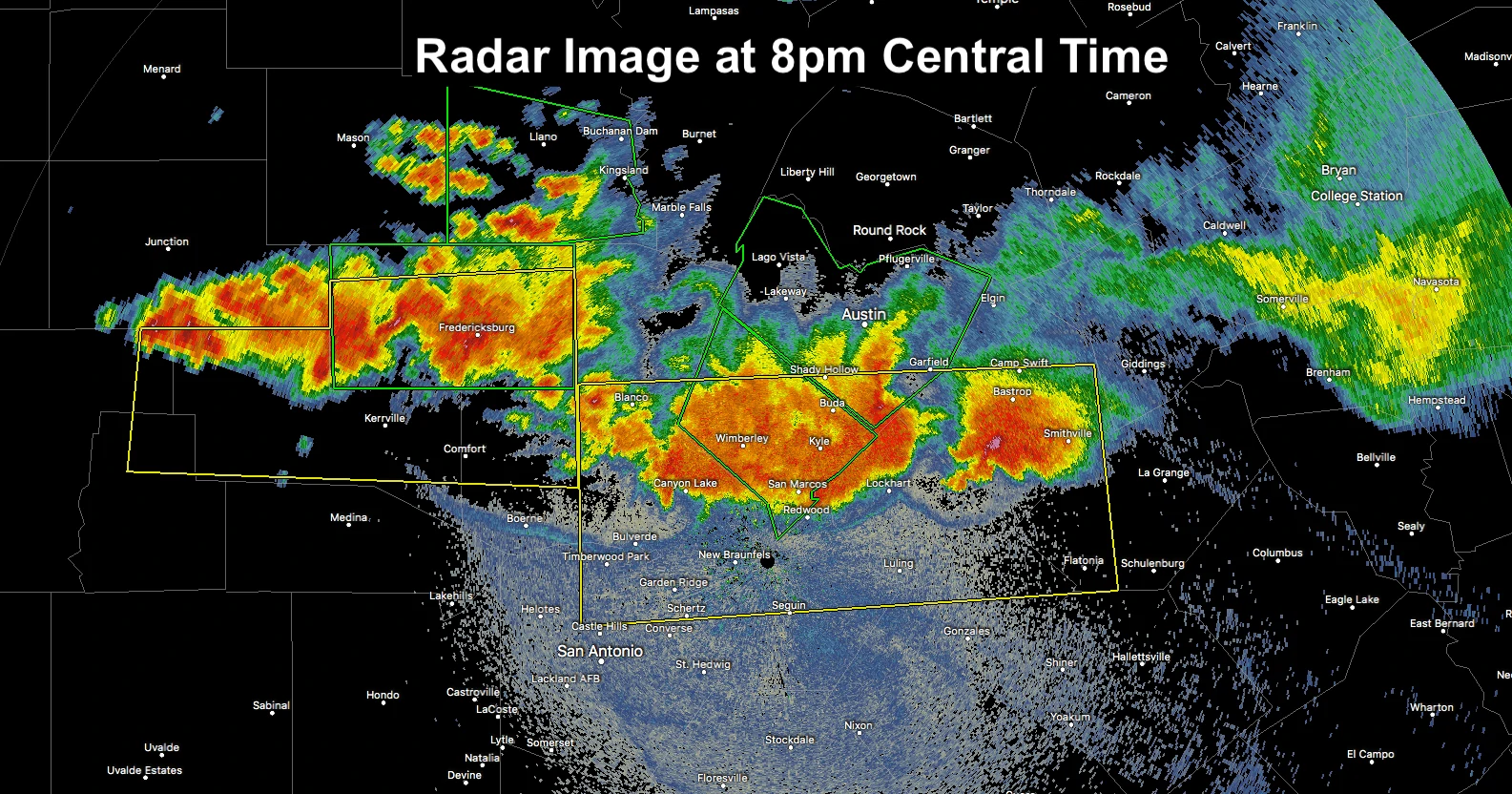
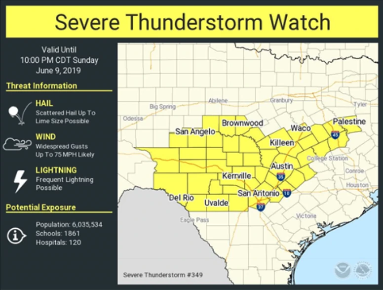
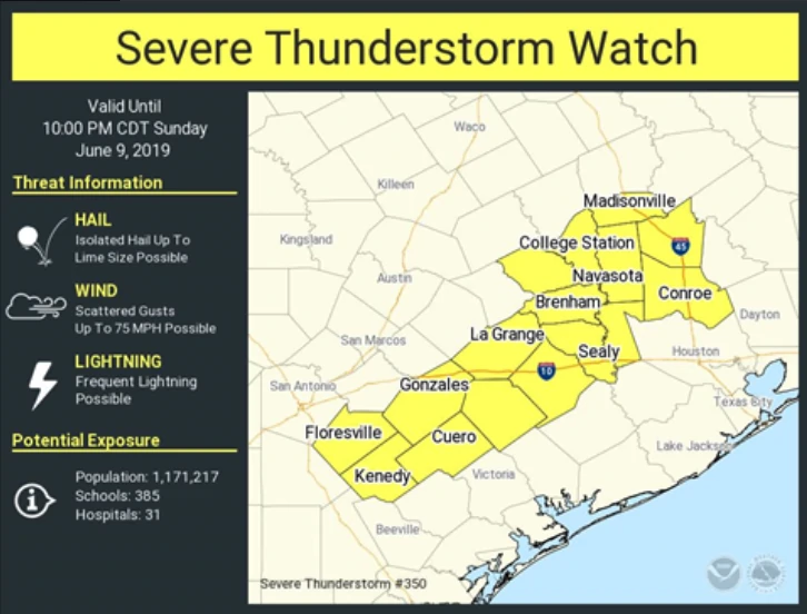
A compact but long-lived squall line continues to push south across central Texas this evening leaving a path of destruction in its wake. It’s expected to continue to push south this evening with the threat for severe weather continuing into south central Texas through the late evening and early nighttime hours. Severe Thunderstorm Watches remain in effect for much of central Texas and a portion of south central Texas until 10pm. While likely to begin weakening as we lose daytime heating after sunset, it would not surprise us to see this line of storms continue to produce severe storms well into the nighttime hours given its history of outsmarting all the short-range forecast models. For the western half of the central Texas Watch area along the borderlands, we’ll likely see additional development later this evening as storms move east from the Big Bend region. Also possible will be storms developing along a southward moving cold front…especially across areas not tainted by this afternoon’s squall line. Given the continued heat and instability across most of central and south central Texas, any storms that continue to develop across the region will have the potential for damaging winds, hail up to 2 inches in diameter, frequent lightning and very heavy rainfall which may lead to localized flash flooding. While the tornado threat is low, the threat is non-zero. As the storms approach your location this evening, stay tuned to local media outlets, news radio or your local National Weather Service office for the latest on these storms and have a way to receive weather notifications if you’re out and about.
NWS Austin/San Antonio
NWS Corpus Christi


0 Comments