
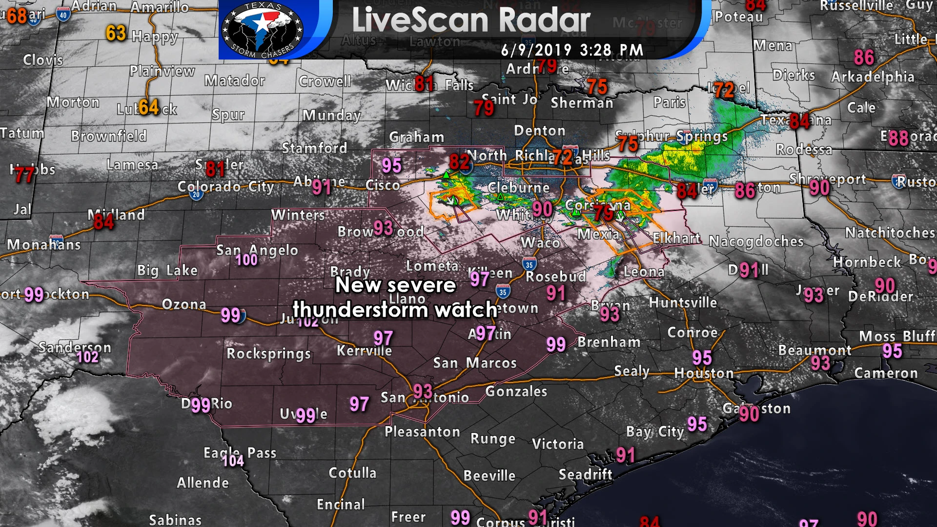
A severe thunderstorm watch has been issued for the Concho Valley, northern Edwards Plateau, all of the Hill Country, Central Texas, and South-Central Texas. San Angelo, Del Rio, Uvalde, Kerrville, Brownwood, Killeen, Waco, Austin, San Antonio, and Palestine are included in this watch. The watch itself runs until 10 PM this evening. Our strongest storms this afternoon and evening could easily produce straight-line winds over 70 MPH – as has been demonstrated by the widespread wind damage across the D/FW Metroplex. Large hail up to the size of golfballs will also be possible, although should be less frequent than the damaging winds.
Remember our forecast from this morning that said storms should hold off until after 2 PM? I didn’t expect a derecho to visit North Texas from Kansas. Those storms produced significant, widespread wind damage across the D/FW Metroplex. For good measure, those storms also produced wind damage at my home in Norman (Oklahoma) this morning. Subsidence (sinking air) was strong, but these storms managed to overcome that and the result was an earlier than expected start time. Those paying attention to the weather would have noted that by a severe thunderstorm watch around lunch – and early issuance of severe thunderstorm warnings by the National Weather Service in Fort Worth this afternoon. The metroplex has been cleared from all watches and warnings.
An outflow boundary from those storms continues to quickly race south into Central Texas. New storms have fired up behind that boundary near Stephenville. The original storm responsible for all the wind damage in D/FW is now near Kerens (east of Corsicana). Honestly, given the fast movement of that boundary and continued storm development, I’m honestly not confident that those storms won’t continue all the way into the Brazos Valley this afternoon. We’ll have to watch for signs of weakening, but those storms have exceeded expectations thus far. Damaging straight-line winds of 70 MPH and hail are possible.
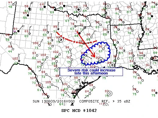
New thunderstorm development is expected farther southwest into the Hill Country and Concho Valley by 6-7 PM. Those storms will quickly become severe once they develop. Very large hail may be the primary initial threat, but damaging straight-line winds are certainly expected with the most intense storms. If storms grow upscale into a cluster or squall line we will see an enhanced threat for hurricane-force wind gusts. These storms will likely impact portions of the Waco, Austin, and San Antonio metros at some point this evening. Thunderstorms may continue well into the evening hours. Storms will generally move east/southeast. Those storms south of the D/FW Metroplex are moving south/southeast.
Remember that you can keep tabs on the weather with our free HD interactive weather radar here – or in our free mobile app.


0 Comments