
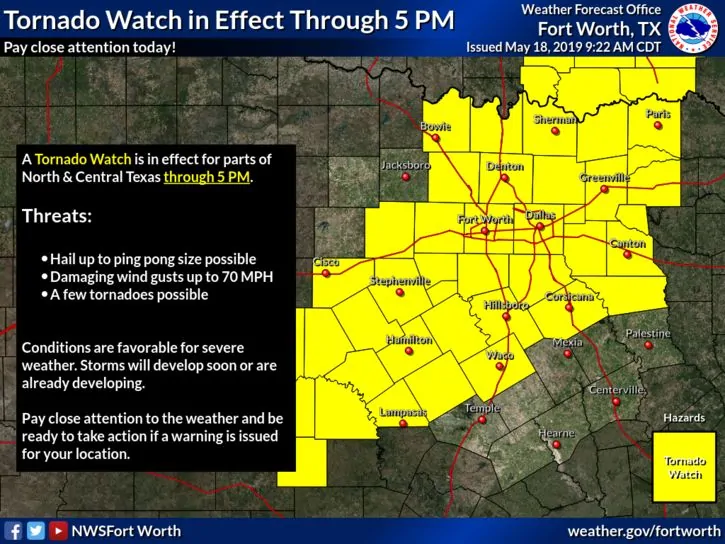
A Tornado WATCH is in effect until 5pm this afternoon for much of north central and central Texas. A WATCH means that atmospheric conditions are favorable for the development of tornadoes. A squall line of strong to severe storms currently stretched from western north Texas down into the Concho Valley region will continue to track east throughout the day. Heavy rain, damaging winds, large hail and a few tornadoes are possible with this activity…especially for areas south of the immediate DFW metroplex. A few of the tornadoes could be intense with major damage possible…especially within any storm cell that can manage to develop and stay more isolated from the main squall line. Keep abreast of the weather as it approaches your area this afternoon. Monitor local media and news radio. Have a way to receive warnings and head to shelter immediately if a Warning is issued for your particular location. Plan now to stay off area roadways if at all possible during the intense portions of the storm once it hits your immediate location.
NWS Storm Prediction Center Norman OK
910 AM CDT Sat May 18 2019
The NWS Storm Prediction Center has issued a
* Tornado Watch for portions of
Northwest Arkansas
Eastern Oklahoma
North-Central and Central Texas
* Effective this Saturday morning and afternoon from 910 AM until
500 PM CDT.
* Primary threats include...
A few tornadoes likely with a couple intense tornadoes possible
Scattered damaging wind gusts to 70 mph likely
Scattered large hail events to 1.5 inches in diameter possible
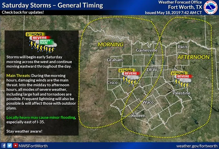
SUMMARY...Intense thunderstorms will continue to track eastward
across portions of Oklahoma and Texas through day, with occasional
severe storms expected. Damaging winds are the main threat, but a
few supercells capable of tornadoes are forecast.


0 Comments