
A tornado watch is now in effect for much of East Texas and the Brazos Valley until 11 PM this evening. Texarkana, Nacogdoches, Lufkin, Jasper, Conroe, Brenham, and College Station are included. This watch does not include the Houston metropolitan area or far Southeast Texas. If it becomes apparent that severe thunderstorm development is more likely farther south than I expect we’ll see the watch expanded and/or a new one issued. A line of strong to severe thunderstorms will continue to move east through the afternoon and early evening hours at 35 to 45 MPH. The strongest storms will be capable of producing damaging straight-line winds of 60 to 70 MPH and brief tornadoes. Any storms that develop ahead of the squall line could pose an enhanced threat for tornadoes. Heavy rainfall and localized flash flooding are expected. Given the saturated soils across East Texas and the Brazos Valley, it won’t take more than 40 MPH winds to begin uprooting trees.
You can keep tabs on storms with our free HD interactive weather radar here.
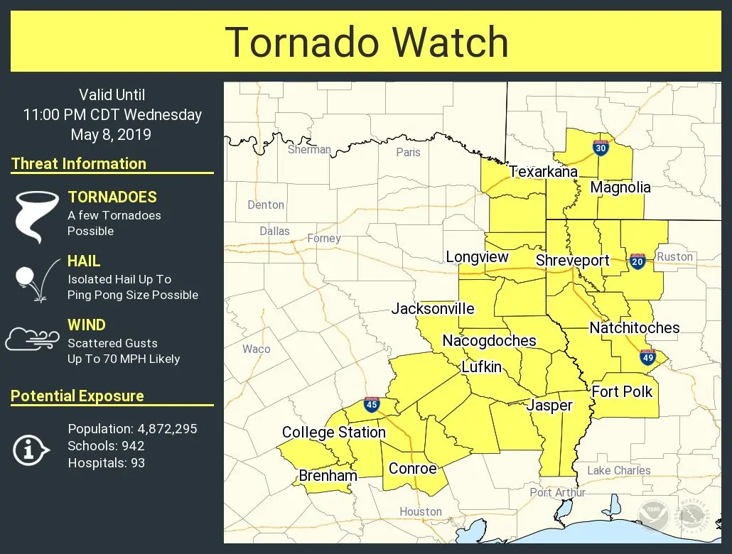
Tornado Watch Number 153
   NWS Storm Prediction Center Norman OK
   215 PM CDT Wed May 8 2019

   The NWS Storm Prediction Center has issued a

   * Tornado Watch for portions of
     Southwest Arkansas
     Western Louisiana
     East and Southeast Texas

   * Effective this Wednesday afternoon and evening from 215 PM
     until 1100 PM CDT.

   * Primary threats include...
     A few tornadoes possible
     Scattered damaging wind gusts to 70 mph likely
     Isolated large hail events to 1.5 inches in diameter possible

   SUMMARY...Storms will continue to intensify across east/southeast
   Texas toward the ArkLaTex vicinity this afternoon in areas
   along/south of an effective front. Adequate deep-layer shear and
   some increase in low-level shear through late today will support
   bowing segments/mesovortices and a few semi-discrete supercells.
   Damaging winds and a few tornadoes are the main expectations into
   this evening across the region.


0 Comments